TORS OF DARTMOOR
a database of both lesser- & well-known rocks and outcrops
Fur Tor (Okehampton Range)Vur Tor, Vwr Tor, Forter, Vurtorre, Queen of the Moor
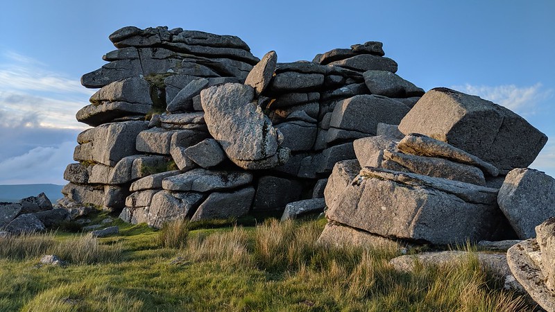 Colloquially known as the 'Queen of the Moor', this is considered to be the remotest of the Dartmoor tors. A huge area of numerous outcrops define what is one of the moor's most spectacular rockpiles with masses of granite clitter cascading down the slopes from the tor's main stack. It is a scene to behold, one of much beauty, and the central core tower of rock warrants attention on account of its imposing walls and fallen blocks which make reaching the top a difficult feat to achieve. On the summit there is a fine, rounded rock basin that holds water; this is shown on many historic Ordnance Survey Maps and is most probably one of the three basins that Ormerod (1859) alludes to. Bray (1844) recorded it to be "a basin two feet and a half in diameter, and eight inches deep." 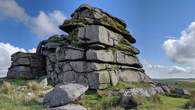 The best description comes from Crossing (1912): "Fur Tor is perhaps the grandest of the Dartmoor tors, for while there are some that rise much higher above the ground than the loftiest of the piles here, and also exhibit finer rock masses, there is none that covers so large an area, or whose surroundings are of desolate character as those upon which this lonely tor looks down. Fur Tor is a wilderness of stone." Indeed, thanks largely to its location being in the wilds of the North Moor, the tor has attracted many visitors, particularly on New Year's Day when ramblers and letterboxers partake in the annual pilgrimage to Fur Tor, in all weather conditions and from multiple directions. A landmark as prominent as this has also been the site of one of the earliest letterboxes that still remains in situ today. 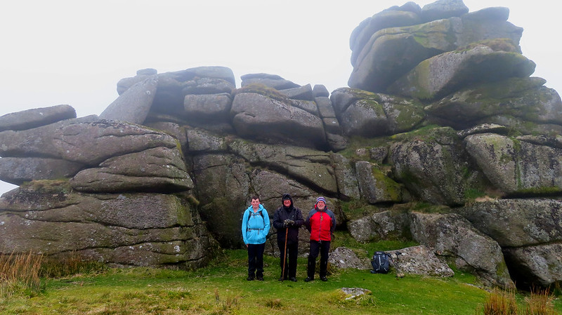 Rowe (1896) writes: "Furtor is the most isolated of the Dartmoor heights, and to signify the 'far' tor, is appropriate enough for a summit and its name, which seems to retain the old English 'feor', which is the most remote and the most difficult of access of any on Dartmoor." Writing much later, Hemery (1983) gives other theories and alternative names: "'Vwr twr', the 'great tor', said the Celt: 'Feor', the 'far distant tor', said the Saxon... 'Vurtorre', wrote the medieval Forester whose duty entailed a personal knowledge of the ground and use of the name, and 'Vurtor' says the moorman..." 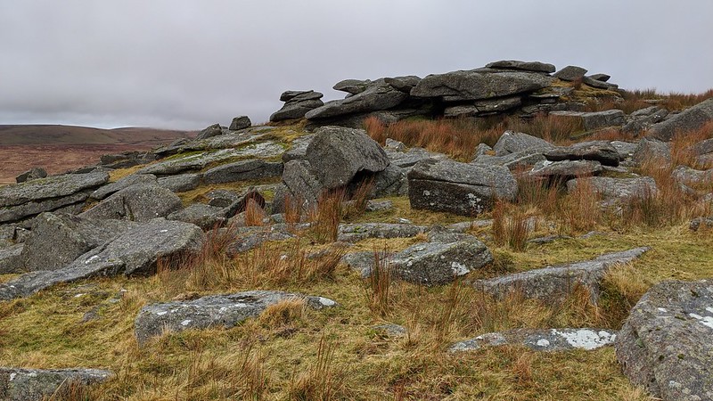 Fur Tor boasts tremendous views that are among the finest anywhere on Dartmoor, where the great sweep of the North Moor unravels in every direction, but especially to the west and north: from the fringes of the high moor at Hare Tor, Lydford Sharp Tor and Great Links Tor, to the depths of the ancient forest at Great Kneeset, Black Ridge, Black Hill and Cut Hill, each tor is seen as a distant pimple on the horizon, and every hill a dark, brooding eminence, indicative of your distance away from any road here. Streams that are often dappled in sunlight weave in between hills to reach the mighty River Tavy at Sandy Ford to the west and is a most interesting characteristic of the panorama that is well worth experiencing if you are prepared and able to undertake this long walk into the heart of the moor.
| ||||||||||||||||||||||||||||