TORS OF DARTMOOR
a database of both lesser- & well-known rocks and outcrops
Goat RockGoat Tor 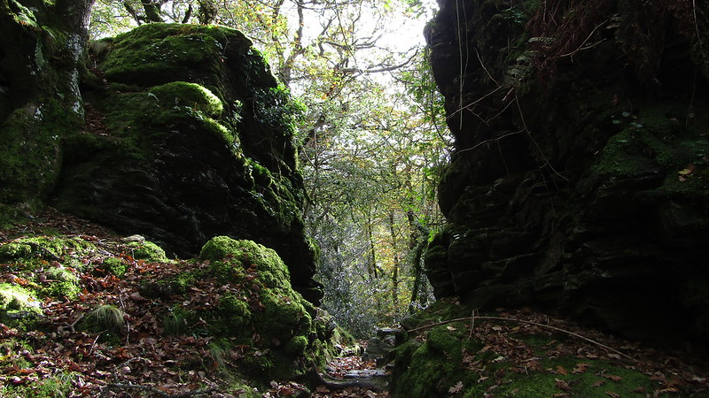 This magnificent tor, for it is so much more than a 'Rock', was so called by Mrs. Bray in a letter to Robert Southey Esq, dated 24th Sept 1833: "Passing the base of the Raven Rock, you still follow the windings of the Walkham till you arrive at the foot of a second acclivity, composed of rocks in forms the most picturesque and fantastic that can be imagined. These have of late been rendered peculiarly interesting in consequence of their having become the favourite haunt of a flock of goats." And in the same work, the author speaks of "Goat Rock (as we call it)" which is near "a miniature alpine bridge that crosses the Walkham at its junction with the Tavy..." Despite this evocative account, Crossing (1912) only makes a disappointing one-line mention of "a rugged pile of rocks..." 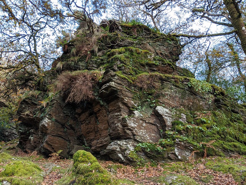 Goat Rock dominates the meeting of the waters at a spot known locally as Double Waters, and its ornamental charm is enhanced by a proliferation of moss, shrubbery and trees that line the dark crevices and caves that have formed in the non-granite rock. The tor is essentially comprised of an avenue; two main stacks, both equally as imposing, rising above the valley-floor in spectacular fashion. 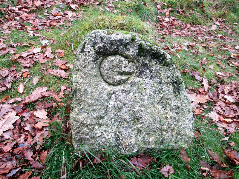 Beneath the tor and overlooking the wooden footbridge is a parish boundary stone that is inscribed 'G' for Gulworthy and 'BM' for Buckland Monachorum. The Walkham and the Tavy are among Dartmoor's fastest-flowing rivers. In fact, Tavy is reputed to be the second-fastest in the British Isles and both rivers are known to swell exponentially after heavy rainfall leading to the footbridge becoming flooded halting access from one side to another. 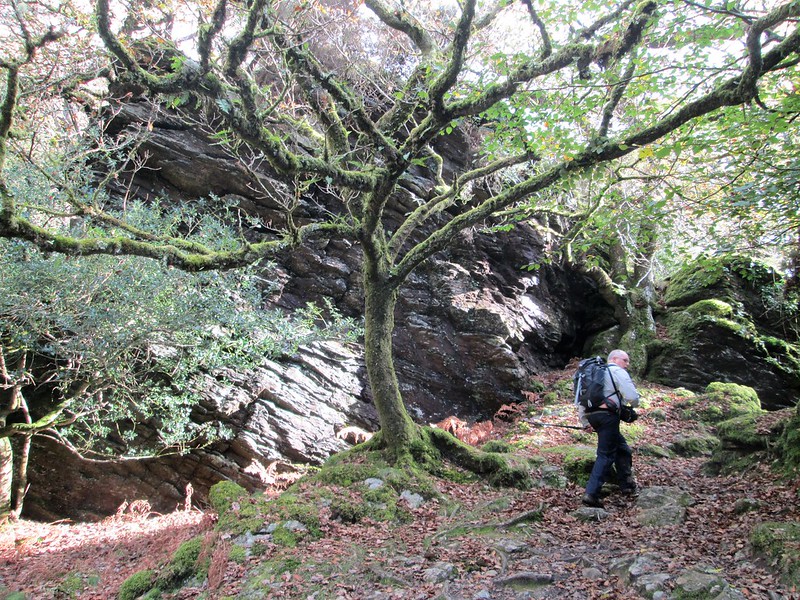 The stature of the tor is difficult to appreciate under today's tree cover, and indeed, an old photograph by Rendell (1996) showing the area with less tree coverage reveals that it rears its head skybound destined for light in an otherwise dark and often gloomy valley. A public bridleway (part of the West Devon Way) passes between the two rock masses and it will be noted that Goat Rock continues up the hill before eventually ceasing just before you come across the enormous crags of West Down. It is a picturesque spot and the visitor will not be let down by the scenery on offer.
| ||||||||||||||||||||||||||||||