TORS OF DARTMOOR
a database of both lesser- & well-known rocks and outcrops
Great Kneeset
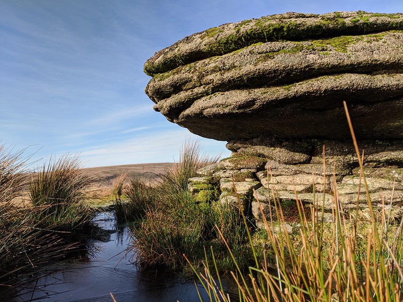 Whilst visible, to the trained eye, from miles around, Great Kneeset is a non distinct hill deep into the North Moor that few people are aware has two low outcrops at the top warranting further investigation. The southern outcrop at SX 5889 8585 is the highest and presents as a huge low slab of granite bedrock barely protruding from the turf. 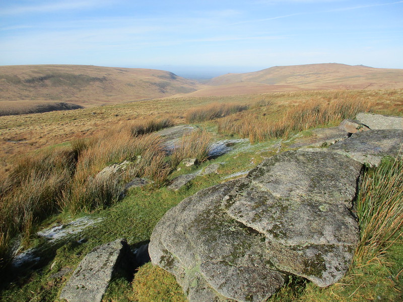 Eric Hemery waxes lyrical about the views that can be obtained from this eminence; "Views from here of what Carrington would call "the great and gloomy wild" are magnificent: the fissured moorscape of the northern fen spreads extensively eastward where Hangingstone Hill terminates the prospect - and south, where Cut Hill and Tavy Hole allow a mere glimpse beyond the continuing fen, while in the south-west the cone of Hare Tor rises against the far-off undulations of Bodmin Moor. The northward view is of the W. Okement Ravine and the highest land of the West Country above its east brink, and of E. Mil Tor beyond Brim Brook Head." 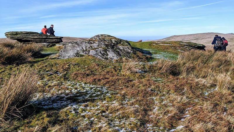 The northern outcrop at SX 5897 8605 has more prominence and presents as a slightly higher, grass-covered pile overlooking the dramatic West Okement Valley but is somewhat characterful with a small overhang on its south-west side. Richard Hansford Worth in 'Worth's Dartmoor' uses the unusual name of 'Great Kneesit' to describe the area although this may be a typographical error as no other author to our knowledge uses this spelling. Given its location, you can approach from most directions but it is perhaps easiest from the west utilising the footpath up from Broad Amicombe Hole. From the north, your route is halted by the West Okement River which is usually difficult to cross and from the south, the huge, flat bog can be tough to traverse after prolonged rain. The eastern side from Black Ridge has the least ascent but involves negotiating peat hags. 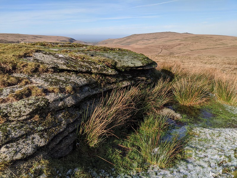
| ||||||||||||||||||||||||||||||