TORS OF DARTMOOR
a database of both lesser- & well-known rocks and outcrops
Great Links TorLinks Tor, Great Lynx Tor, Lynx Tor, The Castle, Linx Tor 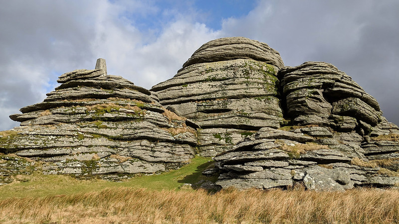 This tor is a giant of the north-west moor, a stunning group of granite outcrops that are capped on the west side by a trig point where a thrilling vista unfolds over rural West Devon farmland and into North Cornwall where the ridges of Bodmin Moor can be seen. The outcrops here are huge and spread across the spine of the hill that William Crossing likens to a 'castle'. The author was clearly impressed with this pile at what "we shall find to be a grand and imposing cluster of rocks, the several piles rising to a great height above the turf. Though its form is not so suggestive of a ruined castle as is that of Hey Tor, when viewed from certain points, such a resemblance is not altogether wanting, particularly when it is seen from the slope of Gibbet Hill..." 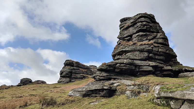 Indeed Great Links Tor is sometimes regarded as one of the most stupendous tors on Dartmoor and it is easy to see why. While the summit rocks dominate anyone standing at their base, the succession of equally as significant piles continue to the east in the direction of Rattle Brook and offer fine views of the distinctive peat ties of Amicombe Hill. The south side of the tor presents as a ruined bastion with crumbling horizontally-jointed outcrops showing collapse and beside one of these, at SX 55102 86746, there is a peat cutters' bondstone, most certainly related to the activities that once took place along the Rattle Brook in past centuries. Other outliers of this tor, notably on the south-west side, are of striking appearance and form natural windbreaks. Below these, at SX 54911 86492, a large ruined cairn can be found, just beside the path, indicative of the importance of the person buried up here. 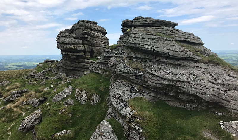 The north side of the tor takes on a different proposition: colossal towers rise above the onlooker all closely horizontally-jointed as to form an impenetrable barrier, and between the highest an avenue provides a good spot at which one can admire the dramatic landscape of hills punctuated with tors that stretch off into the distance, even as far south as Three Barrows. A strange feature, believed to be natural, is also seen that appears as a cavity where a small person could seek shelter, but it is more likely to be related to geology where underlying rocks have given way. Accessing Great Links Tor does not require a particularly long hike from the car park on High Down, but it involves a very steep ascent of around 250m passing between, or over the top of, Arms Tor and Brat Tor. Your efforts will be rewarded, however, with what is one of the finest panoramas experienced from anywhere in the south-west of England and on a clear day the rambler is sure to not be left disappointed. 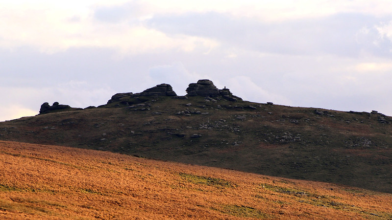
| ||||||||||||||||||||||||||||||