TORS OF DARTMOOR
a database of both lesser- & well-known rocks and outcrops
Great Mis TorGreat Mistor, Mystor, Mistorr, Mis Tor, Mistor, Misor, Miser
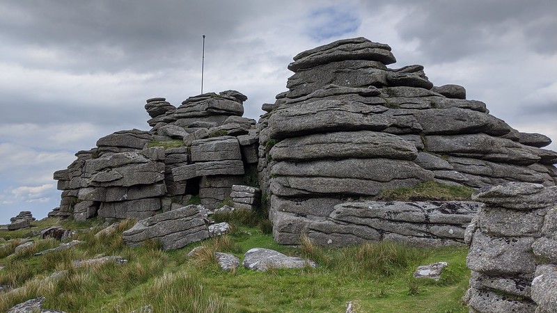 To paraphrase Hemery (1983), Great Mis Tor could be described as the Mountain of Walkham Country, for its massive heaped outcrops command the skyline for miles around. Gigantic granite outcrops crest the summit giving rise to one of Dartmoor's most magnificent clitters, especially on the west side where further outcrops drop downhill towards the River Walkham. For tor baggers, boulderers and walkers alike, it is one of Dartmoor's most striking and exhilarating summits to reach. 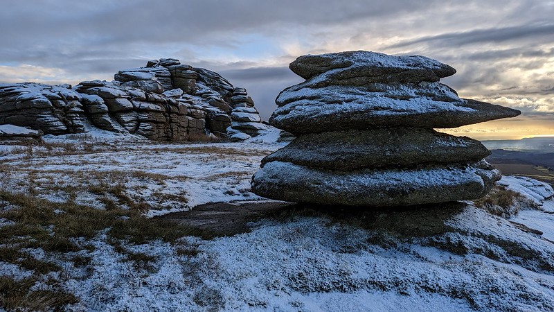 Its prominence did not go unnoticed: it was included on the Perambulation of AD 1240, set out by the knights to define the boundary of the Forest of Dartmoor. Countless authors have written about Great Mis Tor, or Mis Tor as it was often called, describing its romantic beauty. A.E. Bray notes a rock basin on the summit, first noted in 1290 according to Worth; "...we returned, with the determination of soon visiting Mistor, which is the next to the north-east, and which our good shepherd informed us was the most curious on the moor, and that we should there meet what was called Mistor pan: this we concluded must be a Druidical basin of large size." This basin, also known as the Devil's Frying Pan, is unusual in that it is the only known example on the tor, but it is most certainly a natural feature, created by thousands of years of erosion and freeze-thaw weathering. Thurlow (1993) records that the basin "...once had a bridge across its open end, a unique formation long since vandalised." Tim Jenkinson gives dimensions: "92 cms in diameter and 18 cms deep" and concludes: "A fascinating and enduring feature its dimensions have remained relatively constant for around 200 years." Mistor Pan was once incorrectly labelled on historic Ordnance Survey (OS) Maps as a bog and was marked where Mistor Marsh resides. However, and somewhat unusually for the OS, this mistake was amended in later editions. It is a most attractive rock basin, usually filled with rainwater, that is a firm favourite among many Dartmoor enthusiasts. 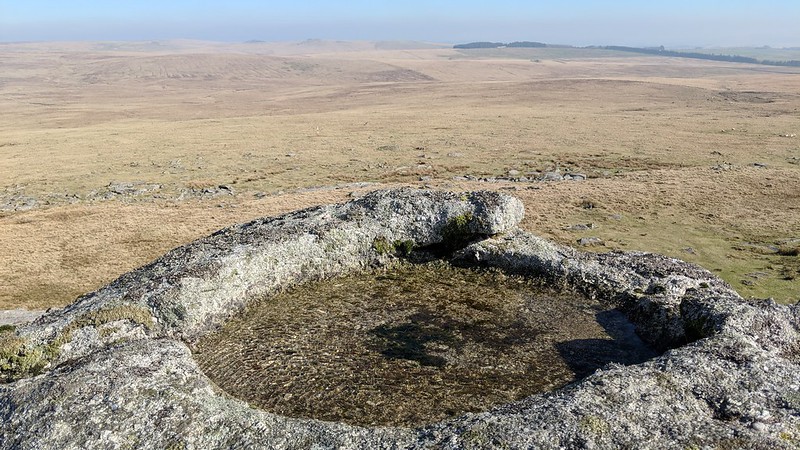 Viewed from far and wide, the heaped stacks of the tor, standing proud on this lofty hilltop, can be discerned from as far away as Shell Top in the south, Rippon Tor in the east, High Willhays in the north and Bodmin Moor to the west. Rowe (1848) describes the vista very well: "On reaching Mistor summit, we shall command a magnificent prospect, along the western border; perhaps the finest from any part of the moor, but among the very interesting objects which open to the view, Vixen Tor and the vale of the Walkham immediately below, will not fail to arrest the attention. Looking down the woodland gorge, between Walkhampton and Sampford Spiney, the eye at length rests upon that part of the noble estuary of the Tamar above Saltash, where it expands into a broad lake at the confluence of the Tavy with its waters, near Beer Ferrers. To the voyager up the Tamar, when he arrives abreast of Warleigh Point, and opens Maristow, Mistor rises with all the grandeur of a genuine mountain in the purple distance..." 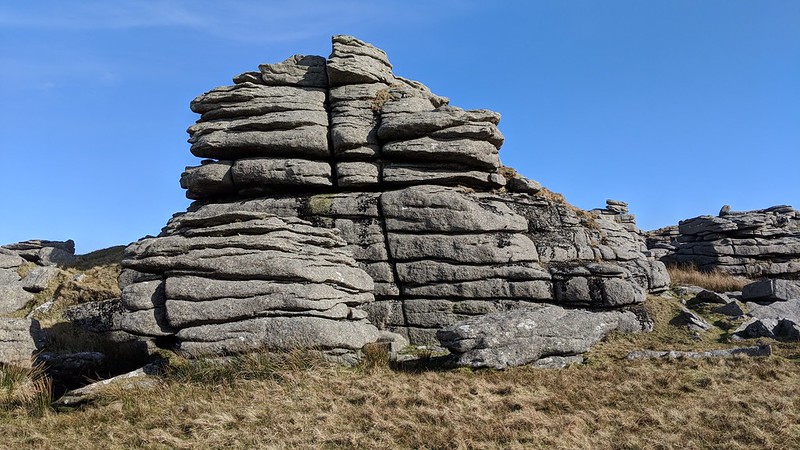 It is a stiff ascent from the west, where the visitor will have to negotiate masses of clitter, but from the east it is a gentler approach. A row of OS benchmarks run up to the tor, north to south; these were cut in the 19th and 20th Centuries for the purposes of surveying elevations. Of those on Mis Tor, found by Rob Naylor (of Dartefacts), the best is at SX 56327 77140. The summit outcrop, a huge elongated rock ridge, is capped with a flagpole which is used by the Ministry of Defence (MOD) to hoist a flag when live firing is taking place in Merrivale Range, to the north-east. The closest access point is at the former Foggintor School, now Four Winds car park. From there a gravel track heads north almost to the summit rocks, ending just short at Little Mis Tor.
| ||||||||||||||||||||||||||||