TORS OF DARTMOOR
a database of both lesser- & well-known rocks and outcrops
Great Trowlesworthy TorGreat Trowlsworthy Tor, East Tor, Eastorre, Estorre, Trowlesworthy Tors 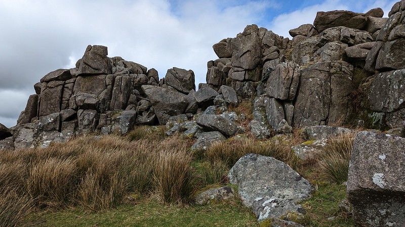 This tremendous tor, that rarely receives recognition, sits on the summit of Trowlesworthy Hill just over 2 kilometres east of the honeypot of Cadover Bridge. The scale of the rocks here is amazing this being one of the South Moor's finest rockpiles, exhibiting pink (or red) granite fragments that are unique minerals peculiar to this south-westerly edge of the high moor. Evidence of quarrying is abundant, especially at its neighbour Little Trowlesworthy where a deep gouge has been cut into the north face of the tor. The extensive clitter strewn across the slopes displays plentiful examples of tare and feather marks with grooves and attempts at rock splitting. 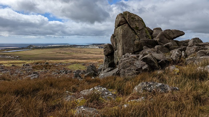 Great Trowlesworthy Tor is simply a massive lump of granite, with two smaller outcrops set to the west. The tor rises stupendously from the turf: its main part presents as a lengthy ridge of broken granite. Whilst it is certainly rugged the tor is by no means the neatest, but a careful ascent to the top is recommended to experience the remarkable panorama on offer. We learn from Hemery (1983) that the nearby Little Trowlesworthy was formerly known, and pronounced, as 'Trolsworthy Tor', with its higher cousin being known as "'Eastorre' or 'Estorre' - that is, 'East Tor'. The tors are so marked on the Woollcombe estate map of the area dated 1842.'' It seems that the Great Tor (because it is higher in elevation, not necessarily size) inherited the 'Trowlesworthy' name and it has stuck, with all modern maps now showing this. 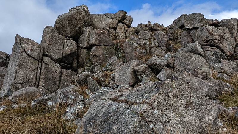 The proliferation of scattered granite here is reminiscent of an even grander rockpile that has not only been used for the stonecutting industry, but also for the construction of prehistoric settlements. To the west of both tors and set either side of the Lee Moor Leat Bronze Age enclosures can be found, with numerous hut circles. Butler (1994) adds: "Uphill [from the Lee Moor Leat] the flank of the Tor is crowded with prehistoric structures. Thirteen separate hut enclosures occupy some 800 m of the hillside below Trowlesworthy Tors, the higher ones in remarkably good preservation despite the drainage ditches and buries of Trowlesworthy Warren. The double-skinned walls of these pounds were carefully constructed of large vertical slabs, many of which still stand in place." The Warren is where rabbits were bred, and the place where warreners built curious X-shaped lines of stones known as vermin traps. A stone would be raised above the ground (see photo below, taken at SX 57482 64470) and food would then be placed within to catch stoats and weasels that preyed on the rabbits here by triggering a lever. Collingwood (2017) explains: "Warrens provided rabbit meat to the city of Plymouth but also it provided readily available meat for the tinners who worked on the moor." The warrens were productive in their heyday, the first to be recorded on Dartmoor being "Baldwin de Redvers to Sampson de Traylesworthy in 1272" according to Hemery. Butler's plan of the Trowlesworthy settlement shows four vermin traps incorporated into the enclosures. Access to all of the enclosures is facilitated by several tiny granite bridges spanning the leat. 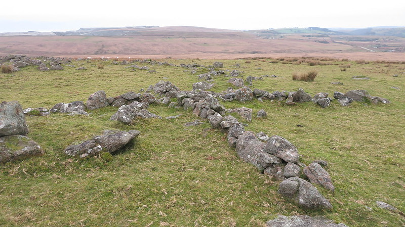 Whilst grand in its sprawl the tor is nonetheless in the proximity of the industrial wasteland of the Cholwichtown China Clay Works. This is considered by some as an unforgivable scar on the landscape, at a place of former beauty, but it illustrates how the value of the land for industry is perceived coupled with the ongoing quest for profit. We are at the start of the 21st Century fortunate that the Trowlesworthy Tors continue to survive from this intrusion and have as yet never been subjected to being broken up and destroyed by the expansion of the works to this side of the moor.
| ||||||||||||||||||||||||||||||