TORS OF DARTMOOR
a database of both lesser- & well-known rocks and outcrops
Great Warmpit Copse Tor
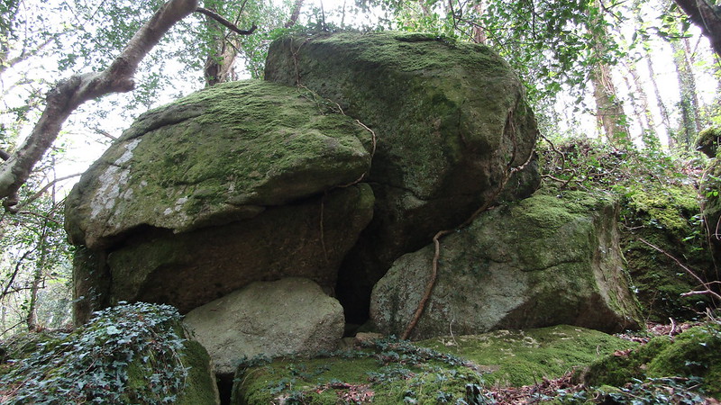 One of the most spectacular of all of East Dartmoor's rockpiles resides in Warmpit Copse, about 1 kilometre east of Lustleigh. Here there is a huge array of giant boulders and outcrops that are scattered on the slopes above a stream. Extending along the east valley side for some 200 metres or so towards the A382, the visitor must stand beneath the rocks to the west to fully appreciate the outcrops on display here. Each one as impressive as the other dwarf the onlooker and there is one rock, pictured below, that we playfully nicknamed 'The Giant's Teardrop'. 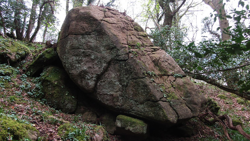 The tor opposes the lower outcrops of Kelly Mine Tor across the valley of Bullaton Stream which, prior to afforestation and the natural regeneration of trees, would have been a spectacle indeed where, on the hillside, there would have been a tremendous sprawl of rocks visible to the naked eye. Nearby is a curious man-made pond which is known locally as Quarter Mile Pond. Built to facilitate Kelly Mine, its primary purpose was to store water that could be pumped via an old pipe along the contours of the hill towards the mine when Kelly Stream, the only other watercourse in the area, dried up. Water was essential for the mine's operations which produced micaceous hematite up until 1951, a type of iron oxide used primarily in rust-resistant paint. The Kelly Mine Preservation Society (KMPS) visited the pond and found it in a dire state, which led to it being cleaned out in 2016. Today, although not used for industrial purposes, water can still be pumped as it always has been by releasing a huge plug in the dam. 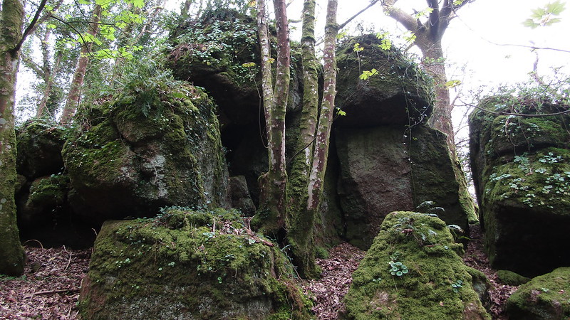 At the bottom of Great Warmpit Copse Tor lies Slade Adit and Brooks (2016) explains: "The Hawkmoor lodes cross the A382 Bovey Tracey-Moretonhampstead road a few hundred yards south east of Kelly. Old adits and cave-ins extend up the hillside to the east of the road towards Hawkmoor mine." He continues: "The new adit was collared on what was probably an extension of the main Hawkmoor lode a few yards east of the road and some 30 feet above it, in such a position that ore trammed out of the adit could be tipped down a chute for loading into a lorry." The adit today is largely overgrown but there are hopes that KMPS will be able to clear part of it in the future. 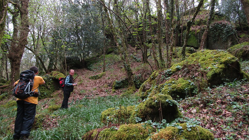 First noted by Max Piper the rocks at Warmpit are on private land and permission to visit should therefore be sought.
| ||||||||||||||||||||||||||||||