TORS OF DARTMOOR
a database of both lesser- & well-known rocks and outcrops
Greator RocksGrea Tor, Grea Tor Rocks, Grey Tor, Grettor Bridge, Leighon Tor (Rowe) 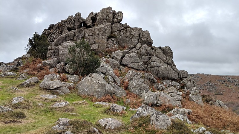 Hound Tor Combe is a beautiful valley through which Becka Brook picks up pace as it cascades over granite boulders between oak trees, all overshadowed by immense masses of granite on the hillsides. The most spectacular of the rockpiles that is set high above the west bank rears its head from the valley side and is marked as Greator Rocks on maps, although it has also been known as simply 'Grea Tor', this alternative spelling is used most notably by both Crossing (1912) and Hemery (1983). 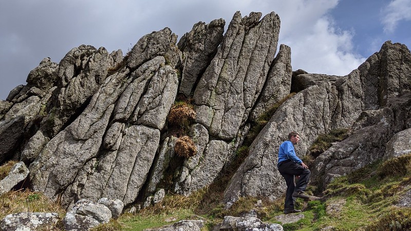 The tor is romantically situated where the hillside briefly breaks to give rise to a spectacular series of crags protruding upwards that from certain angles resemble a series of jagged granite needles. Grea Tor is in parts embellished in a maze of climbing plants that give it a colourful appearance: from the south the two main rock faces are quite bare, with a huge cave in the eastern pile; from the north near to the Hound Tor Medieval Village the Rocks are much more overgrown where trees veil some of the granite. Bracken surrounds the southern base of the Rocks in the summer months but the outcrops nonetheless possess an appearance that cannot fail to impress the visitor as he approaches and clambers over the granite. 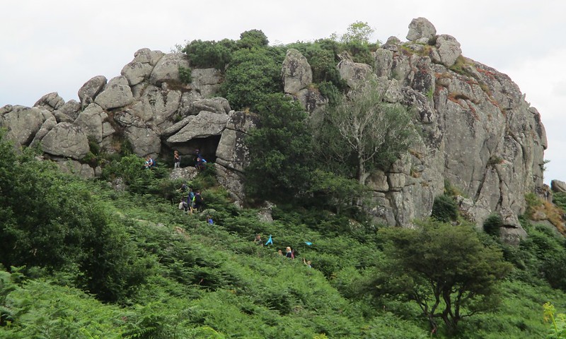 In the past there has been some confusion on maps and in the literature regarding the names of the tors in Hound Tor Combe. At one time the name of Grea Tor was attributed to what we know today as Smallacombe Rocks, and the name of another tor on the same side as Smallacombe, called Leighon, has also been used as an alternative appellation for Greator Rocks. It was Samuel Rowe who inadvertently misplaced both tors in the following account from 1848; "West of Grea Tor on the other side of the Becka Brook. Sometimes called Leighon Tor". It is now generally accepted that Leighon Tor is an altogether different tor on the east side of the Combe below Black Hill at SX 7584 7868 as marked by several prominent Dartmoor authors. William Crossing attempted to rectify the situation in Gems in a Granite from 1905 where in a footnote relating to Smallacombe Rocks he explains "This pile has sometimes been called Grea Tor, but we believe wrongly so. Grea Tor is situated on the other side of the valley but being often spoken of as Grea Tor Rocks the existence of a second pile bearing the name has been supposed. Hence the mistake." Despite this, errors in interpretation continued until at least the 1970s, a situation that to this day is still not helped by the ongoing and glaring omission of Leighon Tor from OS Maps. 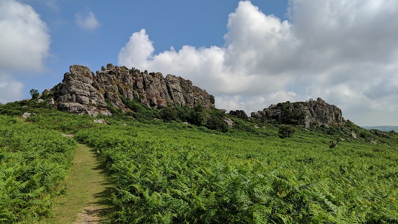 Grea Tor is the epitome of Dartmoor's raw beauty, where moorland ends and gradually becomes woodland and the granite stands testament to the ravages of time. It is the shelter of the little valley behind the tor that no doubt led to medieval settlers to construct the aforementioned Medieval Village, which actually stands closer to Grea Tor. The relatively straightforward accessibility and short distance from Hound Tor makes Greator Rocks well worth a visit. It is perhaps the true sentinel of Becka Brook Country and it would be remiss to not pay a visit to this wondrous ruin of rock.
| ||||||||||||||||||||||||||||||