TORS OF DARTMOOR
a database of both lesser- & well-known rocks and outcrops
Green TorGren Tor, Grantor 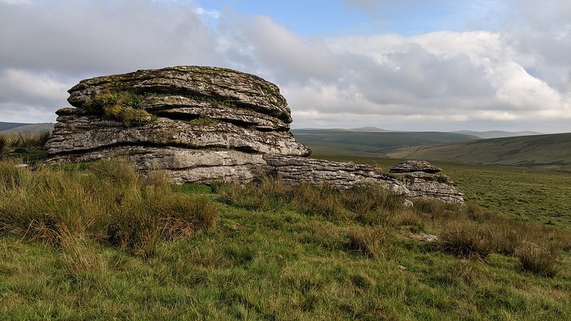 Above the infant Rattle Brook on North-West Dartmoor, Green Tor with grass growing atop the main outcrop well deserves its name. The tor comprises several low-lying squat outcrops that protrude from the gentle south-west flank of Amicombe Hill, and despite its position well below the summit of that hill, it nonetheless attains an elevation of nearly 550m above sea level, making the tor one of Dartmoor's highest. Eric Hemery picked up on this aspect in High Dartmoor - Land and People: "So relatively high is this north-west area of Dartmoor, due to the 'great tilt', that this little tor 'breaking out of the hillside' stands twelve feet higher in elevation than the majestic Great Mis Tor." 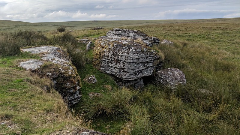 A good approach to Green Tor is from the west at Lydford High Down, via the old peat track which is also a bridleway, skirting the south slopes of Great Links and the twin Dunnagoat Tors, before arriving at the Rattle Brook, from where the tor is clearly visible as a wide scattering of flat rocks. There is a useful clapper bridge over the stream here, unmarked on OS maps, which enables access to the tor along a grassy path. Another option is the direct path from Kitty Tor to the north-east, but this is often very soggy and not recommended in winter. 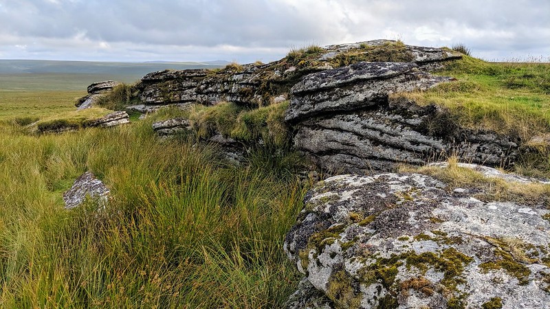 Although not rising to any great height above the turf, the plentiful broken piles of Green Tor are pleasing to the eye, breaking as they do the monotony of the perpetual moorland grass that otherwise extends uninterrupted some three miles to Fur Tor and Cut Hill. At close-quarters the rocks of the tor are more impressive, especially the lower, southern pile that rears its wall of granite high above the ground, its horizontally-jointed facade is interspersed with vibrant green moss. The highest elongated outcrop, characterised by lush turf, offers a superb seat for the rambler to take a break and embrace the unfolding vista. 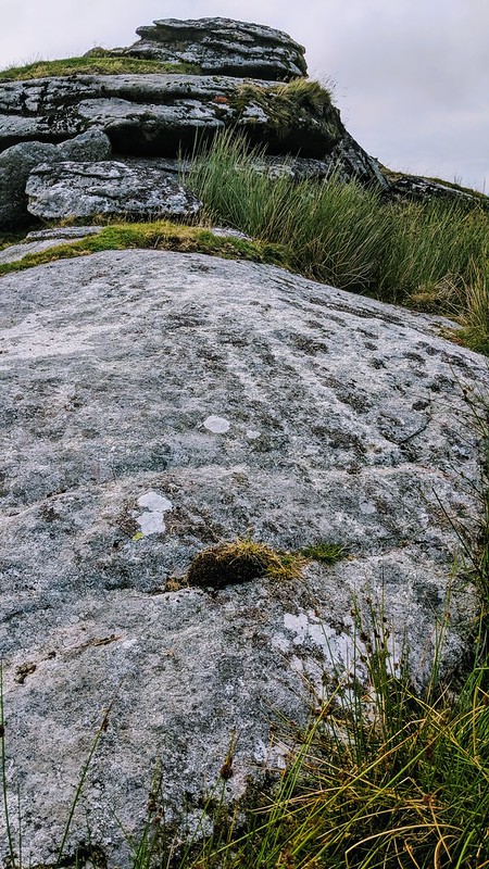 The views are memorable, especially looking southward down the Rattle Brook, the valley sides rapidly steepening and the stream picking up pace. When caught on a sunny day, particularly in low winter light, the Rattle Brook resembles a silver ribbon meandering to its confluence with the River Tavy in Tavy Cleave. It is a beautiful scene where wild, open moorland blends with former industry, for the area is rich in disused tin workings, notably Rattlebrook Mine, whose grassy heaps can be distinguished in front of Rattlebrook Hill, and the Bleak House ruin, standing immediately downhill and opposed across the brook by the Dunnagoat Tors. This remarkable ruin is now a shadow of its former self. It was described by William Crossing (WC) in 1909: "Not very far from the tor [Green] are the walls of a building erected in connection with some peat works further up the Rattle Brook, but which were only worked for a short time. It is now known as Bleak House, a name which its situation on a bare moor at an elevation of 1,740 feet, renders very appropriate." Also known as Dunnagoat Cottage, the ruin was inhabited by the site manager of the Rattlebrook Peatworks, an enterprise that, as WC indicated, was short-lived, lasting from 1879 to the early-to-mid 1900s. The peat, a good insulator, was exported via railway, now just a trackbed, to Bridestowe Station where it met the mainline railway. The burning of peat nowadays has a negative environmental impact so it is perhaps fortuitous that the venture was stopped in its tracks. If you look across to the hillside behind Green Tor from the Dunnagoats, you can still see the omnipresent strips where the peat was cut.
| ||||||||||||||||||||||||||||||