TORS OF DARTMOOR
a database of both lesser- & well-known rocks and outcrops
Gren TorGreen Tor, Grenny Tor, Grinny Tor 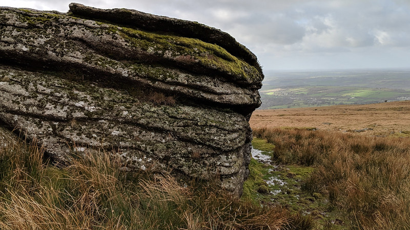 The great sweep of high, open moor at the extreme north-west edge of Dartmoor might be seen as very intimidating crowned as it is by the masses of Sourton, Arms, Brat (Brai), Great Links and Hare Tors to name but a few, yet there remains some smaller outcrops that are often bypassed to reach better places. It is perhaps Gren Tor that best fits this description, as it sits little more than 100 metres above the disused Rattlebrook Railway that once transported peat off the moor but is now a firm track that enables easy access into the depths of the moor. 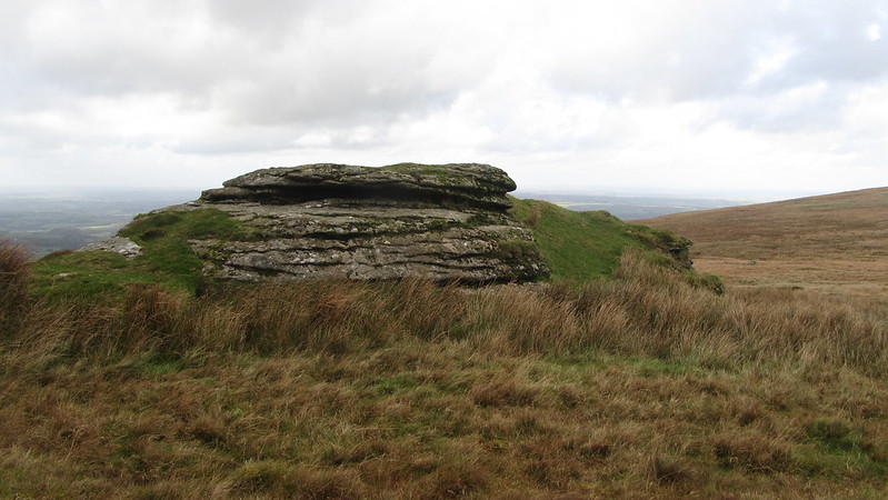 Successive authors have provided few details about the tor, but Crossing (1912, p.183) does state that "Gren Tor, which is a rather striking object, though of small size, is situated close to the track S.E. of the bridge." This 'bridge' that the author refers to is actually located to the north-west and carries the infant River Lyd, and is sometimes called Lydda Bridge on account of the "single-opening clapper bridge" that Hemery (1983, p.933) mentions. The derivation of the tor's name is quite easy to understand: 'Gren' is a corruption of 'Green' and other names given to the tor include Grenny and Grinny. The name is given to those outcrops that present as a grass-covered rockpile, with Green Tor, about 1 mile away to the south-east in Rattlebrook Country, displaying the same characteristic. 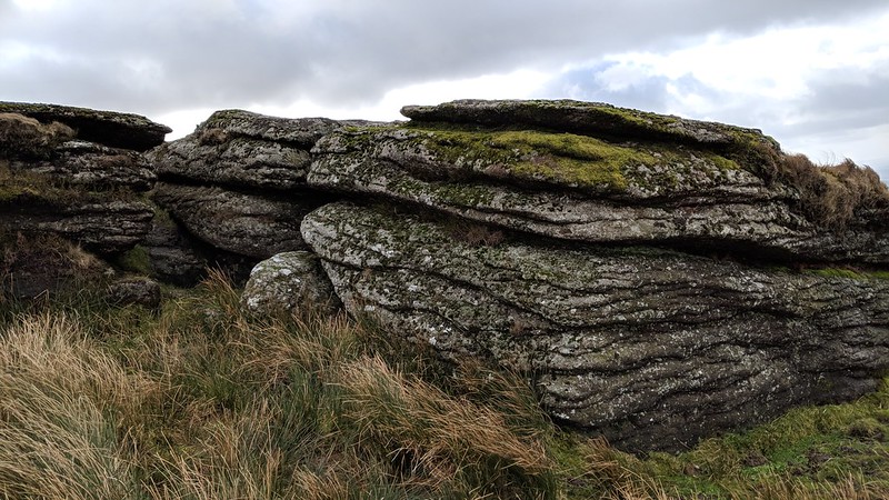 Ordnance Survey Maps show a logan stone at the tor but there is little information about its whereabouts. The tor provides an excellent platform from which the rambler can catch his breath and soak up the awe-inspiring panorama that unfolds, embracing large parts of West Devon, Bodmin Moor and North Cornwall. The easiest route to the tor is to probably follow the course of the old railway from Nodden Gate that loops around the back of Great Nodden that, after negotiating a bridge and hairpin bend, will take you to the bridge over the river. You are then, after leaving the railway track, advised to stick to the grassy path that heads up to the lowly tor since the surrounding ground is often boggy. 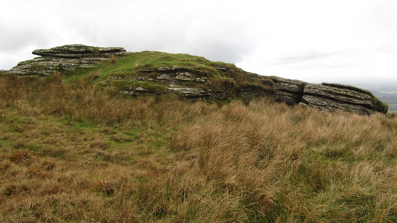
| ||||||||||||||||||||||||||||||