TORS OF DARTMOOR
a database of both lesser- & well-known rocks and outcrops
Hameldown TorHameldon Tor, Hamildon Tor, Hamilton Tor, Ham Tor, Grims Tor, Grim's Tor 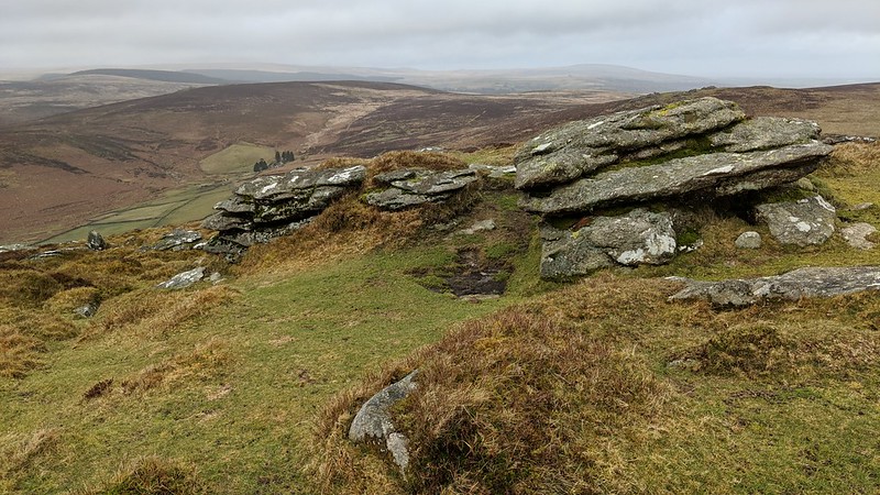 Probably best known for its OS trig point and cairn atop at the high north edge of the ridge but set off the path there are minor outcrops and clitter hinting at a ruined tor. The best outcrop lies on the western shoulder (SX 7016 8054) of the hill, off the ridge path, and the views are far-reaching and well worth the experience with the road only a few hundred metres westward. This low, long pile boasts a wonderful vantage point of Challacombe Down and, beyond, the North Moor with the dark mound of Cut Hill taking centre stage. To the north of the trig point, overlooking Grimspound, there can also be found a logan stone at SX 7028 8074, this a curious upright block that can be espied from the ascending Two Moors Way footpath. The alternative name of Grim's Tor, as quoted by Crossing is linked to the nearby Lake and Pound. 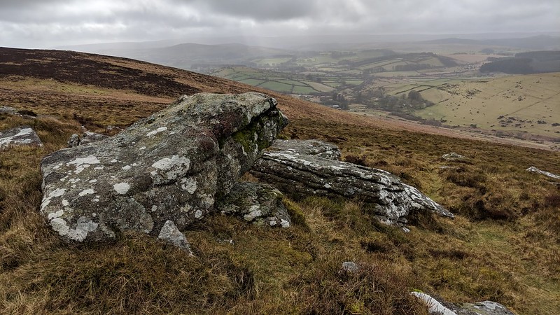 For those that are interested there are a run of boundary stones to the south of the tor that stretch along the ridge for about three miles each inscribed with a place name and DS 1854 (Duke of Somerset). Nearer the main tor is an ancient cross that is described in detail by William Crossing in the book 'Ancient Stone Crosses of Dartmoor and its Borderland': "We shall find it to be a very rudely-fashioned one, formed out of a slab four feet four inches in height, the width of it immediately below the arms being one foot eight inches. One of the arms - the southerly one - is broken off and lies on the ground nearby. The depth of the remaining one close to the shaft is thirteen inches, but it is not nearly so much as this at its extremity." 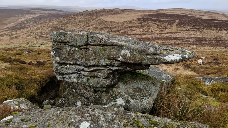 Crossing continues: "The head has also been broken, but it does not appear that it ever rose very much above the arms. From the end of the arm which is now remaining, to the opposite side of the shaft the distance is two feet two inches. The thickness of the cross at the bottom is eight inches, but it is not much more than six inches higher up. It is leaning considerably towards the west. On the eastern face are the letters H.C., which I take to mean Hameldon Cross, and beneath them the letters D.S., while under them again is the date 1854." 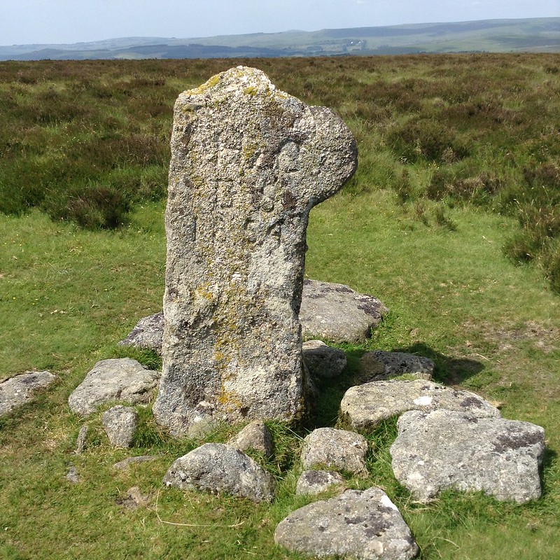
| ||||||||||||||||||||||||||||||