TORS OF DARTMOOR
a database of both lesser- & well-known rocks and outcrops
Hare Tor (Willsworthy Range)Hayer Tor, Great Hay Tor, The Volcano, Air Tor 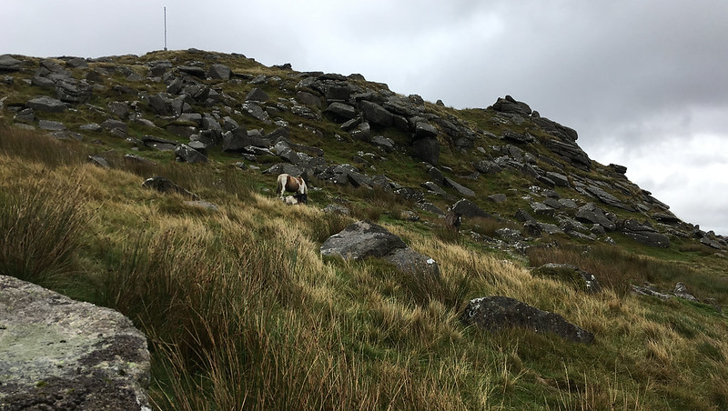 Of the tors that flank the western edge of Dartmoor, one of the most distinctive is Hare Tor whose conical outline commands attention from the Willsworthy Range to the west. It is a huge mound of granite that comprises two main peaks that, to some, from a distance seems to take on the form of the Mount Vesuvius volcano above Naples in Italy; its unusual, intriguing outline easily warrants a closer look. 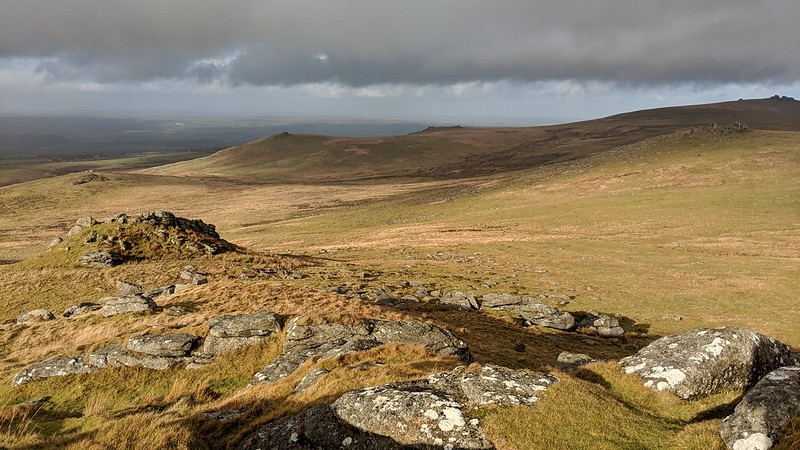 When describing the declining ridge south of Chat Tor, Hemery (1983) states that it "terminates in the grand pile of Hare Tor (1,745 feet)" and notes that "The huge, broken cone has cast its greatest clitter on the south and west slopes. On the north-east edge of the summit is an unusual, oval rock-basin..." Views from Hare Tor remain perhaps the most memorable feature for the visitor; they are incredibly diverse and encapsulate the inner high moor where the remote Fur Tor is seen crowning the hill with her giant rocks to the east; southward lie the craggy tors above Tavy Cleave and the view stretches out beyond towards White Tor above Wapsworthy; westward lies Bodmin Moor in Cornwall and the rolling fields in between, including the conspicuous eminence of Brent Tor; and northward are the imposing tors of Brat, Lydford Sharp and Great Links, and the tiny pimple of Chat Tor on Rattlebrook Hill. On a clear day the vistas are among the finest in Devon. 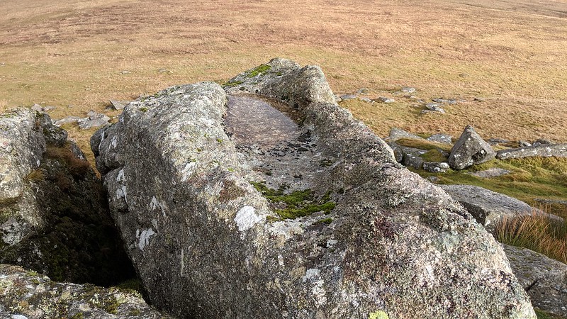 The modern name of 'Hare Tor' is thought to derive from that of 'Higher Tor' which, through speech, contracted to 'Hayer Tor' and thus 'Hare Tor', and when seen from southerly viewpoints such as from the Tavy Cleave Tors it indeed appears to be one of the higher tors standing well above its neighbours Ger and Sharp Tors. Crossing (1912) in his Guide speaks of a Great Hay Tor above its smaller neighbour Little Hay Tor which adds credence to this theory. Another suggestion for the tor's name is that from the east it loosely resembles a crouching hare. 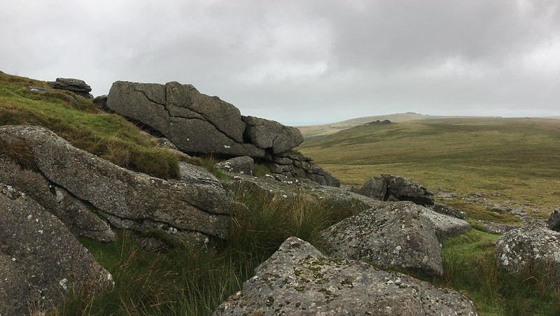 Bound (1991), in 'The A to Z of Dartmoor Tors', gives the walker some routes to Hare Tor: "A not too strenuous walk from Lane End can be undertaken to Tavy Cleave, up the Rattlebrook, north-west up Deadlake to the WD stone and the cairn due north of the tor. Then climb gently to the summit of Hare Tor for the panorama before dropping down via the old rails of the mobile target on Willsworthy Range above Reddaford Leat to Lane End. The more direct way is the opposite; Hare Tor is seen from the parking area and, providing the marshy patches near Willsworthy Brook are avoided, the walk is easy, if up hill all the way."
| ||||||||||||||||||||||||||||||