TORS OF DARTMOOR
a database of both lesser- & well-known rocks and outcrops
Harton ChestHarton's Chest, Harton Tor 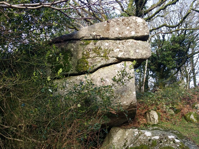 When walking along the ascending ridge path above Lustleigh Cleave, you pass a number of tors, and it is a short distance after visiting West Sharpitor where in winter months you may be able to spot a pale crag jutting from the treeline in the distance. This is Harton Chest and on approach from the south-east side you are greeted with a giant outcrop, the Chest referring to the upper pile that is just part of an impressive tor sprawled over the hillside here. 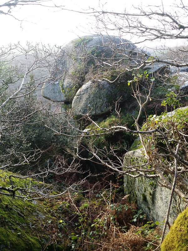 It is hard to grasp the exact scale of the lower outcrop as its huge buttress is partially obscured from the footpath, but what you need to be aware of is that it drops away steeply where the hillside gives way to numerous boulders and clitter extending far below towards the river, and when exploring the slopes please proceed with caution. It is easy to see why this is a popular area for bouldering, and when climbing onto this rock you are rewarded with a magnificent view embracing much of the wooded hillsides that are typical of East Dartmoor. 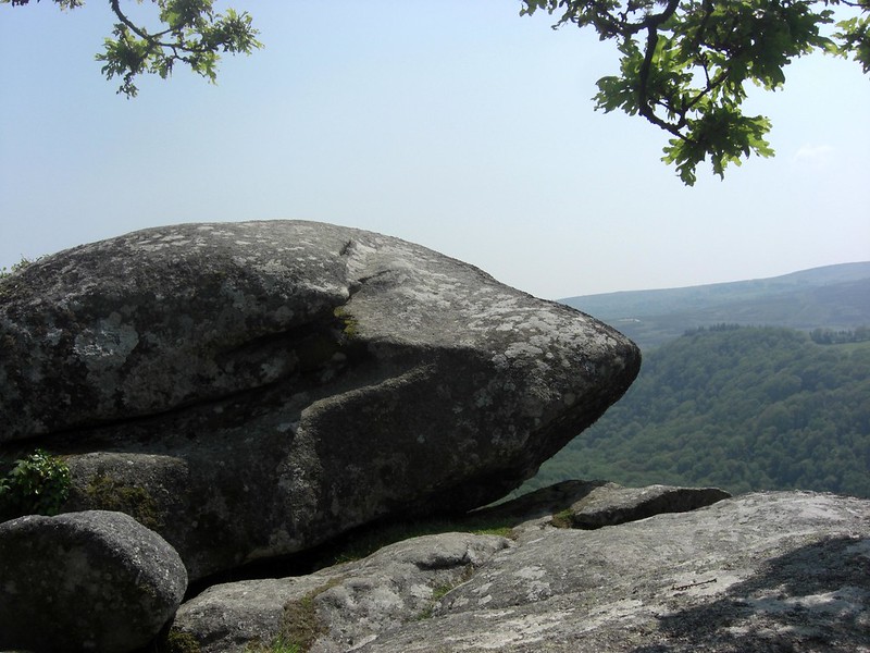 We learn from the Holiday in Dartmoor website of the existence of two further granite outcrops at SX 76589 81779 and SX 76624 81737 about 100 metres to the west of Harton Chest, that are known as Lookout Rocks 1 and 2. These, while essentially a part of the same tor, are a magnificent section with towering walls rearing up from the steep valley floor. Set at just 50 metres or so below the track at the top of the cleave, the rocks are not visible until you are standing on them, and indeed there are stunning views through the canopy that take one's breath away. 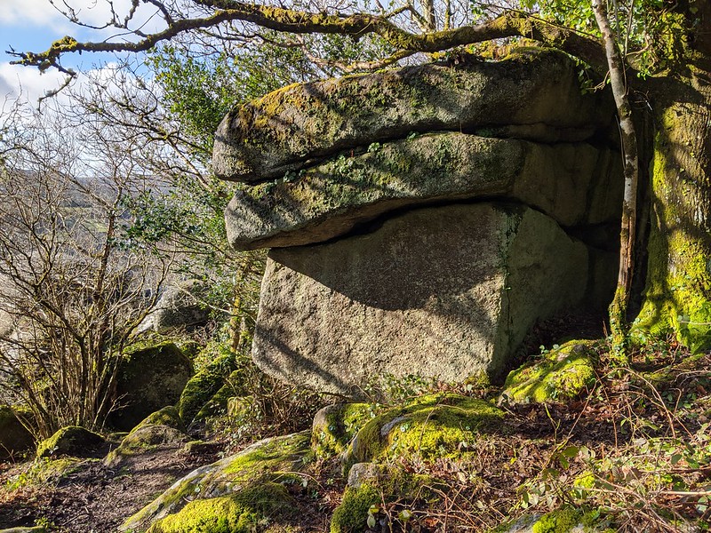 Harton Chest is one of a number of striking rockpiles lining Lustleigh Cleave, and its surroundings are defined by the formation of this valley which sits on the Sticklepath Faultline, classed as a 'wrench' or 'tear' fault that is believed to have been created as a result of tectonic forces in the Atlantic Ocean creating cracks within the Earth's crust. It is thought to be responsible for the earth tremors that were felt throughout the region in November 1955.
| ||||||||||||||||||||||||||||||