TORS OF DARTMOOR
a database of both lesser- & well-known rocks and outcrops
Hedge TorHedge Down Tor, East Down Tor 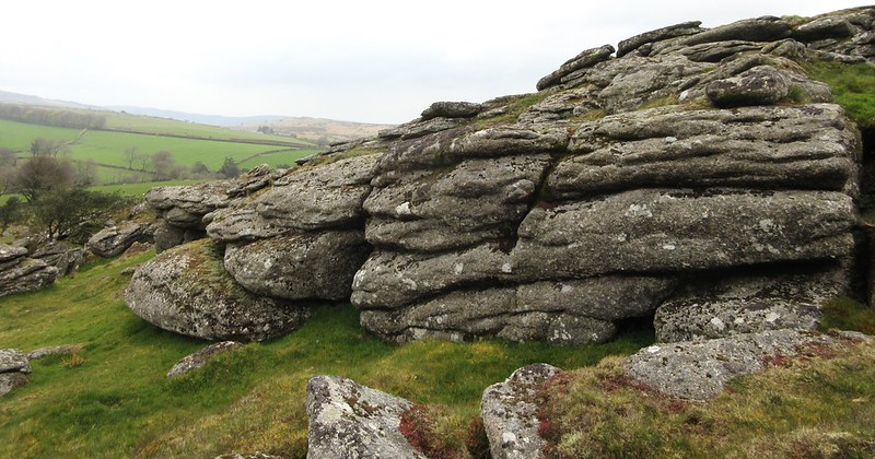 The lesser-known tors of Dartmoor can, in many ways, be just as striking, if not more so, than many of the well-known and celebrated tors that we are all accustomed to. Sitting on the northern shoulder of Hedge Down lies a terrific tor of considerable proportions. It resides on a salient of open access land that juts into the private fields belonging to Hedge Barton and has strangely received minimal attention in the literature. This is most alarming not just because of its stature but also because it is so easily visible from nearby Chinkwell/Honeybag and Hound Tors. 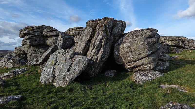 Consisting of two main and quite separate piles, the name of 'Hedge Tor' dates back to as early as 1926 when it was mentioned in an article about the South Devon Hounds, albeit only in passing. Seemingly missed by Messrs Crossing and Hemery, it is described in more detail by Tim Jenkinson (TJ) where he observes that there are "two most impressive outcrops" and "a sprawling rock field above the farm." TJ's attention to these rockpiles spearheaded Max Piper (MP) to encourage the Ordnance Survey (OS) to acknowledge the name of this fine tor, with the name of 'Hedge Tor' first appearing on their 1,25:000K maps in March 2024. We later discovered that the tor may have been known as 'East Down Tor' as clearly marked on an 1802 map entitled 'Dartmoor Prison'. The name disappeared from subsequent maps. 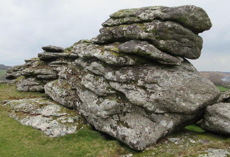 The rocks are horizontally jointed and run along the spine of the hill; from the east side the north pile resembles a wall, and a number of minor caves can be found between the other stacks. The south pile is the summit, a much smaller outcrop but nonetheless attractive, including on the west side two very shallow rock basins that trap a thin sheet of water. Views from here are wonderful, especially northward where the distinctive Easdon Tor takes centre stage, with Hayne Down and Bowerman's Nose to the right. The far more popular Hound Tor crests Houndtor Down to the east, while southward the range of tors that are visible is incredible. To the immediate west the twin humps of Chinkwell and Honeybag stand together veiling the East Webburn beyond. It is a lovely vantage point that might come as a surprise to the rambler who finds himself surrounded by far more illustrious neighbouring tors. 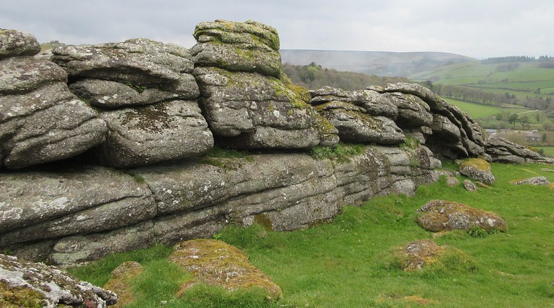 Before the Countryside Rights of Way Act (CRoW Act) came to fruition, the tor was set on private land, but since the 2000s access rights have changed and the public can now freely reach the tor by climbing one of the two recently constructed stiles that have been erected over the wall to the east of Chinkwell Tor, improving the previous access which was limited to one crossing. Without doubt the best route to the tor is via the northernmost stile (at SX 73052 78628), with a fairly straightforward path downhill that passes through a gateway and over a small brook where the tor looms on the horizon. It is well worth a visit on a clear day to experience the solitude that is seldom afforded at other tors in the locality. Please be warned that reaching Hedge Tor from the southern stile (at SX 73220 78336) is more problematic as it involves an ill-defined route passing through a miry piece of ground and then a scramble under trees in the dip, before climbing the slope.
| ||||||||||||||||||||||||||||||