TORS OF DARTMOOR
a database of both lesser- & well-known rocks and outcrops
Heltor RockHel Tor, Hel Tor Rock, Whitestone, Hell Tor 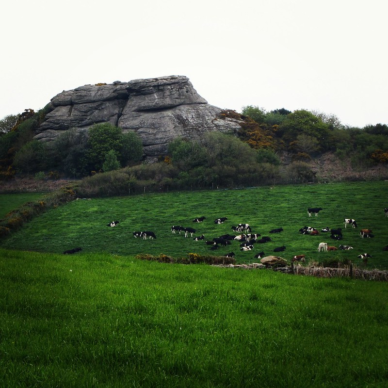 Along with Blackingstone Rock, Heltor Rock (or Hel Tor, as it was once spelt) is an outstanding landmark within the parish of Bridford and quite a surprise when travelling along the narrow lanes from either Moretonhampstead or Bridford village. It stands sentinel above the surrounding farmland and its eminence makes it easily visible from the summit of Blackingstone Rock one mile to the south-west. Rowe (1985) tells us that another name for Heltor is 'Whitestone' and that it "occupies a more commanding position" than Blackingstone Rock and that when "Viewed from Dunsford and the immediate neighbourhood, it wears the appearance of some antient castle-keep, drapiered with ivy, and built to defend the pass below." Although it lies on private land, Hel Tor is easily reached by using a permissive footpath from the south at a stile by the road which leads right to the feature. 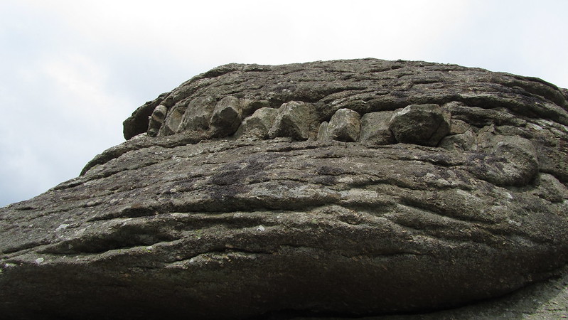 The tor is a giant outcrop with deep fissures and splits that is essentially divided into two sections, with the natural gap in between being known as the 'Devil's Gully' to rock climbers and boulderers, appearing by this name in Clapham's (2017) Climbers' Club Guide. This chasm in the tor, where the onlooker stood within is dwarfed by magnificent walls of granite on both sides, offers fabulous views of Heltor Hill to the west. The summit of Hel Tor is perhaps an even more impressive feature and a sight to behold: exceptional rock basins speckle the tops of both masses and those on the north particularly warrant attention. Ormerod (1859) was clearly impressed when he visited Hel Tor that he dedicated a considerable amount of detail to the basins here, writing: "Near Bridford, at Hell Tor, we find several basins." and that: "On the southern part of the Tor there are 4 perfect and 1 imperfect basins, on the northern part 5 basins, and of the last, one is the largest basin that the Author has seen in this district." 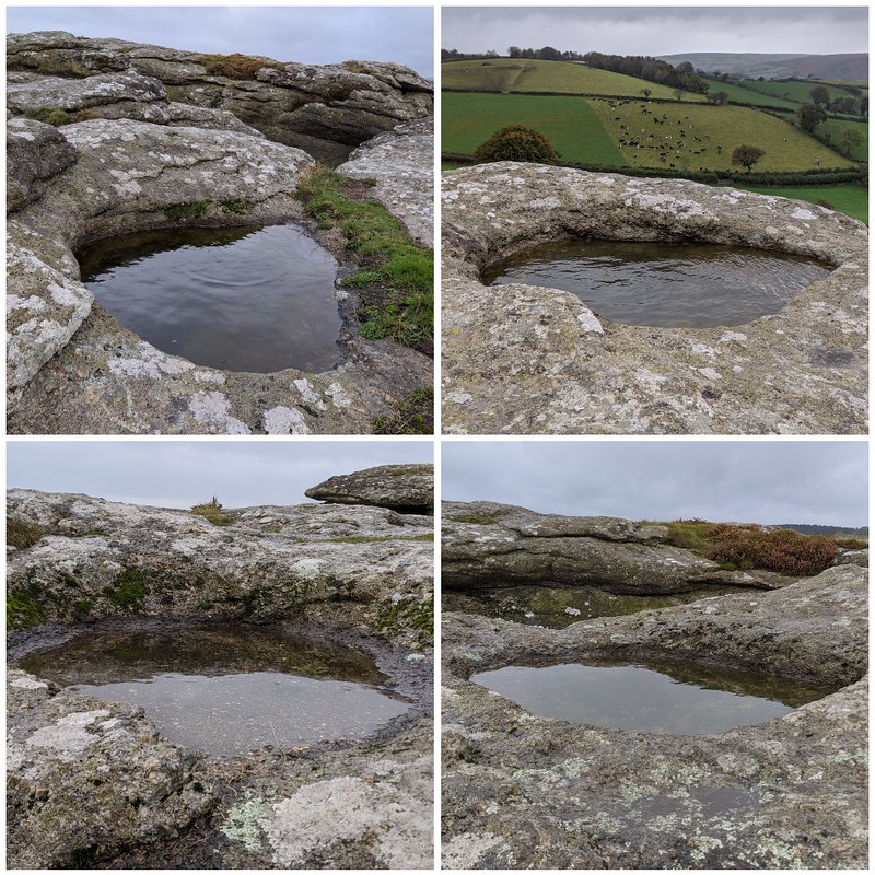 Ormerod's tremendous account of the staggering display of rock basins on the tor has not gone unnoticed by much more recent observers, such as Collingwood (2017) who comments that each basin in its own right "would be worthy of remark on any other tor." One of the most conspicuous features of Hel Tor is an intrusion of microgranite on the south-east side that, to some, could be likened to a set of jagged teeth; and set away to the south-east of the main tor are two more outcrops, one of these sited in a field that is visible from the public bridleway to Burnicombe to the east. There is a legend associated with how both Hel Tor and Blackingstone Rock were formed, best told by Crossing (1912); "Like Hel Tor, it is seen for many miles round, but according to tradition there was a time when these tors were not to be seen at all. This tells us that on the hills on which they are placed King Arthur and the Evil One once took their stand and threw quoits at each other, an encounter in which the latter was defeated. As the quoits fell they became changed into rocks, and thus the masses that we now look upon were formed." 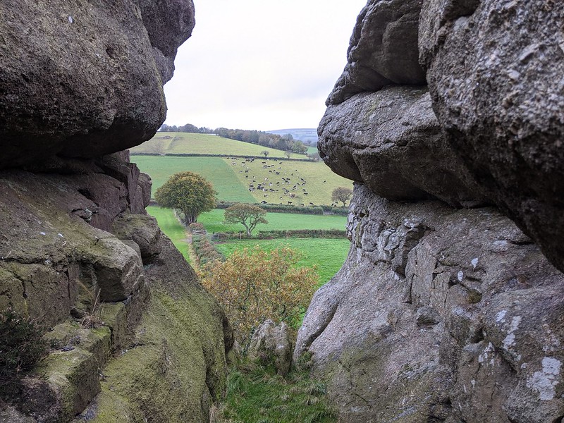 The views from Hel Tor are simply awe-inspiring and embrace a significant portion of the Teign Valley, "the panorama being as beautiful as it is varied." to quote Crossing. But it is those that penetrate northward towards Mid Devon that remain the most spectacular because here, so detached from the high moor, the visitor's attention is drawn to a mesmerising array of fields that unravel for miles in every direction. An ascent to the summit on a clear day will not leave you disappointed.
| ||||||||||||||||||||||||||||||