TORS OF DARTMOOR
a database of both lesser- & well-known rocks and outcrops
HenchertrawRuddybrook Rocks, Ruddy Brook Rocks 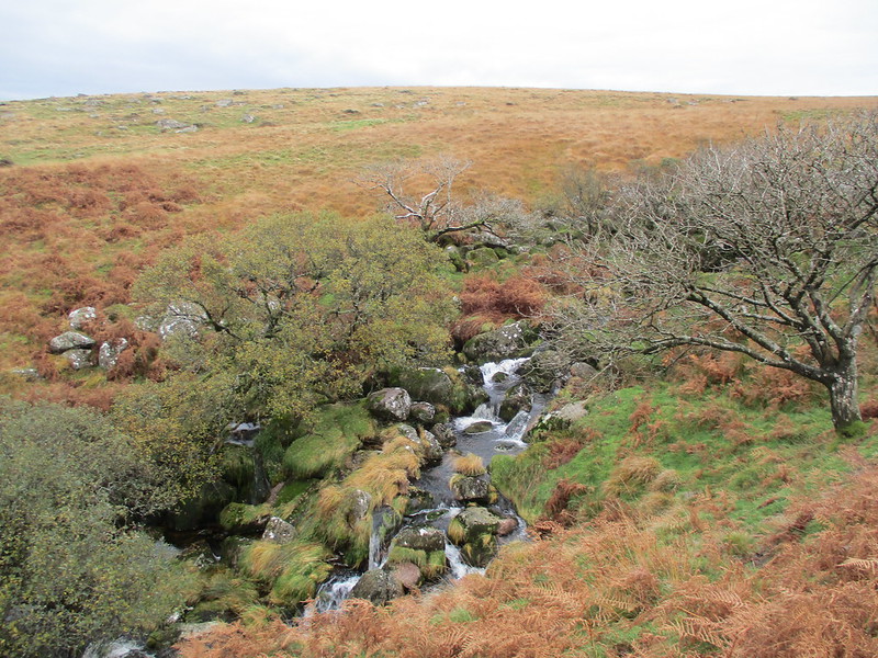 This beautiful little gorge on a lower section of the Red Brook in Avon Country is first described by William Crossing in 1905 and was rightly included as one of his Gems in a Granite Setting, where he writes (p128): "Henchertraw is really Hencher Trough, the latter being occasionally applied on the Moor to those miniature canyons formed by the narrowing of a stream, where the banks are unusually high." He continues: "A stranger wandering near it might be attracted by the tops of mountain ash trees that bend over it but he would otherwise not suspect the existence of its hidden beauties. It is only when he stands on the brink and looks down upon the tiny stream that these are revealed to him." Then exercising his usual evocative descriptive powers the author adds: "There he sees the innumerable little waterfalls, ferns and moss-coated rocks, with, perchance, a gleam of sunshine darting through some opening and turning the crystal drops that hang upon the foxglove or the heather sprays into beads of gold." 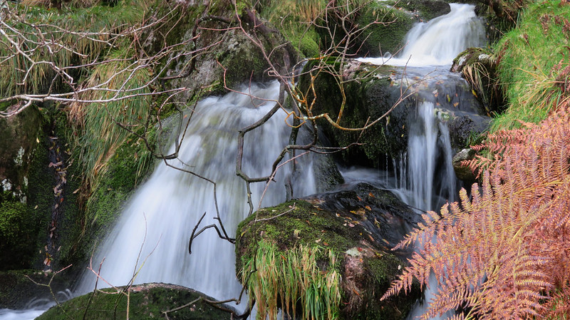 Some years later in 1921, and staying on the subject of the origins of the suffix 'traw', Hugh R. Watkin remarks: "It is suggested that the names "Troy," "Tree" and "Trew" found separately as place-names and in compound words are of similar origin. Although there are possible exceptions I do not think the majority of instances have anything to do with "tree." For examples, Rattery and Wadstray were, in the thirteenth century, spelt Rattrewe and Wadestrewe (Hist. of To f ties Priory and Medieval Town, p. 627). Long-a-traw, and Henchertraw, occur on Dartmoor, and as it is shown that "la Triwe," "Trywe," "Trewe" and "Truwe" referred to "a narrow short valley, opening or gap"; and that the same word seems to occur in "the Trustede Wey," h.d. True Street, the derivation is more likely of common origin with our word trough..." 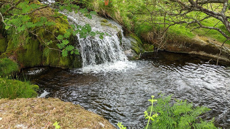 This interpretation of 'traw' as meaning a 'trough' is repeated by Hemery in 1983 and then again by Hayward in 1991 who describes the scene in his book Dartmoor 365: "Here the Red Brook tumbles down through a trough or traw that had delighted many a Dartmoor walker. The dancing stream leaps down over tiny cascades and through swirling pools, whisking its happy way round mossy boulders." Beneath the canyon close to the left bank of the Brook is a small ruin that is linked to the legend of Garth the Tinner. Both Crossing and Hayward provide detailed descriptions of the tale and for those interested in such things you are directed towards their work (see references/further reading) for further commentary. 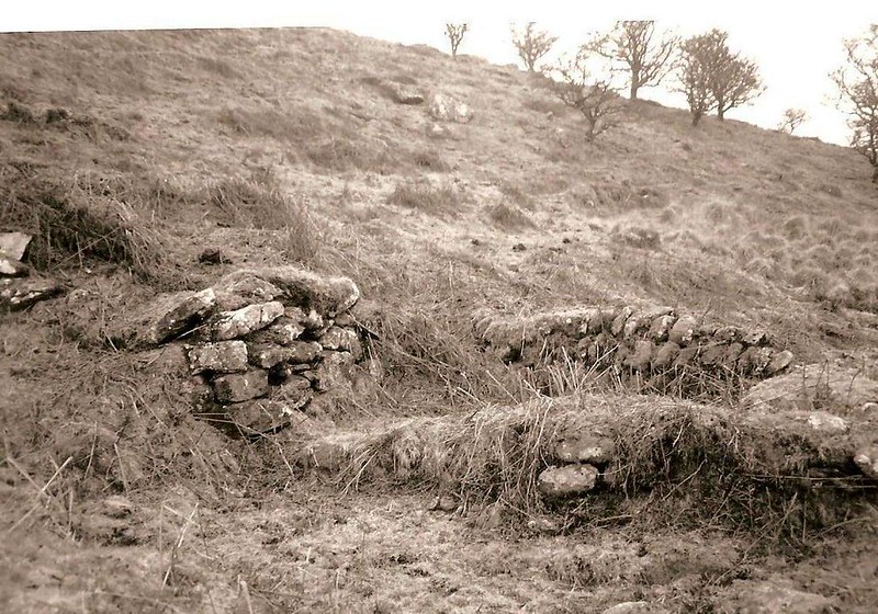 Interestingly the name of Ruddybrook Rocks (RR) appears in various newspaper clippings of the 1920s that recount the exploits of the Hunting fraternity in this area. It is used for something that is significant and well-known close to Red (Ruddy) Brook, with one extract from December 1924 reading: "On Friday from Cross Furzes a fox found on Hickadon ran down Brockhill Mire and to the Avon Valley, and, after several turns up and down, left for the Ruddybrook Valley, where he persistently climbed the steepest hills, only to come down again. As there was a thick fog on all the high land it was necessary to keep close touch. After an excursion up the Middle Brook and over old hill this fox went to ground near Ruddybrook rocks, and after being bolted ran over Zeal Farm to Black Tor and Shipley Brake, turning back over Woolholes into Brentmoor House garden..." The most likely interpretation for RR is that the writer (penname Rex) is referring to the rocky scarp of Henchertraw that remains to this day an oasis in what is an otherwise bleak landscape.
| ||||||||||||||||||||||||||||||