TORS OF DARTMOOR
a database of both lesser- & well-known rocks and outcrops
Higher Knowle Wood South
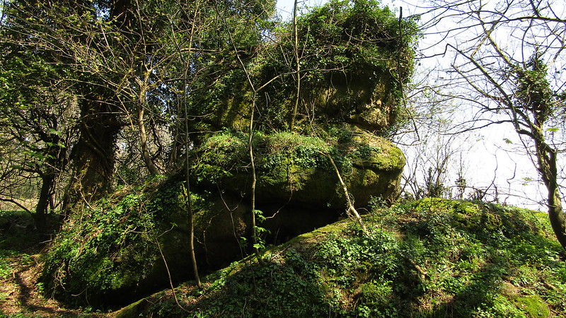 This curious little stack of rock was first recorded by Tim Jenkinson in Oct 2015. Drawn to Higher Knowle Wood by the depiction of what appeared to be three large outcrops on an old OS map to the north (see Higher Knowle Wood North), during his search he came across this strange but more impressive outcrop standing just off the old byway between the road above Hatherleigh Farm and the hamlet of Knowle. Set right on the southern edge of the wood the weirdly shaped rock is covered in vegetation and rises to some 20 feet in height on its western side. Another albeit flattened and much lower outcrop can be found nearby although this is sited behind a fence and is therefore inaccessible. 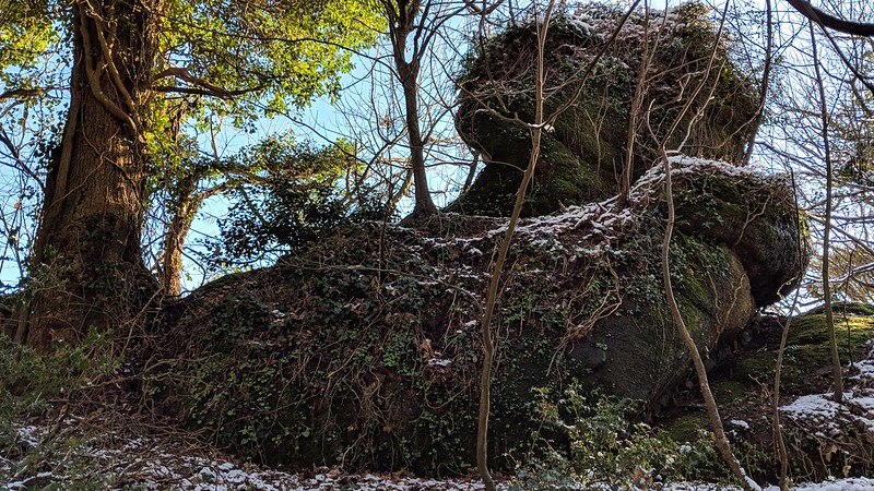 Higher Knowle Wood is managed by the Woodland Trust and they give this description in their Management Plan from 2017 "Exposures of granite occur throughout the site, especially on the slopes, and are a feature typical of Dartmoor woods. The wood is of a mature high forest structure, which sits prominently with the local landscape, and with occasional areas of coppice along the rides, boundaries and beneath the canopy". Indeed, it is that canopy that often excludes light especially in the summer months when the rocks here are covered with luxuriant but often problematic vegetation such as ivy, gorse and briar that can make the access a little more difficult. It seems from the Trust's Plan that this will be addressed "There will be regular management to maintain the light and air conditions for rare lichens and other species characteristic of Dartmoor woods to thrive, through the control of shade bearing species such as holly, coppice along ride/ track edges and the layering of boundary hedges. This will also create space and light for veteran boundary trees to develop and for the lower plant community they support to thrive." 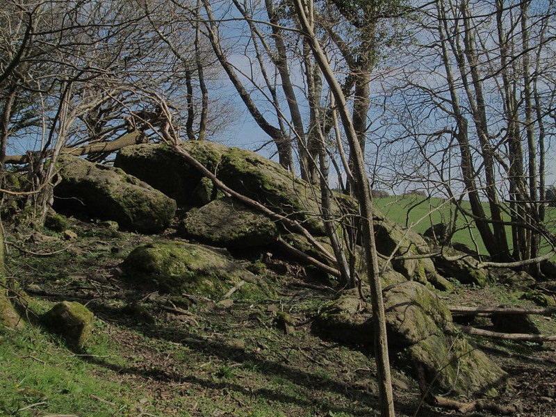 From the main outcrop there are glimpses through the trees over a boundary wall to the south of some of the open fields above the minor road to Lower Knowle. A visit deeper into the Wood is thoroughly recommended where it is possible to follow a level footpath from the southern pile that then loops through the trees to the north taking the visitor within reach of the delights of not only Knowle Rocks but also the impressive non granite Loxter Tor the latter area described by the Trust as "an important exposure of rocks (Woolley Grits)". 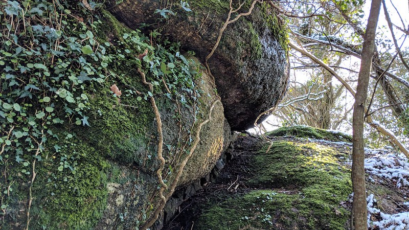
| ||||||||||||||||||||||||||||||