TORS OF DARTMOOR
a database of both lesser- & well-known rocks and outcrops
Higher Park Tor
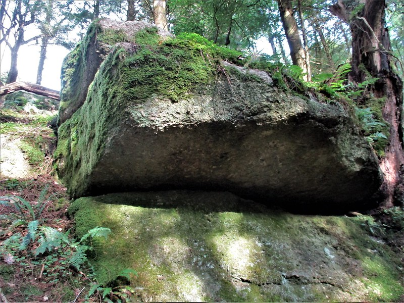 Set to the north of the North Teign River and within the far north-west part of Gidleigh Woods, is an embedded tor at the steepest point of the hillside. This area is appropriately labelled on 19th Century Tithe Maps as 'Higher Park' and is presumed to be related to the neighbouring North Park to the east. The tor is very much emergent with several ledges that protrude from the rather scruffy slope, but they are nonetheless striking at close-quarters where they take on a jagged wall like appearance with a fissured face that looks downhill towards the river. Nearby are two quite distinctive overhanging outcrops that are set on what can be only described as a precipitous slope and therefore care needs to be taken when walking between them as although the ground underfoot is quite springy it can also be slippery. 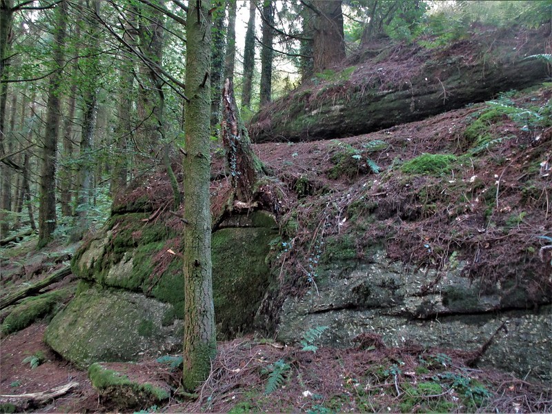 Much higher up the hill is another very large outcrop at SX 6665 8769 this being of a much squatter appearance than the rocks below but one that is once more embedded in the wooded floor and draped in vegetation. As with all the piles in the vicinity the tor here is shrouded in dim light from the density of the conifers towering above the rocks, where over the years deposits of pine needles have crept up over the lower sides of the granite somewhat reducing the size of the outcrops. Higher Park is certainly a very secluded place and appears to be rarely visited as there is a distinct sense of detachment and solitude when walking between the shadowy piles with only the sound of the tumbling river for company. 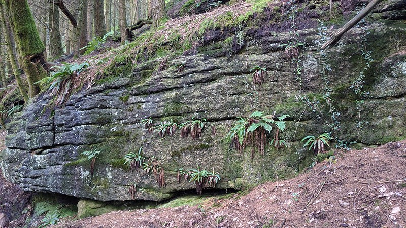 Thanks goes once again to Dartmoor Guide Paul Rendell who came across these rocks during an excursion to the Gidleigh area in 2020 and who then later led a walk here with the ToD team in October 2021 to confirm the site. However, please be warned that although the tor can be reached from paths by the river below, this is all private land and therefore permission must be sought from the landowner before embarking on a visit. 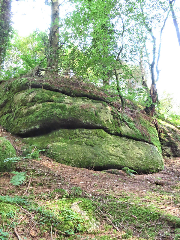
| ||||||||||||||||||||||||||||||