TORS OF DARTMOOR
a database of both lesser- & well-known rocks and outcrops
Hockinston TorHockington Tor 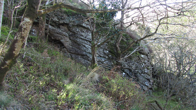 The Dart Valley between Dartmeet and New Bridge is arguably one of Dartmoor's finest wooded gorges and within its confines lie a myriad of broken rockpiles that stud the steep (and often precarious) valley sides. Above the east bank of the River Dart, enshrouded by oak trees and whortleberry plants, lies Hockinston Tor, whose existence has led to a troubled reputation about its difficult accessibility that has plagued walkers. But, in truth, with care it is not extremely tough to reach and if you visit in winter or spring you will find the terrain easier to traverse. 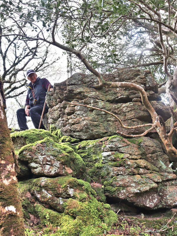 Hockinston is an impressive and ornate tor in a spectacular setting. Its position requires a point of call: being on the edge of the granite pluton, pink granite, interspersed with quartz and tourmaline, has riddled the rocks leaving them strewn across the slope with angular jointings. There is one main linear outcrop that extends downhill to the river, and atop this, the visitor is rewarded for their efforts; a most splendid view, encapsulating the valley below Bench and Sharp Tors, captures the attention, with the distant roar of the river a stark reminder of the erosion it caused to carve this deep chasm. It is recommended to take the time to enjoy this perspective of the valley and notice the tumbling rocks of North Bench Tor in White Wood. The rich texture of the trees will leave you spellbound. 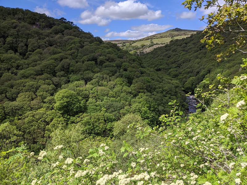 Above Hockinston Tor resides much dishevelled slab granite and clitter that was pointed out to us by Dartmoor Guide Paul Rendell. At SX 69690 72012 a massive slab that is visible from Mel Tor can be found, albeit situated amid dense gorse and bracken, and below this at SX 69634 72006 is a totally ruined area of granite with a small, but conspicuous square rock further down at SX 69601 71966. In essence, all of this is part of Hockinston Tor since they sit on the same spur that is reminiscent of a once much grander outcrop in the vicinity. It is advised for safety reasons that should you visit any of these rocks, you do so with company just as a precaution. 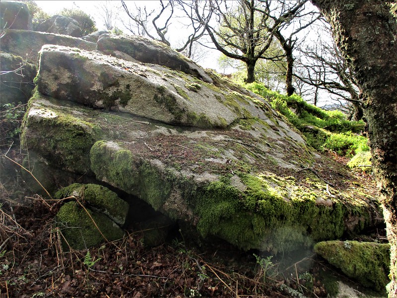 Whilst the tor is clearly marked on Ordnance Survey Maps choosing a route to the rocks can be both troublesome and tiresome and can leave you overwhelmed as there is no clear pathway indicated. However, if you leave Dr. Blackall's Drive just before reaching Brake Corner you can descend into a clearing above Sharrah Pool Marsh where there is a path heading north west into the wood and towards the tor. Following this you will find the journey simpler, but be warned that although faint animal tracks do exist elsewhere, these are not to be relied upon as they can peter out.
| ||||||||||||||||||||||||||||||