TORS OF DARTMOOR
a database of both lesser- & well-known rocks and outcrops
Hollow Tor (Rundlestone)Stone Tor (Hemery), Billy's Tor (disputed) 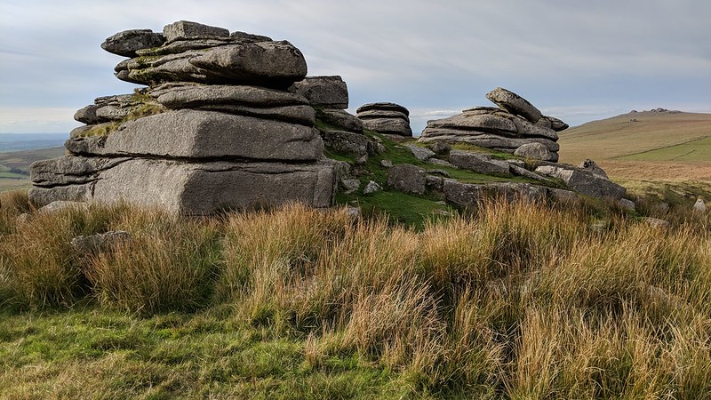 Sitting in a pretty isolated spot, although being close to a road, Hollow Tor is a fine granite outcrop, begging to be scaled, and offering wonderful views of the North Moor. On its highest point you'll find the faint remains of a rock basin that's no longer intact. 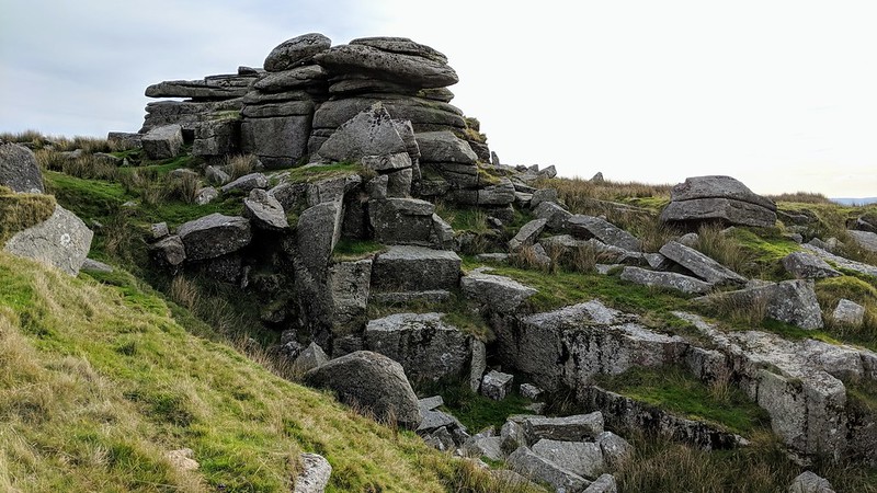 Its north face has been desecrated by a small quarry. Hemery, in his book 'High Dartmoor', incorrectly tells us that the outcrop was; "Shown on the 1840 Tithes Map as 'Stone Tor' which suggests the quarry-workings to been of early-nineteenth century origin-as they look to be-this local name signifying the tor from which stone was customarily obtained." In fact, the Tithe Map for the Parish of Walkhampton shows Rundlestone Tor as "Stone Tor", and not Hollow. 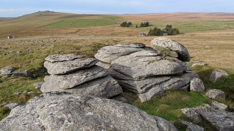 It is also still considered a contender for so-called Billy's Tor mentioned by Eric Hemery, even though he mentions them both as separate outcrops. Nigel Tigwell wrote an article in Dartmoor Magazine in 2012 which began; "The 'mystery' of Billy's Tor is raised in Steven Jenkins' article in Issue 106 (Spring 2012). In fact, Billy's Tor is the local name for Hollow Tor. Arthur Smith who has lived in Rundlestone his entire life and who was mentioned by Hemery in his book High Dartmoor was raised with the name of Billy's Tor. When we moved to Rundlestone in 1997, we were introduced to the rock pile as Billy's Tor by Eunice Smith although it appears the name is now only used by a few locals and former residents." He goes on; "However, the local name was given in the 1930s when Billy Easterbrook was given the licence for quarrying here." 
| ||||||||||||||||||||||||||||||