TORS OF DARTMOOR

a database of both lesser- & well-known rocks and outcrops

Home Search Map The East Access About Team Social Blog

Hollowpark Rock

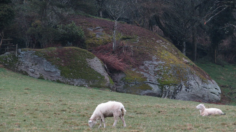
East Dartmoor is a treasure trove of hidden rockpiles that crown the hilltops and valley sides, but they are often cloaked in the darkness of a thick canopy of trees that conceal them from most visitors. Historically, a handful of these tors have been identified by authors and a few others have been named on Ordnance Survey (OS) Maps, but disappointingly and mysteriously some of these latter locations have been removed from modern representations.

One good example of this is Hollowpark Rock, a huge sloping outcrop that had been shown on all versions of OS Maps leading up to and including their 1963 publication but for some reason, the maps were changed, and the name became lost until it was spotted on an old map by Max Piper in 2018. An on the ground visit by Max and Paul Buck the next day confirmed that the Rock is still extant just as expected, so why was the name omitted from later OS editions? The OS responded by suggesting that Hollowpark Rock was probably removed because it was deleted from larger scale plans. They explain that "smaller scale maps derive text from larger scale plans, therefore, when those are revised, any relevant text that has been deleted at larger scale would have been removed too."

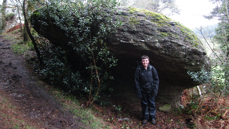
The whereabouts of Hollowpark Rock was published in print in Dartmoor News (DN) Issue 178 in 2021 complete with an NGR, but for Max he felt that it deserved to be back on the map. So, he contacted the OS in September 2021 about the situation via their Error Reporting Tool and, to his surprise, was delighted when it was accepted as a legitimate inquiry. In April 2022, the tor was added to their Landranger Map and in December 2022 to their Explorer Map. This ground-breaking revelation sparked the interest of BBC Radio Devon who contacted Max to ask if he could take one of their reporters/presenters up to the Rock for a short audio interview that would later feature on BBC Breakfast. Later, in May, an article on the discovery was published online (see here).

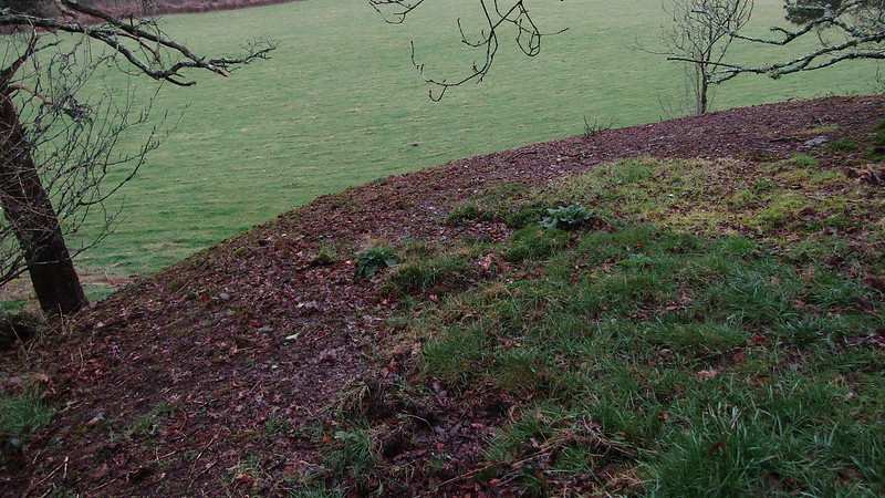
As for visiting Hollowpark Rock, it is conveniently positioned beside a public bridleway on the southern edge of Beacon Plantation. From this angle, approaching from the south-west, it resembles a giant mushroom, and its summit reveals a massive exposure of slab granite that is topped with moss and bracken. In springtime bluebells are found in the adjacent enclosure, but perhaps a better place to appreciate the Rock in its entirety, albeit from a distance and across private land, is as Max describes in DN: "the best view of it is from across the field to the south, by a ford at SX 80843 84555."

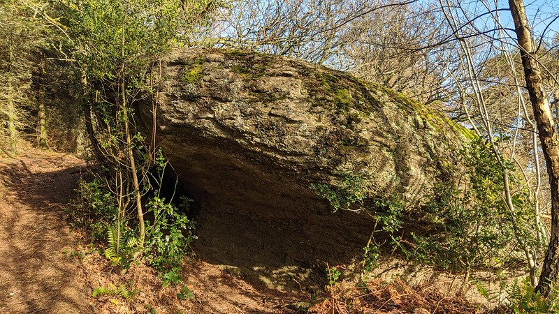
The Rock straddles the parish boundaries of both Bridford and Christow and there is no doubt that it would have once acted as a prominent marker commanding impressive southward views prior to the damming of the Kennick and Tottiford Reservoirs and subsequent afforestation. The Rock's name is also indicated on historic 19th Century Tithe Maps where two plots, 863 and 870, are labelled as Rock Hollow Park and Great Hollow Park respectively. These both reside beneath the outcrop.

It is hoped that the rediscovery of Hollowpark Rock and its reinstatement onto OS Maps will encourage people to visit and admire a long-lost rockpile. Given its ease of access and beautiful surroundings it would be a shame to miss out on a visit.

icon
icon
Hollowpark Rock
The map above is not a navigation tool and we recommend that the grid reference shown below is used in conjunction with an Ordnance Survey map and that training in its use with a compass is advised.
Grid Ref:
SX 8082 8476
Height:
300m
Parish:
Bridford
Tor Classification:
Small
Access:
Public (part private)
Rock Type:
Granite
Credit:
Max Piper (rediscovered)
Ordnance Survey
Reference / Further Reading:
BBC News: 'Hidden gem' Dartmoor tor back on maps after removal
Devon County Council: The Tithe Map of the Parish of Christow
Ordnance Survey, 1:25,000 maps of Great Britain, 1945-1971: SX88 - B (includes: Ashton; Bridford; Christow; Chudleigh; Doddiscombsleigh; Dunchideock; Dunsford; Kenn; Trusham) - Published in 1963
Piper, M. (2021): Dartmoor News, Issue 178, April/June: Exploring the Tors Around the Three Reservoirs
Piper, M. (2022): East Dartmoor's Lesser-Known Tors and Rocks
Tors of Dartmoor Blog: In Search of Hollowpark Rock

Please Support Us

We are proud to see the names of lesser-known tors are now being used more commonly on other websites and whilst this is to be encouraged we do request that, should you wish to use the information on this page, you provide a backlink to the website as reference, by copying the relevant address:

https://www.torsofdartmoor.co.uk/tor-page.php?tor=hollowpark-rock

Please also consider a small donation to the upkeep of the site; any contribution goes toward the fees to keep the database online and any costs incurred when undertaking research such as subscriptions to online archives.