TORS OF DARTMOOR
a database of both lesser- & well-known rocks and outcrops
Holwell Lawn Rock
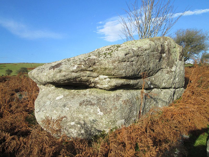 This conspicuous outcrop type rock was first noted in November 2014 by Tim and Ann Jenkinson during a stroll over Holwell Lawn and is situated about 3/4 mile or so to the south of Great Hound Tor in the parish of Manaton. Holwell Lawn is well known for its dazzling display of bluebells in the month of May that draw visitors in their droves. The Rock itself is set on the very edge of the South Devon Moorland and Pony Club (SDMPC) gymkhana course and reaches a height of approximately 1.5 metres on the south side. 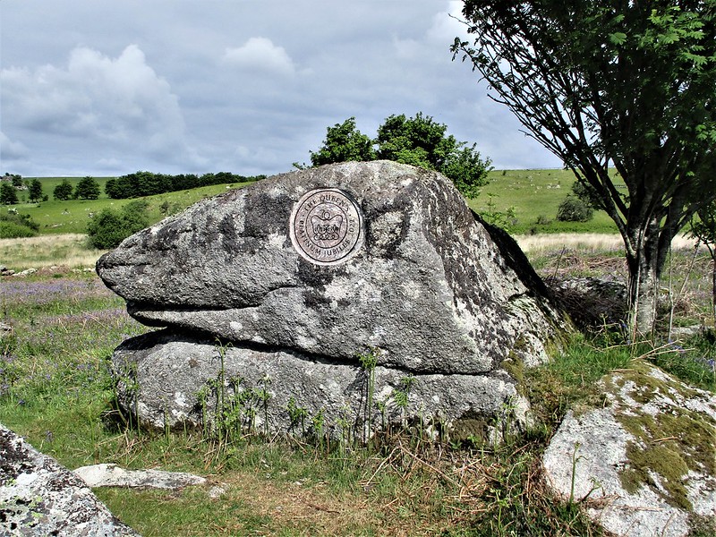 Easily reached by a myriad of footpaths that criss-cross the Lawn, there are stupendous views to enjoy from beside the Rock especially to the southeast where the twin bosses of Haytor Rocks rise majestically above the sprawl of Holwell Tor across the valley. Other and equally impressive piles of Emsworthy Rocks, Saddle and Rippon Tors are seen further on the right-hand side of the horizon, whereas nearer to the south and west are the outcrops and clitter of Holwell Rocks at SX 7391 7769. 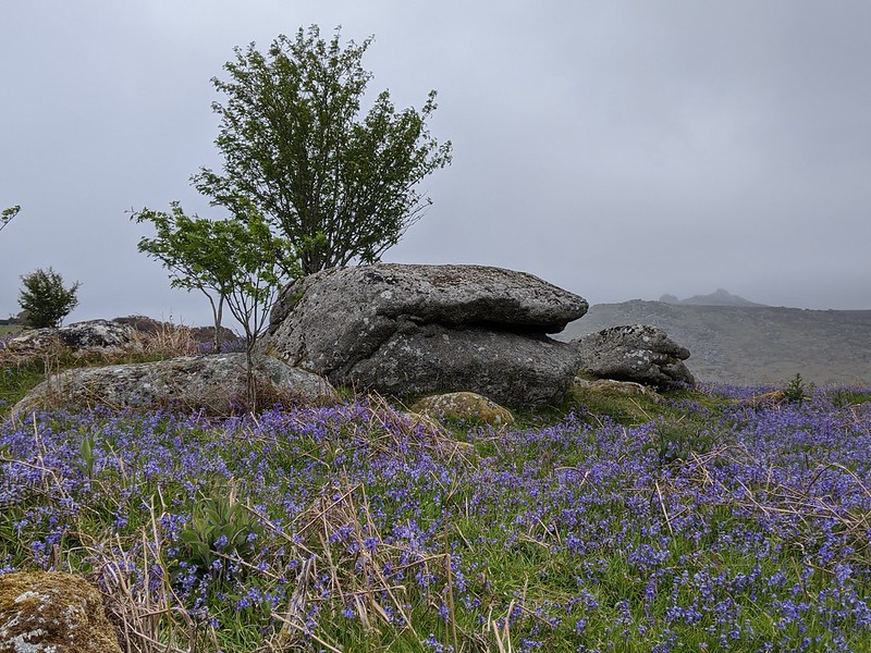 To commemorate Queen Elizabeth II's accession to the Throne in February 1952, a circular inscription reading 'The Queen's Platinum Jubilee 2022' has been carved into the southern face of the Rock as at May 2022, and the legend has been carefully picked out in black paint. Clearly a professional piece of work, as it is complete with the approved Government logo it has nonetheless raised some eyebrows regarding the use of natural granite boulders to record National milestones such as this. 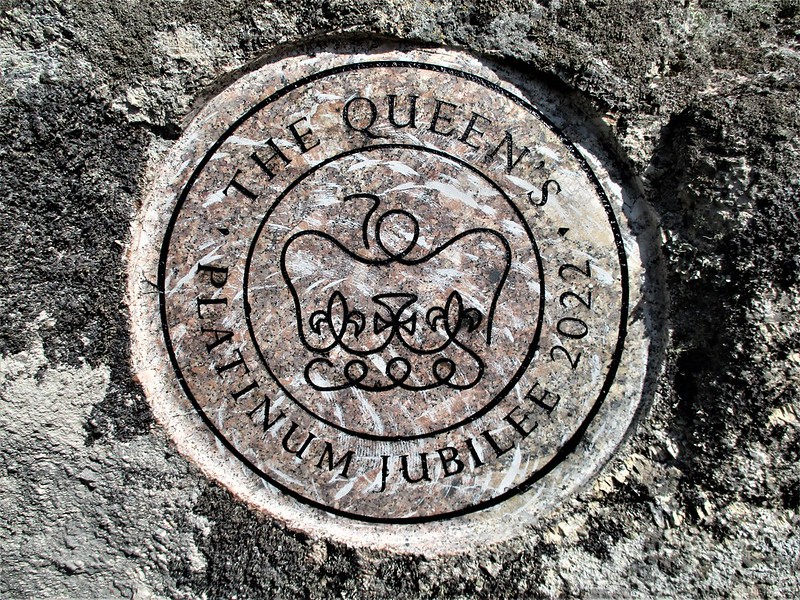 Please be advised that the 100-acre site of Holwell Lawn purchased in 2000 is now owned by the SDMPC and that access is restricted on certain dates of the year in accordance with various equestrian events so it is necessary to heed local signage as closures may apply.
| ||||||||||||||||||||||||||||||