TORS OF DARTMOOR
a database of both lesser- & well-known rocks and outcrops
Hookney TorHookner Tor, Hooknor Tor
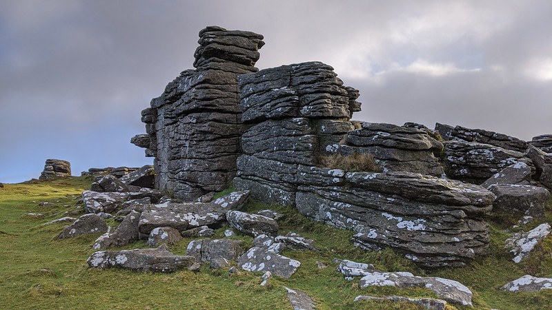 Of the tors that reside between the watersheds of the West and East Webburn Rivers, it is perhaps Hookney Tor that is the most spectacular, boasting a dominant position above the bronze-age village of Grimspound and the lonely Headland Warren Farm. Great views are to be had from its stacks, and its location close to the minor road running southward from Challacombe Cross ensures it is frequently visited, with a wide path passing through the outcrops that is part of the long-distance Two Moors Way route. The tor overlooks one of the most heavily tin mined areas of Dartmoor where the Birch Tor and Vitifer Mine gullies have scarred the opposing hillside. 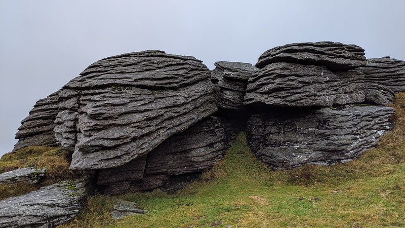 William Crossing writes of Hookney Tor in his Guide, and waxes lyrical about its far-reaching views; "The range of hills forming the southern part of Dartmoor is distinctively visible, and looking through the opening formed by Hameldon on one hand, and Challacombe Down on the other, we see far away in the distance the peak of Brent Hill rising beyond Buckfastleigh Moor, below which are the plantations of Hayford. West of S.W. South Hisworthy and North Hisworthy are seen, and W. by S. the rocks of White Tor. Siddaford is still in full view W. by N." Crossing also refers to "several small piles of rock" that constitute the tor but these are most impressive than he implies and display close horizontal jointings in the granite, particularly on the south side; other piles show collapse and rock partings and form a fine point from which one can enjoy the long, deepening basin of Challacombe Bottom that is nestled between the eminences of Hamel and Challacombe Downs. 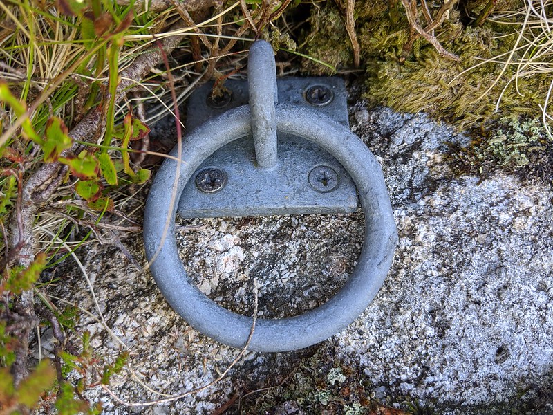 A tumulus or barrow (burial mound) is situated very close to the main outcrops, and is the highest on the hill part-involved with a low rockpile. Heritage Gateway records the mound as being 20 metres wide and 2.4 metres high and is one of a number of tumuli scattered on the surrounding hilltops with King Tor and the Hameldown Ridge possessing even better examples. On the Hookney tumulus, there is a modern tethering ring that is found on the west edge of a rock. Why it was placed here remains unknown, and its appearance is certainly of much more recent origin than other examples of iron rings seen in Tavy Hole and Broad Amicombe on the North Moor. A visit to Hookney Tor will certainly satisfy the visitor with easy accessibility, fine outcrops and views that combine both bronze-age prehistory and industrial heritage. 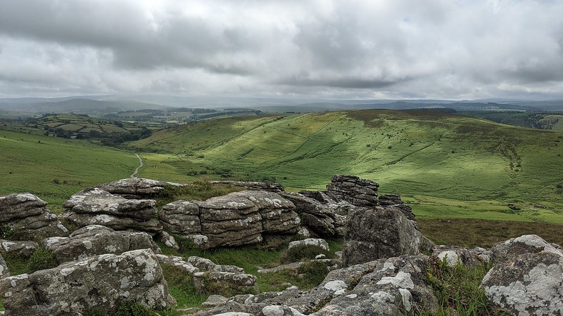
| ||||||||||||||||||||||||||||