TORS OF DARTMOOR
a database of both lesser- & well-known rocks and outcrops
Hound Tor Down Outcrop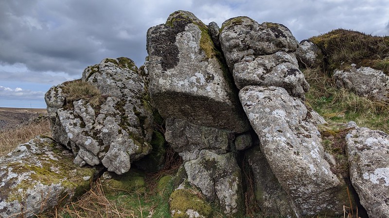 This surprisingly prominent little rock pile on Houndtor Down is set well above and detached by some 250 metres or so to the south-west of Greator Rocks (GR). The main outcrop here is tucked under the newtake wall and has a small vertical cave in its midst with some sizeable boulders scattered beneath. It reaches about 2.5 metres on its east side and there are tremendous views from this part of the Down especially downhill to where the impressively ornamental GR can be seen, giving the visitor a brief air of superiority from this vantage spot. Northward are the splendid crags of Great Hound Tor on the slope above the ruins of the medieval village and eastward there is the rugged Hound Tor Combe with its numerous rock piles standing proud above the valley side. It is a spectacular scene and on a clear day even Lawrence's Tower on Haldon Hill can be seen on the far horizon above GR. 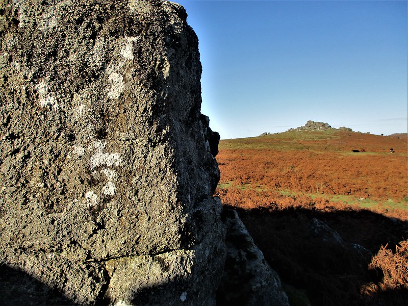 Although not that great in stature the outcrop here is nonetheless worth a look and is well placed to visit the much better attractions in the area. In recent years it has also achieved a certain notoriety as the misplaced location for Holwell Rocks (HR) by Ken Ringwood in 2013. This is an inexplicable error given the previous commentaries from the titans of Dartmoor literature, William Crossing (WC) and Eric Hemery, who both clearly describe HR as being elsewhere at almost a mile away to the south-west to be exact at SX 7391 7769. As is usually the case with errors that are printed in books, this particular one was repeated as recently as 2021 in an article in the Dartmoor Magazine prompting a swift and decisive response from Max Piper to correct the mistake before it could spread further, but the concern is that it will probably not be the last in the series. Errors in supposed factual books tend to stick and can get easily replicated by those who do not make the effort to do their own research nor read reviews or updates of existing records.  In a valiant attempt to put the record straight, in 2023 Tim Jenkinson (TJ) explained the Holwell Rocks conundrum bringing evidence from various sources, some as far back as the early 19th Century by WC. TJ concludes his article: "Understandably, the location of Holwell Rocks has in recent years become strangely problematic and has led to numerous misinterpretations with inaccurate descriptions and grid references and even the application of a new name to the small tor in 2021." (See here about the new name.) He continues: "This once again illustrates how easily errors in the literature can be repeated from person to person and how the lack of OS representation for an area can encourage unnecessary speculation. In this instance there was never any reason for mistakes given both Crossing and Hemery's accuracy in reporting. Thankfully Max Piper has set the record straight for 2022, and this article will hopefully reinforce that message. Once the name of Holwell Rocks properly appears on OS maps that should see an end to the matter." 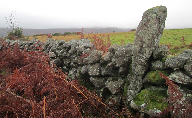 Not far from the outcrop and about 50 metres to the west of it at SX 7438 7842 is another point of interest. Here built into the wall of the newtake is a totally out of context boundary stone. Inscribed with a crossed 'I', it is described as a 'spare' by Dave Brewer (2002) who takes up the story: "It is built into the northern wall of Holwell Lawn facing Greator Rocks and about 6ft tall. According to Mr Whitley of Holwell farm, little work has been done on this wall since 1902 when Lord Justice Eve did extensive repair work to it, but of course the uncompleted bondstone may have been there long before that." The 'I' was once meant to represent the parish of Ilsington but at some point, the stone migrated into the parish of Manaton.
| ||||||||||||||||||||||||||||