TORS OF DARTMOOR
a database of both lesser- & well-known rocks and outcrops
Hound Tor (Okehampton)Little Hound Tor, Round Tor, Parva Hundetorre, Houndetor, Hounteret, Hundatora 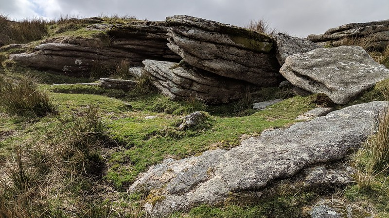 When walking along the lofty Cosdon to Hangingstone Hill ridge, you pass a number of outcrops and points of interest. Hound Tor, roughly equidistant from the two eminences, is one of them, but it is admittedly more impressive when viewed from afar, from the south often appearing as a dark mound. In truth, the tor proper is little more than a low grass-topped outcrop spanning a modest area but when exploring its base, you will realise that there is more to this tor than first envisaged. 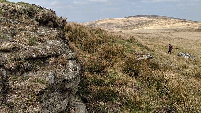 The eastern face is the steepest drop off the summit, an elongated outcrop showing repetitive horizontal jointings. It is also here where a huge 'TP' inscription can be observed; deeply cut into the side of Hound Tor, it denotes this edge of the Throwleigh Parish boundary, adjoining that of Dartmoor Forest. It is also testimony of the tor's past, for its position high up on the ridge rendered it a boundary point in the Perambulation of 1240 under the alias of 'Parva Hundetorre' as explained by William Crossing (1909). However in recent times the tor has been given the name of 'Round Tor' by Eric Hemery (1983) and 'Little Hound Tor' (LHT) a name attributed by the OS to the next hill northward but seeing as the name 'Parva Hundetorre' translates to LHT the OS interpretation is almost certainly an error with the name of Little Whit Hill being more appropriate for their site which is to the north of the White Moor Stone Circle. 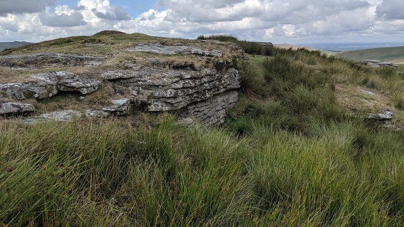 EH insists that 'Round Tor' is the correct name for this pile claiming that all the moormen know and use this name but it has yet to be included on OS Maps. The views from this spot are special; almost the entire course of the Walla Brook can be seen from here. After leaving Watern Combe this tributary of the North Teign becomes a huge floodplain dominating the south-easterly view where the lonely Rival Tor resides. To the north, Cosdon overshadows the aforementioned Little Whit Hill, whilst to the west the impressive ridges of the so-called Roof of Devon and Belstone are to be seen, whilst nearer still Steeperton Hill and its tor are seen as a long ridgeline of broken granite outcrops. 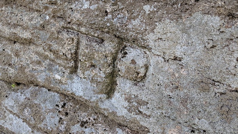
| ||||||||||||||||||||||||||||||