TORS OF DARTMOOR
a database of both lesser- & well-known rocks and outcrops
Ingra TorInner Tor, Chip Tor, Crip Tor (Mudge), Ingater Tor, Ingater Tar, Inga Tor, Innater Tar, Johnson's Quarry  This is a classic example of a Dartmoor tor, located on a spur, consisting of several jointed outcrops. The disused Princetown Railway track loops on the north, west and south sides of the tor. There are great views to be had westward. 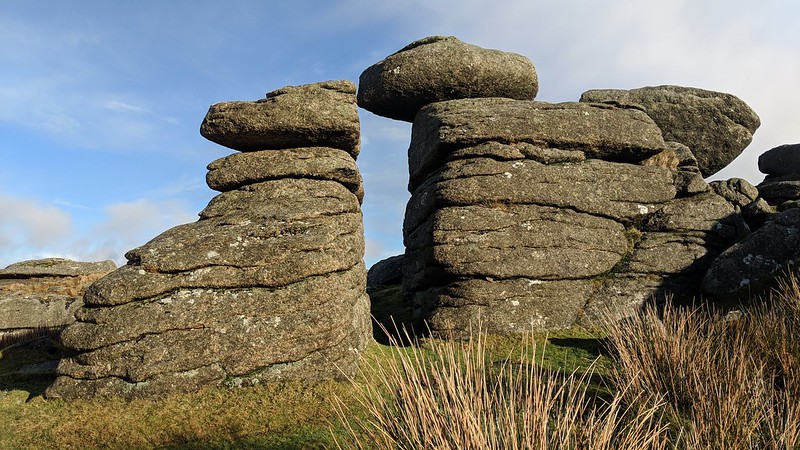 Hemery gives us some insight into the tor's history; "Ingra Tor (1,106 feet), dominating the middle reach of the brook, was obviously a majestic pile until it was attacked by Ice Age weathering and Industrial Age quarrymen." Ingra Tor halt was once a remote stop off on the aforementioned railway line. 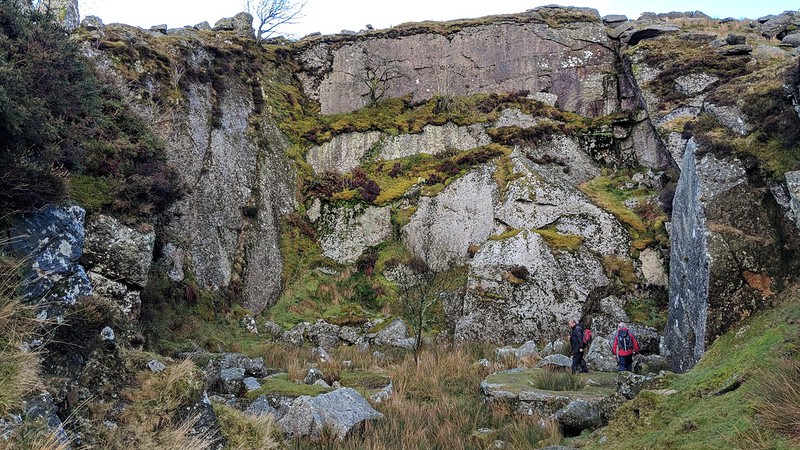 Crossing appears to use "Inga Tor" and Hemery "Chip Tor" to describe the rocks, the latter of which may stem from nearby Criptor Farm. And when consulting Mudge's map of Dartmoor, published in 1809, he marks Ingra Tor as "Crip Tor". However, the location of this name is disputed, with two other locations being possible candidates, the small tor at the farm (SX 5541 7268), and the quarried outcrop east of Swelltor Quarry (SX 5615 7312). What's most compelling about the evidence from Mudge is that Crip Tor Farm and Crip Tor itself are marked separately, and by some distance, the farm shown to be north of the tor. When analysing the map, the reader could reach the conclusion that Crip Tor is either another name for Ingra Tor, or was a cartographer's error. 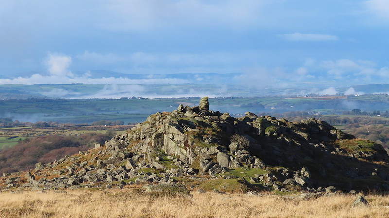
| ||||||||||||||||||||||||||||||