TORS OF DARTMOOR
a database of both lesser- & well-known rocks and outcrops
King's Barn Rocks
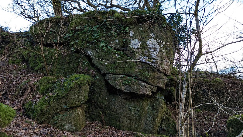 The Tors of Dartmoor Team are indebted to Mike Lucas for drawing our attention to this rockpile in April 2020. Set at less than a kilometre to the west of the hamlet of Harford, across the River Erme, there is King's Wood. Currently owned by the Woodland Trust, with public access permitted, there is a network of paths that weave through the deciduous trees. One of these leads out into a field on the west side to meet up with the public footpath between Hall Farm and Wilkey's Moor at King's Barn, passing on the way a small but interesting tor that is part involved in the wood's boundary wall. 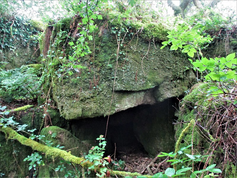 The rocks here are clearly depicted on the Tithe Map of the 1840s and there is no doubt that some stone from the tor was used to construct the bisecting wall. The rocks themselves are at best modest with the most striking aspect being on the east side where vegetation covered granite outcrops can be seen, one forming a low cave close to the wall. More low rocks of small outcrop-type proportions spread into the adjacent enclosure that was once known as 'Kings Barn Park and Court'. These are in the field as opposed to the woodland and are embellished with vibrant moss. 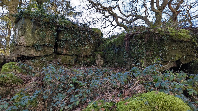 Forming a distinct spur when seen from King's Barn, the rocks here are notable for their picturesque setting and seclusion above the rarely trodden path into King's Wood. At the foot of King's Barn Rocks lies the channel of the now dry King's Gutter, a leat (manmade waterway). We learn from Jane Marchand (2003) that: "King's Gutter is a leat cut in 1818 to bring water to fields north-west of Ivybridge, belonging to the Rogers of Blatchford Manor. The name King comes from the owner of some of the land through which it flowed. The cutting of the leat obviously involved considerable work, it is stone lined in some places, in others it runs along some substantial stone walls on its lower side." The leat was probably constructed to supply local farmsteads with their drinking water. 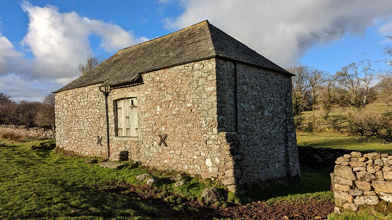 The sturdy building King's Barn is itself of historic interest as it dates to at least the early 19th Century when it was marked on the Tithe Map. It could well be earlier and was possibly built by John L. Rodgers who at that time was the owner of Hall Place, Brook, Kings, Wides and Blacklands. The tenant of the Barn at that time was Henry Sanders. As with other nearby barns in the area, such as Brook and New (both on private land), King's Barn's primary purpose was to facilitate agricultural storage and provide refuge for animals. Today King's Barn has been largely rebuilt and repurposed, with slate roof tiles and guttering helping to preserve the condition of the building.
| ||||||||||||||||||||||||||||||