TORS OF DARTMOOR
a database of both lesser- & well-known rocks and outcrops
King's Wood Tor
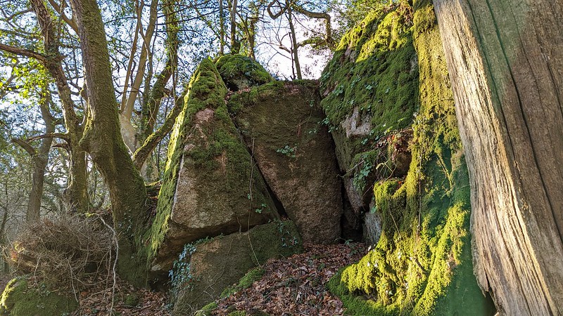 Set in the parish of Harford some three miles to the north of Ivybridge this small tor in King's Wood was first noted by Mike Lucas in 2020. Part of the Hall Farm Estate the land on which the tor resides is now managed by the Woodland Trust having once been owned by the Trust's founder Kenneth Watkins. Bounded to the south by a tributary of the River Erme and to the north by a lane, there are as described by the Trust 'steep boulder slopes' in the Wood upon which some impressive outcrops stand especially on the north side. 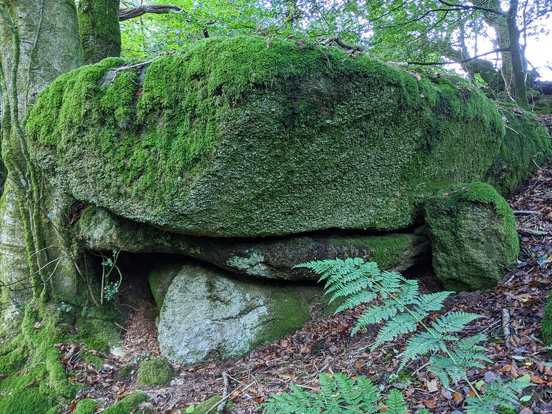 All shrouded in half light on account of the trees, the rocks are mostly moss and vegetation covered but above the main group there is a curious vertical cave that could easily accommodate a crouching person and close by is a huge pyramidal boulder. The whole wood here is serene and standing amid the rocks of the tor it is eerily quiet. 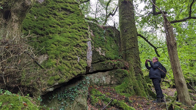 Access to the Wood has been complicated in recent years by the decision of another landowner to close the nearby Harford Moor Gate car park that in the past offered a convenient starting point to reach the Wood at less than a mile to the east. Indeed, the Woodland Trust now warn of 'only one or two suitable places to park within a comfortable walking distance'. However, they do offer some directions including access via a management gate that leads directly off the public highway on the narrow road to Cornwood from Harford. From the gate they explain that there is a permissive route running along the length of the site at approximately 700 metres that eventually links up with a public footpath in the southwest corner of the wood. Halfway through the Wood the permissive route crosses a stream on a rickety wooden plank that after heavy rain can be impassable. 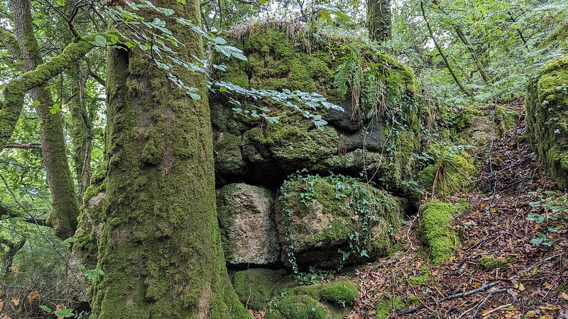 The tor can be reached with perseverance via long distance footpaths to the south such as the ones running from Ivybridge via Wilkey's Moor or along the picturesque west side of the river through Longtimber and Pithill Woods.
| ||||||||||||||||||||||||||||||