TORS OF DARTMOOR
a database of both lesser- & well-known rocks and outcrops
Kitty TorKit Tor, Amicombe Hill 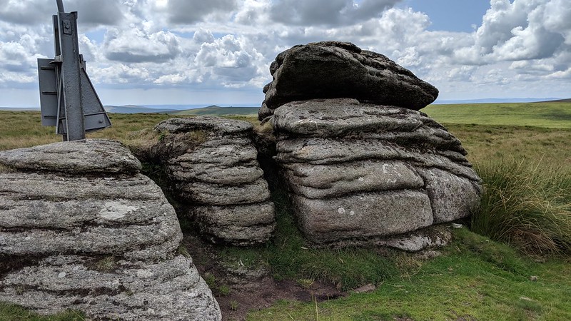 High up on North Dartmoor, on the massive whaleback of Amicombe Hill, is situated one of Dartmoor's smaller tors. It is almost ironic that such a huge hill - indeed one of the moor's highest at 584m and extending for several kilometres to the south - should be capped by such a meagre rockpile. This is Kitty Tor of curious name which consists of two outcrops. The summit is a diminutive rock, horizontally jointed, that is prominent because of its rather obtrusive flagpole. This flies a red warning flag, visible from far and wide, when the Okehampton Military Range is undergoing live firing, although the actual boundary of the range lies a little to the east of here. If you look carefully on the top of this rock, under low lighting, you may be able to discern an Ordnance Survey benchmark. It is heavily eroded and the broad arrow is faint. 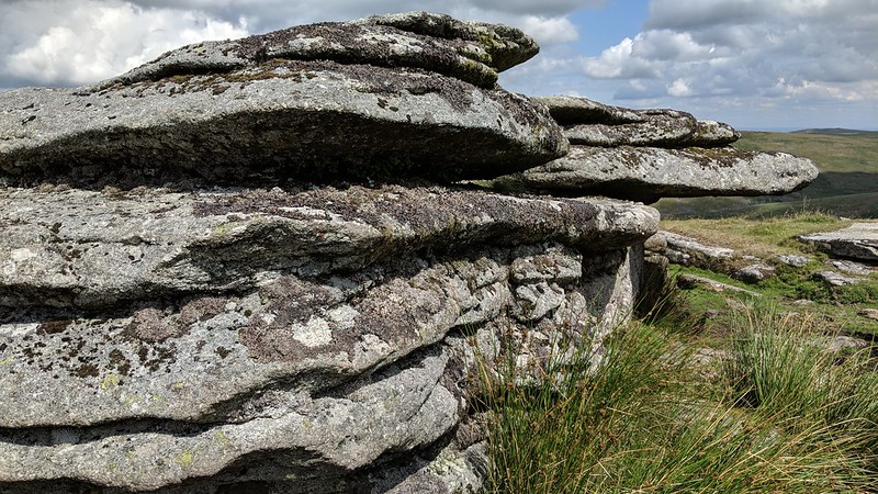 40 metres to the north can be found two military range huts on the more impressive section of the tor. There is a broad squat outcrop here that has on its underside a sizeable overhang that provides much relief to strong gusty winds that blow across from the Atlantic. The broken up granite slabs give rise to a considerable clitter on the eastern shoulder of the hill where it falls into the West Okement Valley. Adjacent to this runs a tricky path that descends steeply to Sandy Ford. 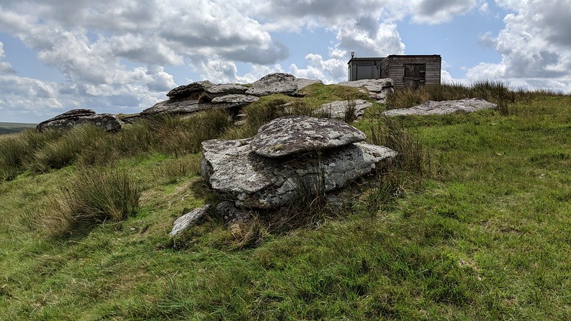 Although the rocks are inconsiderable in stature, the views on a clear day more than compensate. Hemery (1983) describes these: "the skyline in the south-east is provided by the lofty Hangingstone-Whitehorse ridge, where the Dart Head Cut is discernible as a dark line on the west flank of Whitehorse Hill; south-westward beyond the Rattle Brook valley are the tors of Hare, Chat, Dunnagoats, Great Links and, a little further north, Hunters." In January 2024 we have a more recent description from Tim Jenkinson: "Stenga Tor to the north with Black Tor beyond. NE Fordsland Ledge, High Willhays and Yes Tor. E Lints Tor pimple." Comment on Kitty Tor: "Overshadowed by military huts and flagpole on second pile to the south. W Great Links Tor and Hunt Tor." 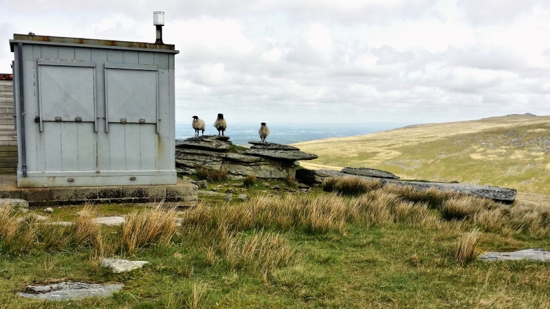 Amicombe Hill was once the headquarters of a major Dartmoor peat cutting venture. We learn in the Geology of the Country around Okehampton that: "The extensive peat cover of northern Dartmoor has been systematically exploited only at the Rattlebrook peat works [560871], which was sufficiently large to merit the residence of an overseer at Bleak House [560865], now a ruin. Peat was cut from channels running westwards down the slope from Kitty Tor. It was stacked at the works and air-dried for several weeks, then transported by special railway to Bridestowe Station. The peat works was opened in 1878 and the mineral railway in 1879; an attempt to re-open the workings was made as recently as 1951."
| ||||||||||||||||||||||||||||||