TORS OF DARTMOOR
a database of both lesser- & well-known rocks and outcrops
Lade Hill TorLadle Hill 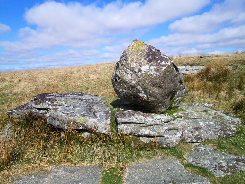 Despite its dominance in the area high to the north of the East Dart River, the dome of Lade Hill whilst represented by ascending contours in grid square SX 6382 is surprisingly not marked by name on any modern Ordnance Survey Map. It is yet another oversight by the map maker. We first learn of the hill by this name on the very first Ordnance Map by the late cartographer Lt. Col. Mudge in 1809, but it is misplaced much too far to the south, roughly where Braddon Tor resides and on the wrong side of the Dart River. It seems that this is the first and last time 'Lade Hill' ever appeared by name on a map. The first description and correct siting of the hill is in Crossing's accounts of the moor, and in his 'Dartmoor Worker' we are told of the origins of 'Lade' as a "ditch or drain" that "leads water", it being a word derived from the Anglo Saxon 'lad' that the author explains as "a canal, or conduit, and is indeed only another form of 'leat'." Hemery (1983) gives support to this interpretation in High Dartmoor, but the name never made its way onto the Harvey Map to which Hemery was affiliated, the author having successfully established the locations of other tors, hills and ancient tracks by getting them named on the map, a trend that continues to the present day. 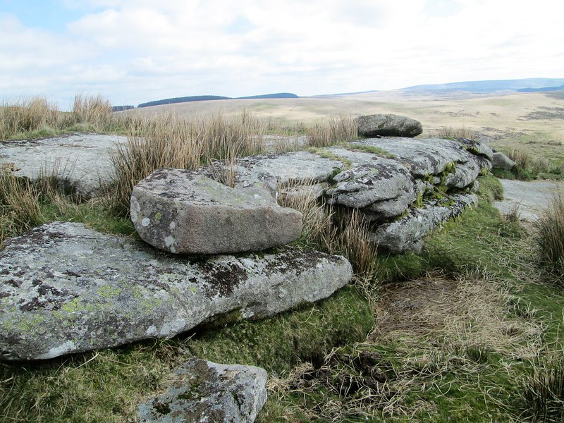 In the Western Times, Friday 31st March 1933, we read in an extract about the now much-loathed subject of hunting: "A delightful and almost circular gallop was shortly afterwards set in motion from the left bank of the East Dart above Hartland Tor. This good fox led hounds up the valley a short distance, and crossed the river by Broadun Rocks. Keeping over Broad Down to Archerton Newtake, hounds raced up to Rough Tor Gate, when a right-handed swing brought them back to South Devon country by Sandy Hole. After crossing the river here they ran over Wynne's Down to Ladle Hill, on the slopes of which they earthed their fox. This was a fast 14 minutes. The Ladle Valley had a line up to the rocks at its head and Wynne's Down was next tried in the direction of Sittaford Tor." 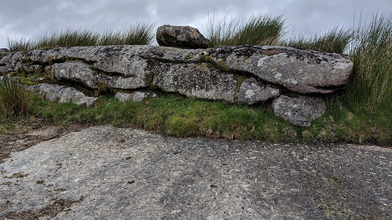 Nearing the summit of the hill on the south side where it is crossed to the east by a sturdy newtake wall heading north towards Sittaford Tor, are several scattered boulders and lowly outcrops with one nearest at the highest point supporting a peculiar but distinctive rounded logan-type rock that was seemingly overlooked in the literature until 2017. Despite referring to the "stony south slope" of the hill, Hemery (p495) strangely fails to mention the curious feature. From the vantage point here there are breathtaking views to the south with many tors visible including as far away as Hay Tor, Rippon Tor and Buckland Beacon. 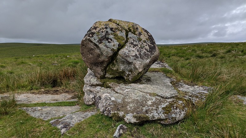 The hill is well worth a visit but the climb from the river is arduous so the preferred option is to descend from the direction of Sittaford Tor beside the aforementioned wall.
| ||||||||||||||||||||||||||||||