TORS OF DARTMOOR
a database of both lesser- & well-known rocks and outcrops
Latchell TorLetchole Tor, Freeland Rocks, Freeland Tor
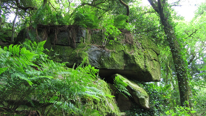 Sir Walter Besant wrote about this area in the latter part of the 19th Century, when this tor that occupies most of the Letchole Plantation above the hamlets of Freeland and Water half a mile from Manaton, was still visible from afar. Inspired by this account and using snippets of information contained within the Book of Manaton regarding the site of the once village dairy at Latchel, the name of the tor resurfaced in 1999 when Tim Jenkinson rediscovered the rocks and photographs from his excursions that later emerged on Flickr. The tor was then included in Ken Ringwood's 2013 book on Dartmoor's Tors and Rocks. Interestingly the western outcrops here actually reside in what Tithe Maps show as 'Freeland Rocks', and the area is also shown bereft of much tree cover in an old postcard that was reproduced in Dartmoor News (2020). This is where the name of 'Freeland Tor' is introduced. 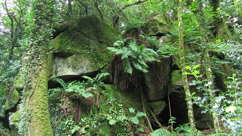 Although not visible from the road below as the tor's giant rocks are totally enshrouded in trees it can only be seen at close quarters by climbing up through the wood from the public footpath below but be warned that the tor lies on private land, although its lower rocks can be seen from the path in winter months. Here the tor's rocks rise up from the hamlets almost to the pinnacle of the hill. Consisting of two main outcrops there are many more boulders strewn across the slopes of the plantation, and Tim writes: "The largest pile can be seen on the lower eastern side and is about 100 metres above the bridlepath from Water to Manaton. Here giant rocks with interesting caves are intermingled with oaks, firs and holly trees." 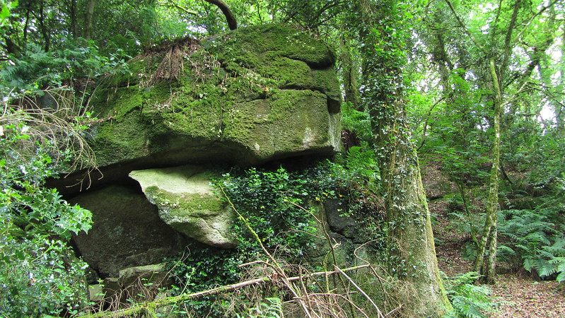 Although Besant uses the name of Latchell Tor for the rocks and also mentions a 'Nymphenhole' and 'The Ridge' in his account, the name of Letchole can be traced back to the Tithe Map of 1842. Higher up the hill from the tor stands Freelands Tower, that was originally built as an astronomical observatory c1900 and was later used as a lookout by the Home Guard in World War II. The top of the tower is just visible above the treeline in winter months from the slopes of Hayne Down to the south-west.  In his account of the various Lesser-Known Tors of Dartmoor from 2002, Tim concludes: "A secluded, unspoilt and overgrown tor, whilst Latchell escaped literary attention in the 20th century it has been a privilege to rediscover it at the turn of the 21st."
| ||||||||||||||||||||||||||||