TORS OF DARTMOOR
a database of both lesser- & well-known rocks and outcrops
Leigh Bridge Rocks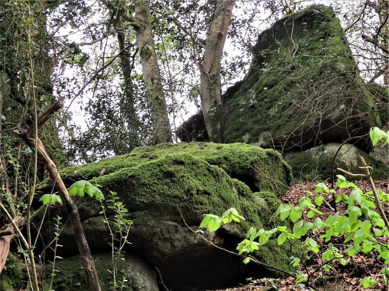 Just above Leigh Bridge on the south side there is a scattered rock field that presents as a ruined tor of mossy boulders and outcrops, the largest of which appears to be on the right side looking uphill. This rock, that is just beside a gate and track, is like the entire collection situated on private land, but can be viewed from the lane that passes below. 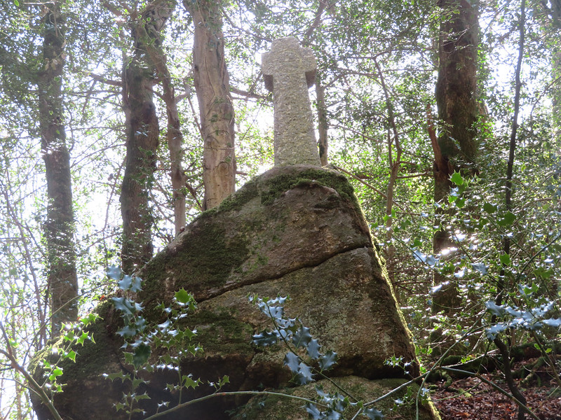 The Rocks are little to impress in themselves and flung about as they are on the hill are now only indicative of a once grander pile on the valley side, but the area is absolutely stunning and abounds in interest. Atop Leigh Bridge Rocks is Leigh Bridge Cross that had served as a waymarker before sadly falling into disrepair in the winter of 2013/14 when the DNPA had removed it from its original position. For a few years after the cross had remained off site until the summer of 2019 when a replacement replica was christened on the same boulder as the original cross. According to the Dartmoor Crosses website, the original cross was thought to have been used as a waymarker at Teigncombe Farm, nearby, which is sited on the Mariner's Way. 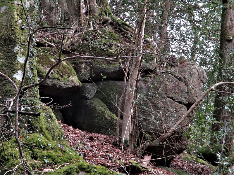 Leigh Bridge itself, a short distance west, is also an interesting structure that is described by Historic England as a "Road bridge over the River Teign. Probably late C18-early C19. Granite stone rubble with rusticated ashlar voussoirs. Single span bridge with a plain segmental arch over vertical abutments. Parapet has simple flat-topped coping and ramps up towards the centre following the humpback of the road. No terminal piers." The bridge is a beautiful feature which overlooks the meeting of the North and South Teign Rivers that swell into one of the moor's most beloved rivers, passing through the celebrated Fingle Gorge. 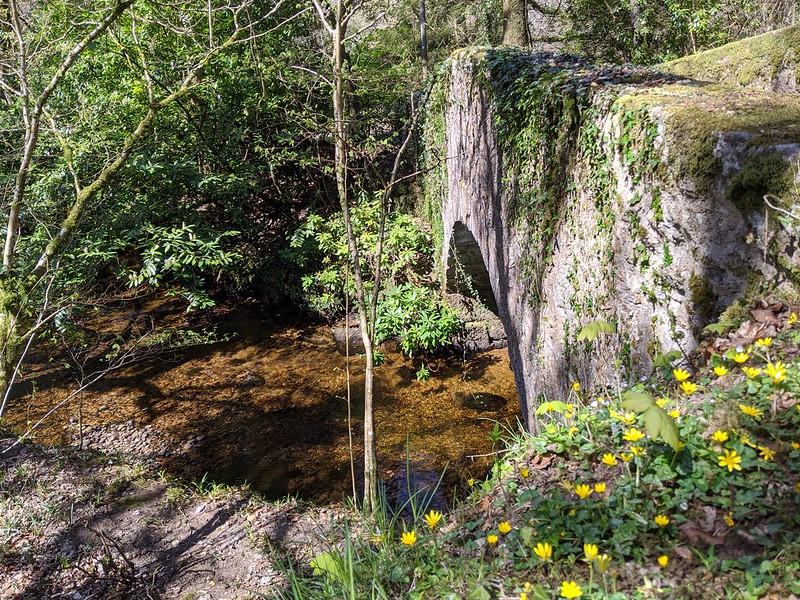 Leigh Bridge Rocks are a little obscured but there is much to enjoy about the locality, from the soothing sounds of the Teign to the birdsongs high up in the canopy and peacefulness of the lane. It is a place worth visiting and the historical setting is archetypal of the Dartmoor borderlands.
| ||||||||||||||||||||||||||||