TORS OF DARTMOOR
a database of both lesser- & well-known rocks and outcrops
LimsboroLimesboro, Luntesborowe, Lullingesfote, Lullingyssete, Limsboro' Cairn, Limsborrow, Linsboro', Lynch Tor, Linch Tor, Lints Tor (Mudge), South Lints Tor (Prowse) 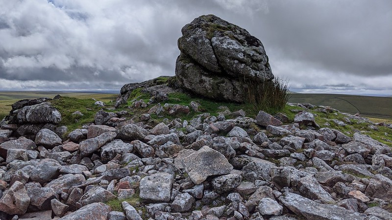 This is a natural outcrop circled by a man made cairn of granite stones, and is the highest rockpile on the hilltop. The military have also installed a flagpole here to warn the public of live firing and on the east side propped up against the pile a military telephone point can be found. 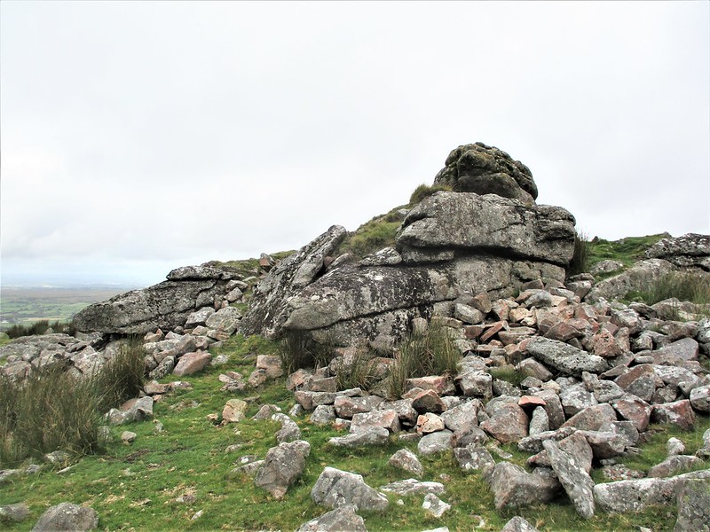 This outcrop is considered, by some Dartmoor authors, to be a southern pile of Lynch Tor but is afforded separate recognition by Eric Hemery (p.1018): "Beyond the track is Linsboro', a Bronze Age cairn built around a small tor remnant..." He explains as a footnote that this is not an uncommon practice with others noted on Cocks Tor and Corndon Tor. Later, on the same page, he refers to Lynch Tor separately stating that "the separate clitter some way to the right is that of the Linsboro' outcrop..." 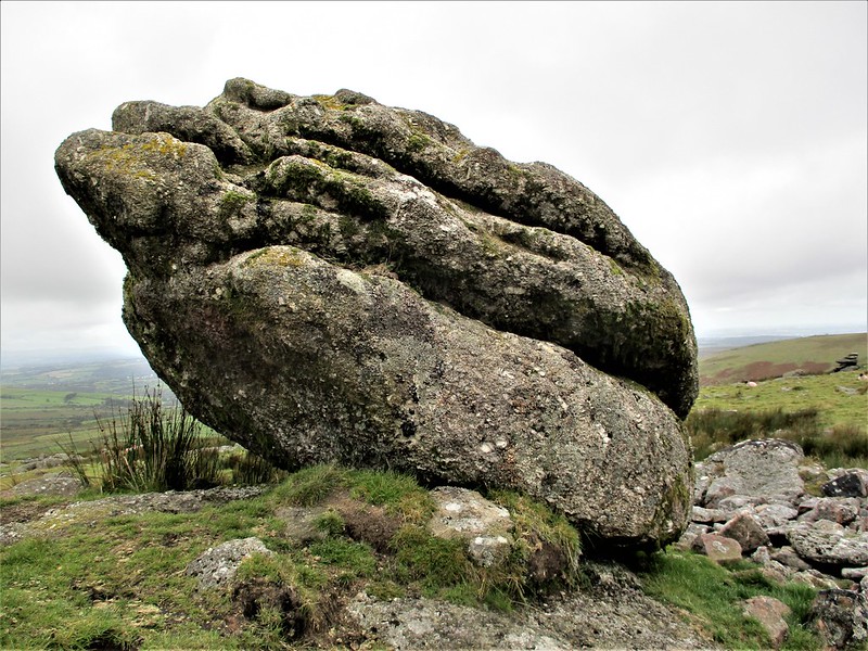 The rockpile is distinctive from surrounding hilltops, and from the barren wasteland of the Upper Walkham Valley it can be seen as a distant pimple on the top of the hill. From a certain perspective the summit rock resembles a logan stone that is poised on a 45-degree angle. It was first mentioned as a forest boundmark called 'Lullingesfote (Hullingssete)' way back when Henry III tasked twelve knights with setting out the boundary on a perambulation in 1240, and, today, is one of the checkpoints on the circular walk across Dartmoor which is undertaken by many walkers every year on their quest to follow this ancient route. 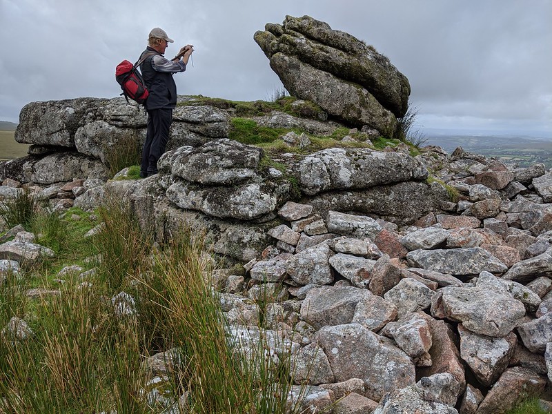 At SX 56642 80575, a huge, albeit shallow rock basin can be spotted on a nearby rock a little way to the east. The views from Limsboro are unforgettable and are concentrated westward across the sweeping fields of West Devon and into Cornwall, beyond the often dark mass of Bagga Tor; northward is the giant dome of Standon Hill and the striking range of tors that sit above (and to the left of) the Rattle Brook. Curving eastward is the remote Fur Tor silhouetted on the horizon and nearer the head of the River Walkham; and southward is the giant heap of Great Mis Tor and the Staple, Roos and White Tors.
| ||||||||||||||||||||||||||||||