TORS OF DARTMOOR
a database of both lesser- & well-known rocks and outcrops
Little Bee TorLittlebee Tor, Little Be Tor, Little Be-Tor, Bee Tor
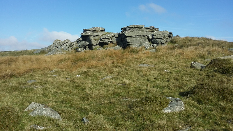 There appears to be a little confusion regarding the exact location of this tor. In 'High Dartmoor' Hemery (1983) discusses the site of 'Little Bee', in response to a reference by John Lloyd Warden Page of 1889 and deduces that the tor is most probably the small southerly pile of the Littaford group at SX 616 768. However, on page 117 of his 'Guide' Crossing (1912) disputes the authenticity of the name 'Little Bee', suggesting that its inclusion on maps has been an error and as a result has been perpetuated largely through ignorance. 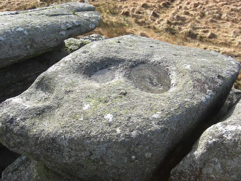 Despite this criticism, we are willing to support Hemery's assertion that the separate and compact pile approximately 250 yards north of the newtake wall and about 200 yards south of the main Littaford outcrops, is the tor in question. When viewed from either the south or south west the tor formation is impressive. Two large outcrops greet the walker when heading north across the Longaford ridge from Crockern and these form the southern face of the tor, the tallest of which measures approximately 20 feet in height. These weathered and cracked rocks form several small caves in their midst and to the west nearby, the rubble of a third outcrop lies. The summit of this tor offers fine views of the West Dart to the south west, as it winds beneath Beardown Wood and to the east Bellever Tor is visible. The highest point of the tor is marked by a small propped logan type rock beyond which, a few feet to the south, there are three good examples of miniature rock basins in the flat topped rocks of the outcrop. 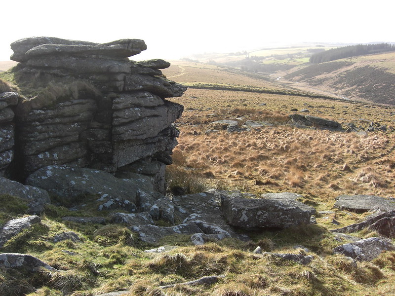 According to Bound (1991) an ancient map of the County of Devon by Donn (1795) shows the name 'Longbetor' where he considers Littaford Tors are now known to exist. This name lends further support to the notion of there being a 'Little Bee Tor' (or 'Be Tor') in the area. In addition, Ringwood (2013) writing much more recently concurs with this and says that the tor is; "The lowest of the Littaford Tors." Therefore the most likely site would seem to be the aforementioned first cohesive group of outcrops north of the newtake wall, high above the West Dart, as they are sufficiently detached from the main Littaford piles to warrant a separate identity. 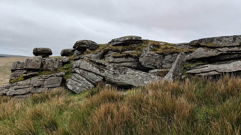 An account of the area appears in Mrs Anna Eliza Bray's 'The Borders of the Tamar and Tavy' from 1879 where Little Bee Tor is mentioned in one of her husband's letters; 'whilst the tors that follow Crockern Tor in succession are there called Littlebee Tor, Long Tor, Higher-white Tor, and Lower-white Tor. White Tor, or Whiten Tor, as my tenant pronounced it, we did not visit; and as I have some doubts about the real names of the tors, I shall only say that the first (a small one) that we approached had something in its appearance which so much reminded me of Pew Tor basin in the shape of a rude oval, terminating in a point or lip, about twenty inches long, eighteen wide, and six deep. A square aperture among the rocks here, somewhat like a window, suggested the idea of its possibly having been used as a tolmen, through which children, and sometimes, I believe, grown people were drawn to cure them of certain diseases.' However, it is clear from this description that the Brays are actually further north on the main Littaford Tor as this is where both the 'window' and rock basin with 'lip' can be found.
| ||||||||||||||||||||||||||||