TORS OF DARTMOOR
a database of both lesser- & well-known rocks and outcrops
Little Staple TorLittle Steeple Tor, Little Stapletor, Little Steepletor, Staple Tors 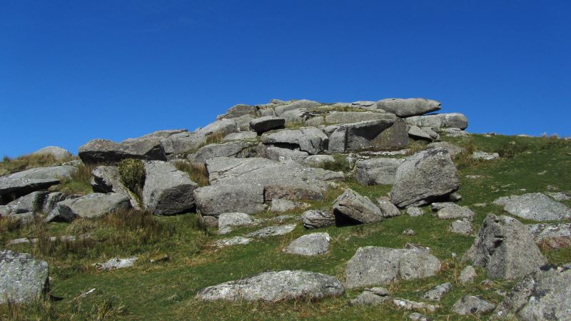 Hemery (1983) says of the tors lining the Walkham Valley: "The ridge of great tors along the west side of the river's middle reach begins just north of the B3357 with Little Staple Tor (1,256 feet), the ruin of its weathered cone resembling a broken causeway..." The tor is perhaps less grand than implied, being rather dishevelled and diminutive compared to its neighbours which means you are likely to have it all to yourself. 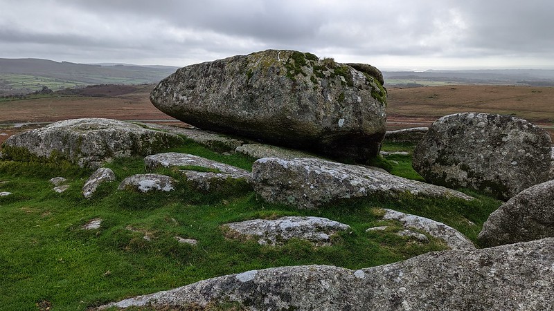 Despite other commentators speaking generally unfavourably about the rockpile, it nonetheless boasts one of the grandest rock basins on the Staple (Steeple) Tors ridge. This superb specimen collects water part way until any excess flows out through a drainage lip on the west side. Measuring an impressive 77cm X 64cm and being some 10cm deep it is embellished with stonecrop and was first mentioned by John Lloyd Warden Page in the late 19th Century. 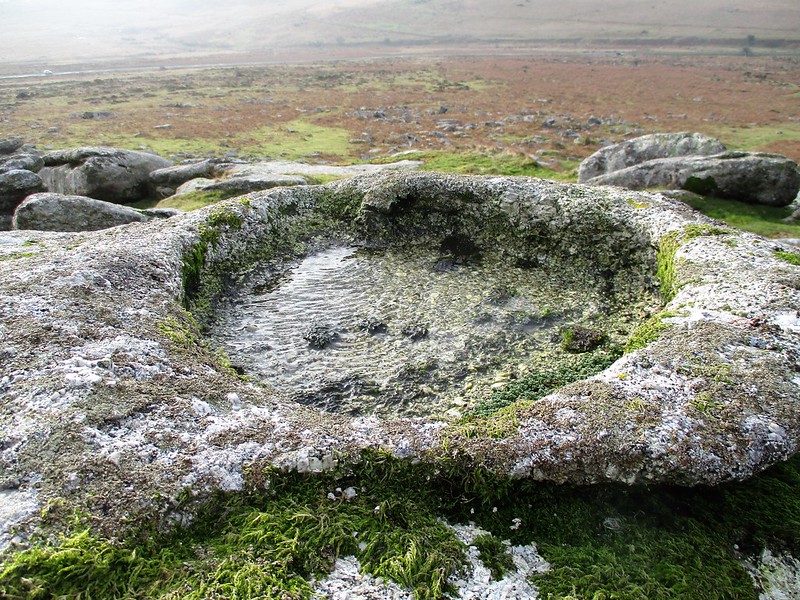 The basin is clearly the focal point of the tor and this alone makes Little Staple most worthy of a visit. Whilst views to the north are hindered somewhat by higher ground, elsewhere they are remarkable: southward the ground drops to the sentinel tors of Vixen and Pew, both of which from here resemble natural fortifications; and scanning to the right of these tors the ice cream van in the Pork Hill (Barn Hill) Car Park can usually be seen, beyond which in the far distance are the undulations of Bodmin Moor in Cornwall. 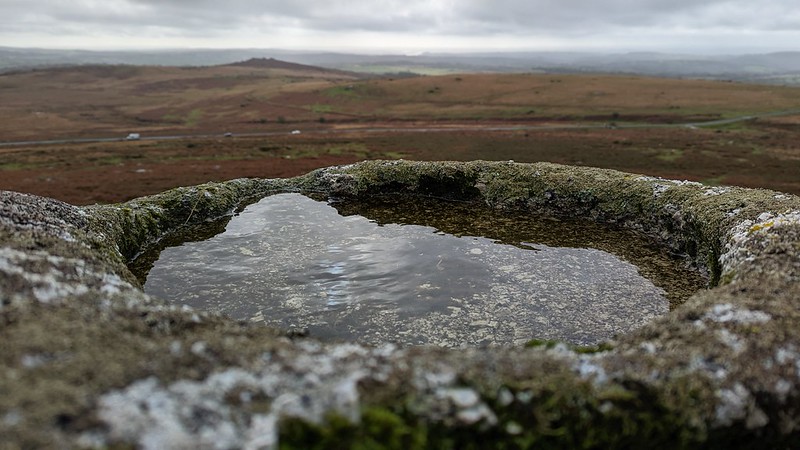 As with Middle and Great Staple Tors further up the ridge, there is a proliferation of granite strewn across the slopes here. This can make for tricky progress when approaching Little Staple Tor from the east, so visitors are advised to take the grassy path from the small car park on the B3357 to the south-west.
| ||||||||||||||||||||||||||||||