TORS OF DARTMOOR
a database of both lesser- & well-known rocks and outcrops
Little Trowlesworthy TorLittle Trowlsworthy Tor, Trolsworthy Tor, Little Tor, Trowlesworthy Tors 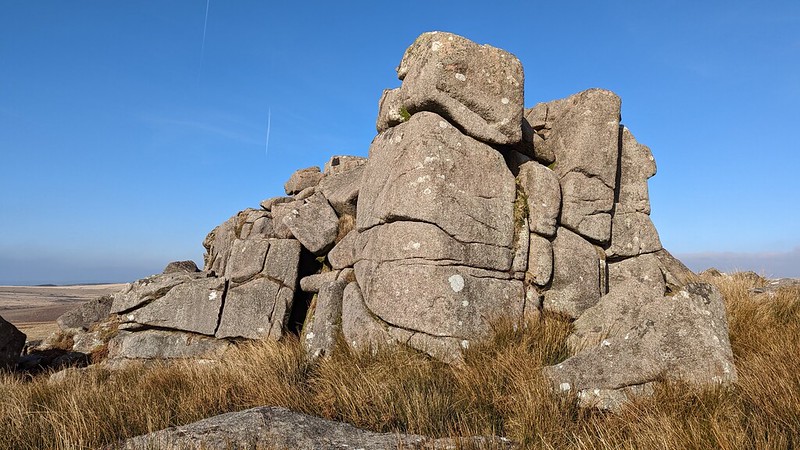 Despite being called 'Little', this tor is by definition quite large. The tor presents as a single ridge of broken granite which although having spread in all directions, most of it is concentrated to the west. The outcrops exhibit pink (or red) granite fragments that are unique minerals peculiar to this south-westerly edge of the high moor. 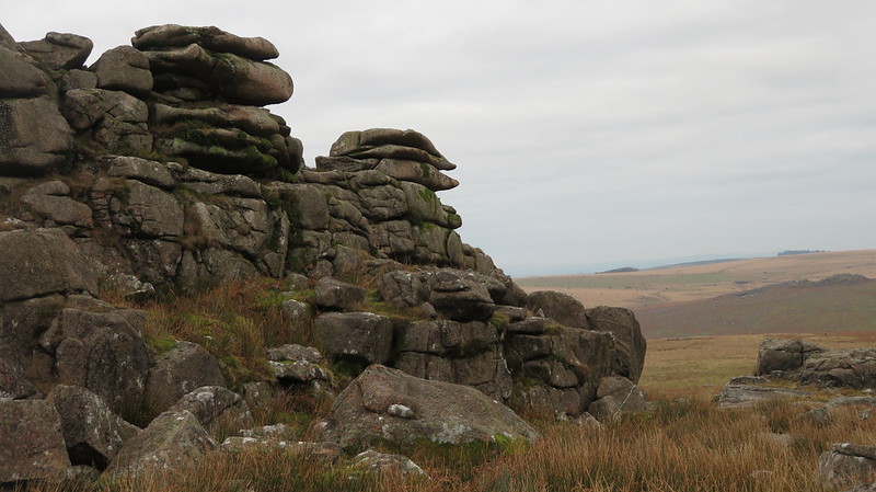 The tors here are great to visit, as they offer not only rocks to clamber about on and geology to inspect, they also provide a thrilling vista. The finest prospect is probably that of the Plym Valley, northward, where the river is seen snaking below the old farm of Ditsworthy Warren House and out to Gutter Tor. Equally the scene towards the Tamar and East Cornwall in the west is also very fine. 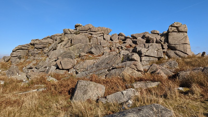 The hillside here, known as Trowlesworthy Hill, is fascinating for the staggering array of historic antiquities that are scattered across the slopes, such as vermin traps, pillow mounds, cut granite, prehistoric enclosures, and more. Perhaps the most notable feature observed by John Hayward (1991) is a huge cylindrical rock, known locally as 'The Bandstand', which he describes it as "a grandiose scheme to erect a flagpole in Devonport." Writing earlier Hemery (1983) explains: "it is the result of an over-ambitious nineteenth-century project to provide a base for a flagpole at Devonport Dockyard, the finished block proving too much for the transportation techniques of the day." Below to the west and just a short way above the Lee Moor Leat the abundant clitter once facilitated the construction of dozens of Bronze Age hut circles. 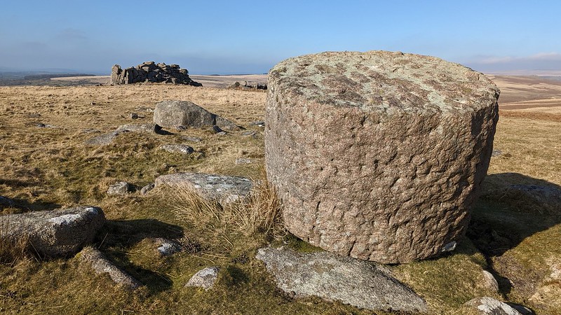 The north side of the tor has suffered from the excavation of a quarry whereby 19th Century stonecutters removed a large section of the outcrop in their quest to exploit the granite. The unusually coloured building stone here was seen as valuable and highly attractive, so we are extremely lucky that the stonecutters' ambitions did not extend further to destroying the two Great and Little tors completely. Two spoil heaps lie to the immediate north and Crossing (1912) mentions an old wall extending towards the River Plym. This is possibly a reave or prehistoric field boundary.
| ||||||||||||||||||||||||||||||