TORS OF DARTMOOR
a database of both lesser- & well-known rocks and outcrops
Logging RockTeign Logan Stone, Teign Logging Rock, Drewsteignton Logan Stone, Moving Rock
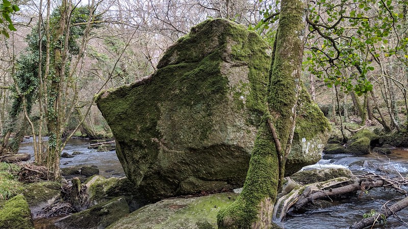 This fantastic balanced rock is positioned on the north-west (left) bank of the River Teign under Hunt's (Hunter's) Tor and rests on a large curved backed boulder that is set in the river. Its name of 'Logging Rock' can be found on the 1839 Tithe Map for the Parish of Drewsteignton, but the name 'Moving Rock' can be traced further back to Donn's 1765 map. 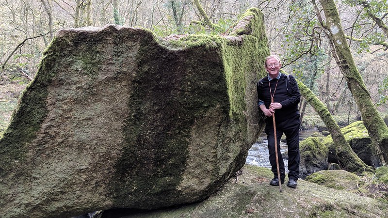 It was often described in the literature of the late 18th and early 19th Century as a logan or rocking stone that Samuel Rowe reminds us once formed an important feature in the 'Mystic apparatus of Druidism'. Rowe, in 'A Perambulation of Dartmoor', p.34 goes on; "The celebrated Drewsteignton Logan Stone might be repeatedly passed by, without exciting more curiosity or attention than any other huge granite mass standing aloft in the bed of the river." It seems that Reverend Rowe was quite taken with this rock for on page 109 he makes another reference to it, calling it a "monumental relic". If that wasn't enough he comes back again on page 122 with even more details, the logan "Rising boldly out of the bed of the river, near the northern bank. It is an irregular pentagonal mass the sides of which are of the following dimensions." The widths were also measured by Rowe, the "Eastern, five feet four inches in width; northern, seven feet eight inches, north-west six feet four inches; south-east, five feet four inches; and the southern, towards the river, ten feet six inches. It is about seven feet six inches in height at its western corner." Interestingly, he claims that the rock "Still logs perceptibly, but very slightly, by the application of a man's strength..." 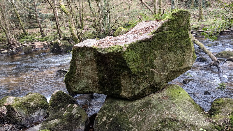 We also learn from H.E. Carrington that "when rocked, [it] emits an audible murmur, of a particularly awful nature..." 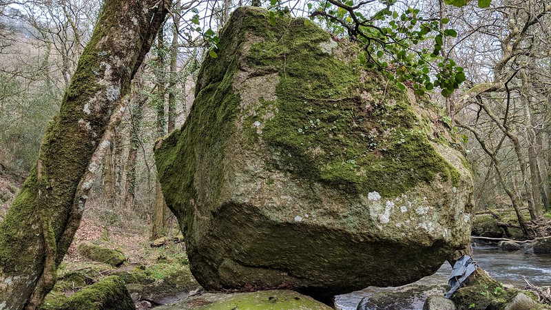 From comparing old photographs from c1860 with the present day, Tom Greeves (2015) shows apart from the growth of vegetation just how little the area has changed over time.
| ||||||||||||||||||||||||||||