TORS OF DARTMOOR
a database of both lesser- & well-known rocks and outcrops
Lower TorRuss Tor, Rustor, Rock Tor (possible)
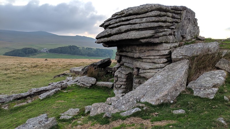 This is the distinctive yet small tor 150 metres to the south of Higher Tor on the Belstone Ridge. It is a heavily fissured outcrop with conspicuous, marked horizontal jointings that are so different from the nearby granite on high, and is in respect considered a separate tor in its own right. 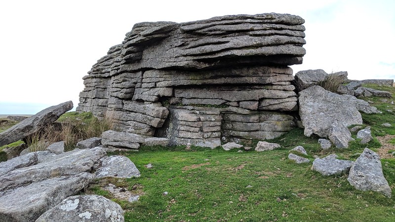 Eric Hemery (1983) describes the tor but, surprisingly, fails to give it a name, when describing the route from the Belstone parish boundstones to Higher Tor; "This picture also shows a rock outcrop on the rising ridge beyond the stones; equidistant from stones and distant tor, the rock consists of a cohesive mass of medium-grained granite with a pronounced canopy." 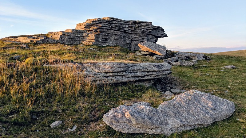 Indeed, the small overhang is quite prominent especially from the east side where it provides a little shelter from prevailing winds coming from the north and west. The somewhat diminutive stature of the outcrop here in comparison to its neighbours has possibly leant it the name of 'Rock Tor', a name that appears on a map published in 1941. This strange anomaly doesn't seem to have been continued onto later maps. 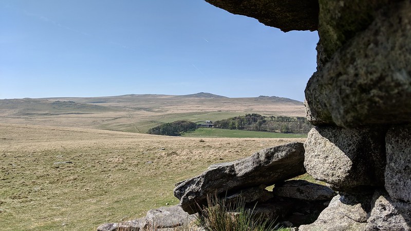 On top of the lower south-east side of the summit rock there appears to be an inscription that has been cut into the granite. The word which is very difficult to read seems to show 'RUSTOR' in small letters thereby lending some credence to the use of that name locally, in memory of Russell who used to frequent this point. Thanks goes to Chris Walpole for providing information on the location of these letters. The name of 'Lower Tor' has also been used to describe this tor as a result of its proximity to Higher Tor, this name first appearing in print in 'Dartmoor's Tors and Rocks' by Ken Ringwood (2013). It is a lovely place to enjoy the views southward towards Taw Marsh and Oke Tor where the great spine of the ridge bends south-westward to reach the military observation post on Okement Hill.
| ||||||||||||||||||||||||||||