TORS OF DARTMOOR
a database of both lesser- & well-known rocks and outcrops
Lowery Tor
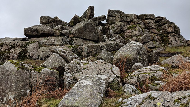 What a view this is. Overlooking Burrator Reservoir from under Peek Hill this is truly a lesser-known tor. No longer marked on modern OS Maps Lowery Tor is nonetheless very well documented in Dartmoor literature. Whilst it was first mentioned by William Crossing in his Guide to Dartmoor, he fails to describe its splendour. Located immediately to the south of Peek Hill, Eric Hemery strangely misplaces it, putting it somewhere to the south of Leather Tor, where the piles of Lower Leather Tor reside, a mistake that has since been replicated onto Harvey's Map of Dartmoor. 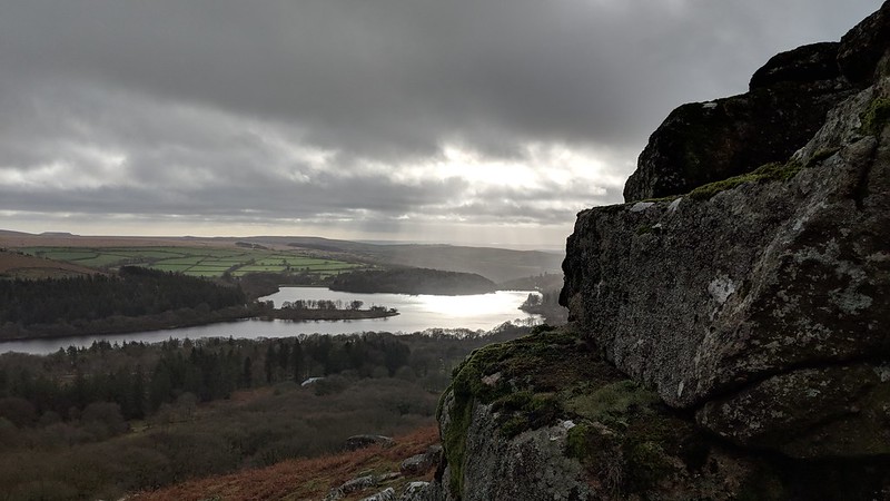 In contrast to this error, Hemery's book entitled 'Walking the Dartmoor Waterways' from 1986, actually shows a map of the Devonport Leat that indicates Lowery Tor as lying directly below Peek Hill and not at Leather Tor, and in Anthony R. Kingdom's 1991 book on The Yelverton to Princetown Railway (page 46) Lowery Tor is correctly positioned on an old OS representation just to the south of Peek Hill below the now disused RAF Sharpitor site. Hugh Breton is another who misplaces the tor but not by far to a point atop Peek Hill which is a little to the north of its actual location. 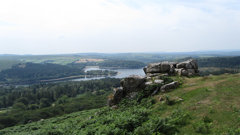 It is not until several years later that we get a much better idea of Lowery Tor's true position when Tim Jenkinson writes in 1996: "No tor in this collection occupies a more desirable position than Lowery Tor. Upon reaching the summit of Peek Hill from the north the walker is greeted by a breath-taking sight. To the south the magnificent expanse of Burrator Lake backed at its south-eastern edge by Sheeps Tor is one of the finest scenes on Dartmoor. The widespread scattering of low outcrops here are collectively known as Peek Hill Tor. Little more than 200 metres from the summit point just before the hillside begins a sharp descent to Croft's plantation sits the compact pile of Lowery Tor." 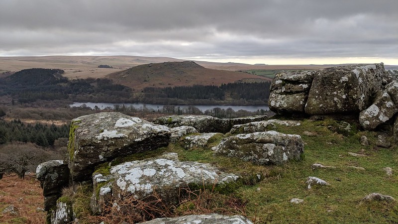 Tim continues: "The flat square rocks of the tor's higher side, form an excellent platform from which to sample and marvel at the scenery that is mapped out below. From beneath, the tor's crown lies broken, its summit rocks having toppled forward onto a huge, rounded slab of granite." He goes on to describe the evocative views: "In addition to the lake, Lowery Tor looks out to the east towards Leather Tor with Down Tor, Hingston Hill and Combeshead Tor beyond. To the southeast the small outcrop of Shell Top is distinctive above the mountainous slopes of Sheeps Tor. Quite simply a place of unparalleled beauty, Lowery Tor is a mere 15-minute walk from the road."
| ||||||||||||||||||||||||||||||