TORS OF DARTMOOR
a database of both lesser- & well-known rocks and outcrops
Manaton RocksManaton Tor, Manatton Tor, Feather Tor, Town Rocks
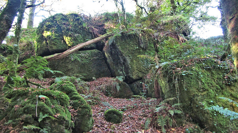 At SX 748 815 there is a tor of delightful proportions. Now more commonly known as Manaton Rocks, both Crossing (1905) and Hemery (1983) refer to the group as a tor, with the latter author stating that it was once known as 'Feather Tor'. Forming a well scattered group of huge boulders, the tor is bisected by a well worn path leading from the village. This path, although wooded, twisted and muddied in several places is nevertheless the easiest route of access and on the ascent, offers tantalizing glimpses of the hidden tor ahead. 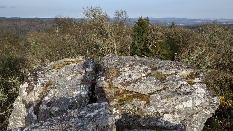 The highest rocks are on the north side, overlooking the pleasant upper reaches of Lustleigh Cleave and Hunter's Tor to the north east. Signs on both sides of the largest rock repeat the message 'Footpath to Manaton Rocks', but do not warn of the ill defined and quite dangerous track ahead. Extending westward from the main rock, large boulders run to an old enclosure wall and for some distance beyond, to a point in woodland above Ebworthy Farm. Views from the summit are exhilarating, especially to the south where St Winifred's church tower backs on to the huge dome of Black Hill with Hay Tor on the horizon. South west the sprawling tors of Hayne Down and the celebrated Bowerman's Nose stand majestic. North westward Easdon Hill climbs, with on its southern flank the conspicuous stack of Figgie Daniel. 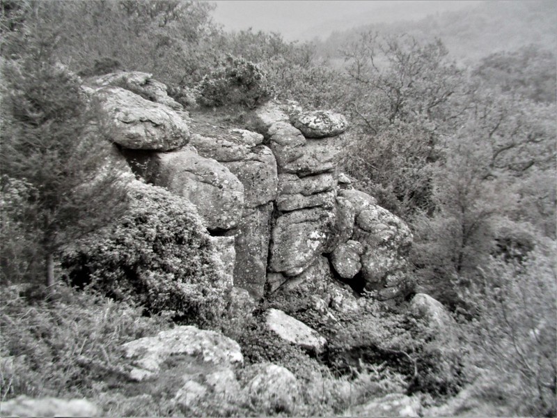 The main rocks are weathered and rounded; they sit amid an assortment of vegetation that is of almost ornamental design when viewed from the west. South of this point, the remainder of the tor reveals itself as four massive outcrops, though not as distinctive as the higher rock, they still form crags of varied heights, some nearing 25 feet, that overlook the church. Clad as they are in fern, conifer, gorse, rowan and oak these magnificent portions of the tor, resemble other wooded rock faces on the moor, such as the draped crags of Ashbury, Hazel and Luckey Tors. All in all Manaton Tor is well worth a visit, as not only is it a wonderfully serene place, its rural charm beyond compare, it also provides excellent views from the summit of the rugged south eastern quarter of the moor, views that are quite simply too good to miss. 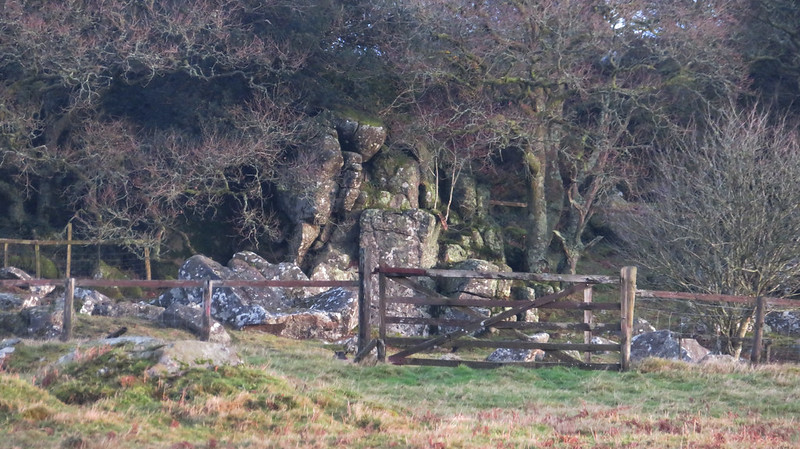 Please be advised that at the beginning of 2022 the National Trust, who have owned the main rocks since 2017, have carried out extensive tree felling and clearance of vegetation around the summit. This has improved viewing the summit rocks that were previously hidden until you were stood on top of them.
| ||||||||||||||||||||||||||||