TORS OF DARTMOOR
a database of both lesser- & well-known rocks and outcrops
Manga HoleNorth Teign Rocks 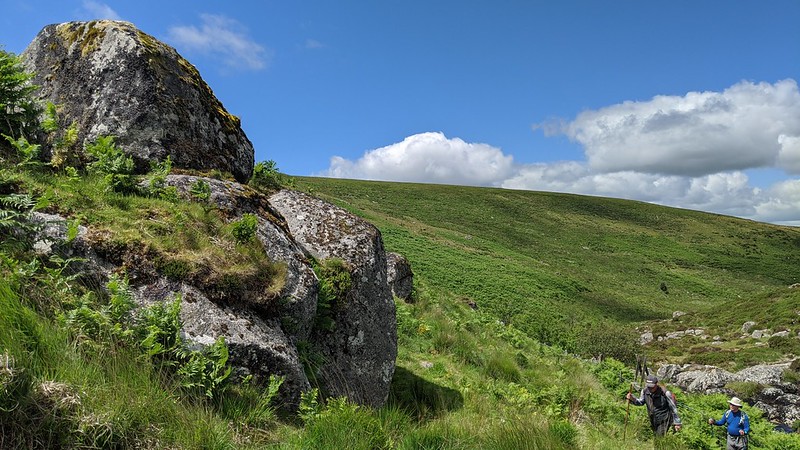 Nestled beneath the intimidating eminence known as Manga Hill lies a secluded valley through which the North Teign River flows. Below and to the north of the ruinous Manga Farm, the river picks up pace, entering a cleft or a 'hole' as it is so commonly called on Dartmoor. The river leaps over large granite boulders below an imposing outcrop that protrudes from above the left bank at SX 64026 85106, spoken of locally by the name of 'North Teign Rocks' by Dartmoor Guide Paul Rendell. They can be reached by crossing the river and ascending a stile beneath. 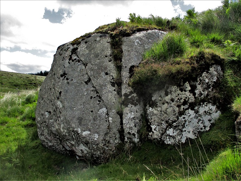 It is perhaps the next section that is the most picturesque as the river cascades over pale sheets of granite pitted with sizeable rock basins. Eric Hemery (1983) goes into great detail about this area, calling the gorge 'Manga Hole'; "The cleft excavated by Teign at Manga Hole is very fine. It is seen to greatest advantage on approach from upstream, by way of Teignhead Bridge and a narrow path branching right from the track to Manga House Lane. Remaining below lane and house, this leads to the brink of the hole, where falls and a great waterslide precipitate the frothing water at some velocity around the bends in the channel." 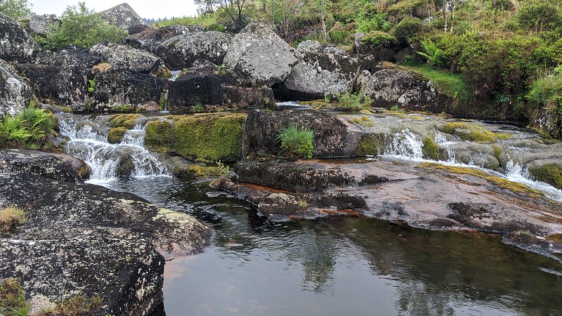 A little way downstream and above the right bank can be espied another outcrop, albeit a poor one: an overgrown example enshrouded in gorse bushes at SX 63975 85199, casting a modest clitter reaching to the riverbank. It is possible that more of this rockpile resides beneath the impenetrable gorse, and some may have even been plundered for the newtake wall below. Shielded from the great hills, this is an altogether special location that provides excellent refuge for the walker, especially during winter months when the bracken has receded and the river levels are low. 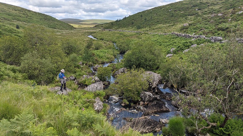
| ||||||||||||||||||||||||||||||