TORS OF DARTMOOR
a database of both lesser- & well-known rocks and outcrops
Middle TorMiddletor 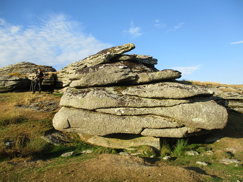 Often overlooked in the literature of the moor, Middle Tor has much to offer the visitor. Although it is set below the more illustrious Kestor Rock, the tor here is modest yet splendid, and the tor's rocks are beautifully jointed. It is unfortunate that so little appears to have been written about the tor because it is a lovely one to clamber about on. 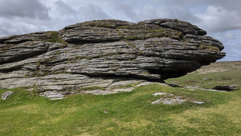 The tor here is exactly midway between Kestor and Frenchbeer Rock (Tor), but unlike these rockpiles it is rather spread out on the spur of the hill before dropping down to the east. Low turf that is regularly grazed surrounds the tor and this is the perfect place to enjoy the vista, both out towards the Dartmoor border-country and beyond but also into the high moor proper. 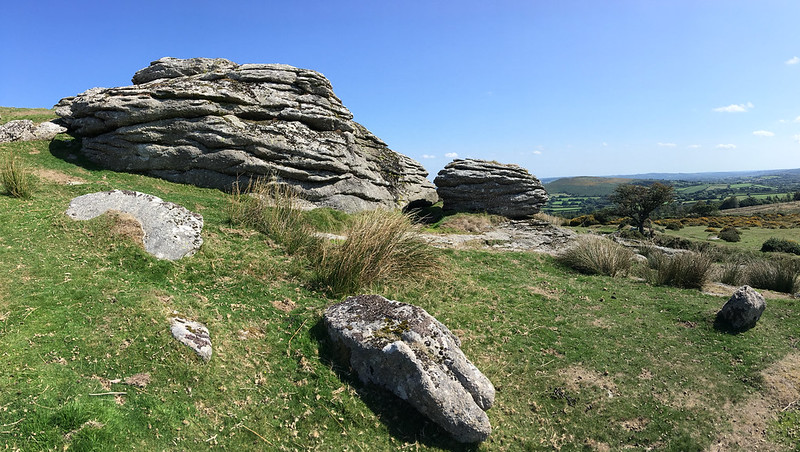 Samuel Rowe (1848) writes of a rock basin on the summit and might be the first to describe this spectacular example; "On Middletor, near Castor Rock, on the other side of the Teign, as we have mentioned, is a fine rock-basin." Eric Hemery (1983) later gives dimensions; "...approximately seven inches deep and with a well-formed edge." The summit outcrop is the most conspicuous feature of the tor and the section seen by those approaching from Kestor, looking somewhat like a crouching bird. If you head south you will discover an entirely hidden rock face, a delightful elongated outcrop with slabs atop almost about to slide off. 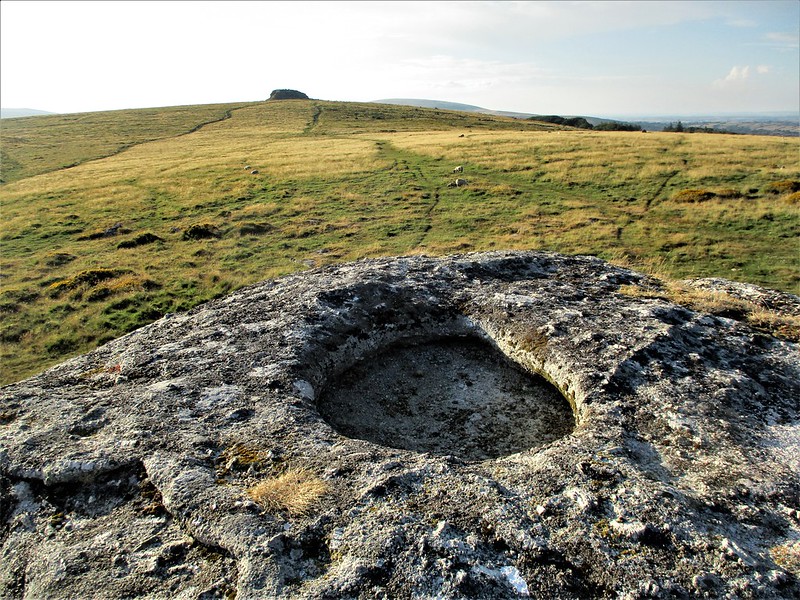 To the east by a solitary tree more rocks occur of pleasing yet small proportions, where the rocky crest of Meldon Hill rising above Chagford stands sentinel. Grassy paths lead to Middle Tor from all directions and on approach from the north you might notice a conspicuous reave system; these being prehistoric boundary walls with one at SX 66873 85998 more resembling a stone row. Nearby Shovel Down and Teigncombe Tor possess many more antiquities.
| ||||||||||||||||||||||||||||||