TORS OF DARTMOOR
a database of both lesser- & well-known rocks and outcrops
Middle Vag Tor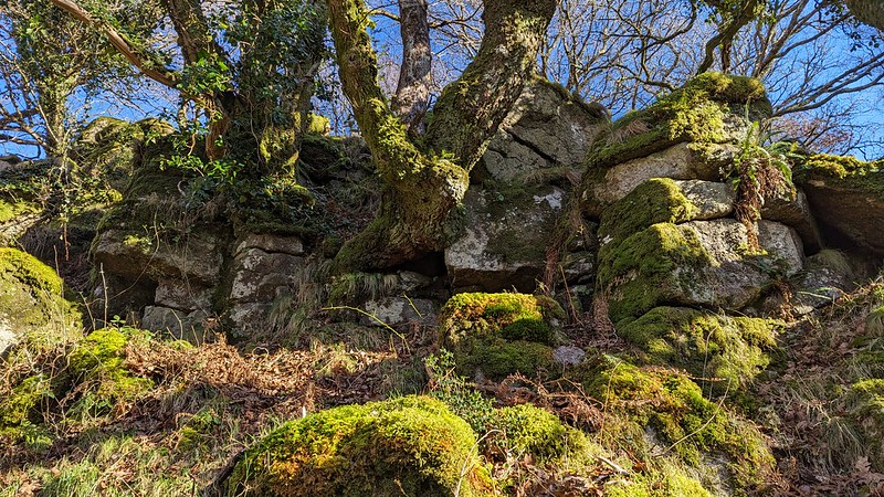 Above the River Dart and roughly equidistant between Little Vag Tor and Vag Hill Tor lies another rockpile of fierce character. This has been termed as 'Middle Vag Tor' by the Tors of Dartmoor Team and was first possibly described, albeit not named, by Eric Hemery (1983) taking the path on the left bank south of Dartmeet: "As Cumston Island comes into view, a rock outcrop, beetling and rugged, is seen to project from the underside of Vag Hill, left; its clitter, reaching the very river-bank, has fanned out to strew rocks over a long stretch of riverside and, over the ages, nurtured a vigorous but stunted growth of oaks." 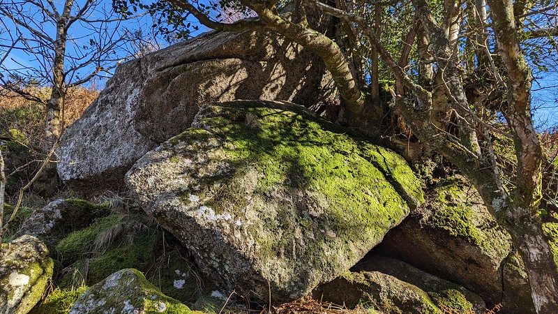 There are three parts to this tor: the first (SX 67417 72374) is a humble rockpile that culminates in a small stack on the edge of the trees. It looks somewhat more impressive as you catch sight of it from the riverside path, appearing to protrude boldly from the slope. Close to this (SX 67438 72358) is a fabulous fissured pile that extends from a small winding path down to the riverside. Embellished in vibrant moss and interspersed by gnarly oaks, this is perhaps the most photogenic section. 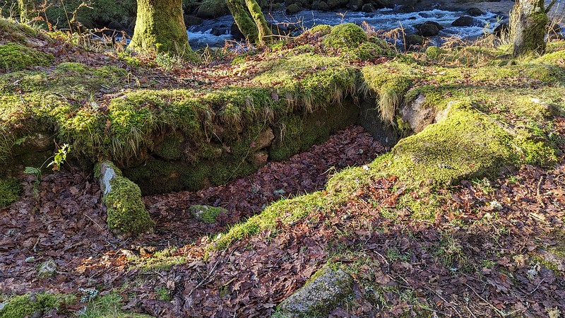 Moving south, we come to the final significant pile (SX 67420 72292) which heralds a magnificent clitter of epic proportions. These massive boulders, seemingly resting on top of one another, run adjacent to the river at the foot of this great hill. The rocks continue eastward where they merge with the clitter of Vag Hill Tor that is an even grander rockpile in the immediate locality that warrants exploration. Beneath this part of Middle Vag Tor is the fine relic of a vermin trap. Hemery comments that it is "a walled pit measuring 10 1/2 feet by 3 feet 4 inches." It can be found at SX 67439 72259. Vag Hill Warren was one of Dartmoor's rabbit warrens which R.G. Haynes remarked was "about 520 acres" and that "the 1613 lease defines the area of the warren which lay between the River Dart, Yar Tor, and Corndon Tor." 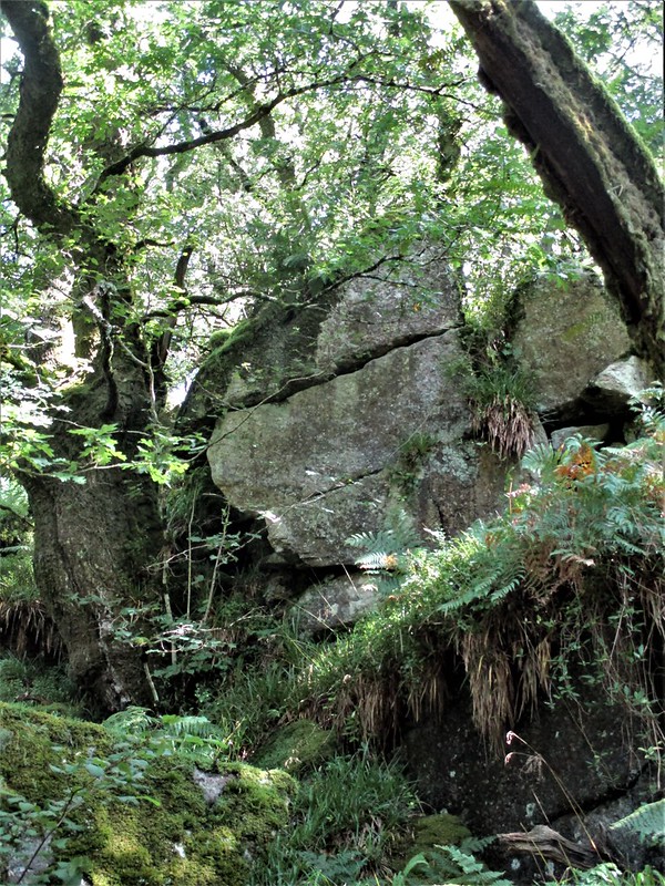 The path along the River Dart from Dartmeet to Luckey Tor is notorious for being difficult to walk and navigate in places due to fallen trees, large granite boulders, high water levels and being in some parts washed away. Fortunately, though, the section from Dartmeet to Middle Vag Tor is well-defined and simple to follow. The beauty of the gorge, with its ruggedness captivating artists and photographers alike, as well as its exhilarating seasonal canoeing downstream from Dartmeet, continue to draw people from all over. There really is no other place on Dartmoor where one can so quickly escape into a wilderness of strewn granite and oak.
| ||||||||||||||||||||||||||||