TORS OF DARTMOOR
a database of both lesser- & well-known rocks and outcrops
Mill Bottom South
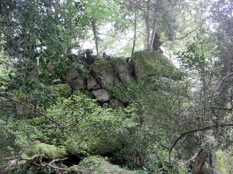 Lustleigh is a haven for small tors, gigantic boulders and overhanging rocks. In that part of the village known as Mill Bottom, to the south-west of the hamlet of Wreyland and close to the course of Wray Brook, there are two separate and distinct rock outcrops. A public footpath runs below both of them to allow for viewing. 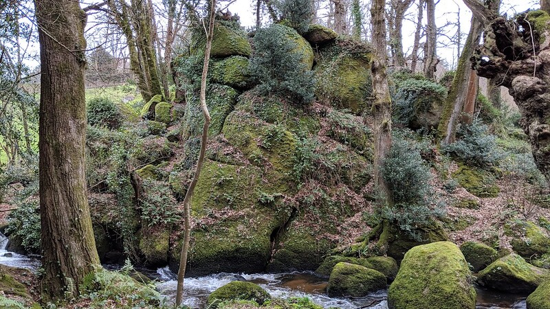 Tim Jenkinson (2015) writes with great enthusiasm about this special scene; "Mill Bottom is where the Wray Brook (River Wrey) comes through the valley under the old Lustleigh Mill. It can be easily reached via a footpath leading south west from the hamlet of Wreyland. There are two rock outcrops of interest in the area: the first at SX 786810, set in a wooded area; the second and main part a little further south, presents from the side as a rugged tall elongated cliff face just above the river on its east side." This is the southern pile, presenting as more like a cliff face edging to the waterside with rocks split and filled with vegetation. The author also comments on the apparent lack of reference in the literature; "Surprisingly Cecil Torr, who lived in Wreyland and wrote extensively about the area in 'Small Talk' makes no mention of the rocks here close to a path he must have walked many times back and forth. This is a most tranquil spot that is well known to villagers." It is an alarming omission given the area's easy accessibility. 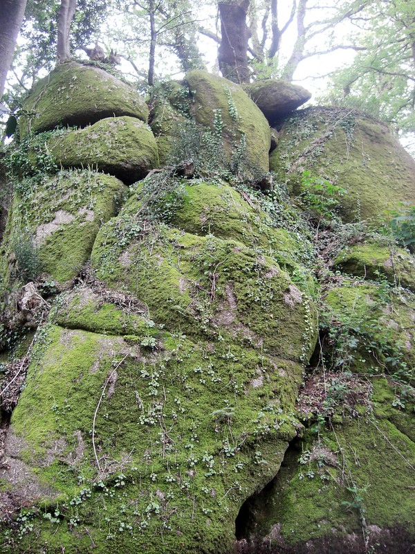 The wall of rock here is a charming feature complementing the flow of the Wray Brook as it hops and leaps over mossy granite boulders through the valley. At the visitor's first sight of the rockpile, their heart rate quickens at the sight of the brook progressing over a series of strewn granite boulders beside the leafy, rock-studded valley-floor, to the point where, after crossing the wooden footbridge, better glimpses can be had from across the water where the cliff acts sentinel over the entire Bottom, with further granite seen high above. It is a most picturesque scene and perhaps typical of what William Crossing would describe as a 'Gem in a Granite Setting' as with his delightful book of the same name from 1905. 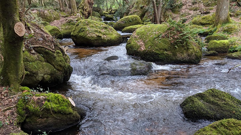
| ||||||||||||||||||||||||||||||