TORS OF DARTMOOR

a database of both lesser- & well-known rocks and outcrops

Home Search Map The East Access About Team Social Blog

Nattor (Sheepstor)

Nat Tor

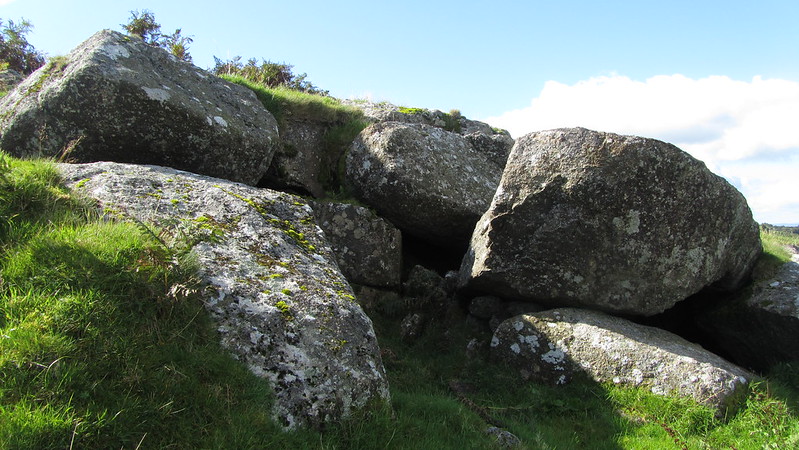
This private tor consists of a few small granite outcrops, with no real significant height. It is more a collection of exposed boulders rather than an obvious outcrop, but it suggests it was once a more impressive sight.

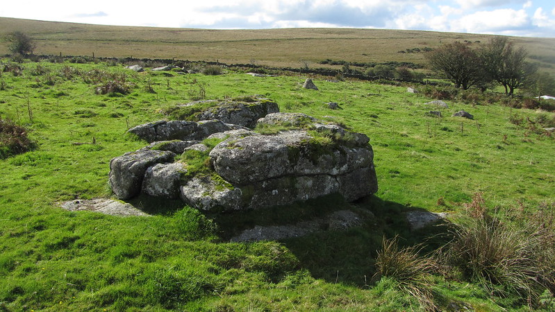
Hemery first mentions it: "Nattor Farm stands due south across the brook and almost equidistant from Yellowmead. The diminutive tor that gives its name to the farm stands immediately above it within the highest enclosure bordering the mine-road."

It can be viewed from Sheeps Tor should you not wish to seek permission to visit.

icon
icon
Nattor (Sheepstor)
The map above is not a navigation tool and we recommend that the grid reference shown below is used in conjunction with an Ordnance Survey map and that training in its use with a compass is advised.
Grid Ref:
SX 5733 6734
Height:
280m
Parish:
Sheepstor
Tor Classification:
Ruined
Access:
Private (but visible from public land)
Rock Type:
Granite
Credit:
Eric Hemery
Reference / Further Reading:
Eric Hemery: High Dartmoor

Please Support Us

We are proud to see the names of lesser-known tors are now being used more commonly on other websites and whilst this is to be encouraged we do request that, should you wish to use the information on this page, you provide a backlink to the website as reference, by copying the relevant address:

https://www.torsofdartmoor.co.uk/tor-page.php?tor=nattor-sheepstor

Please also consider a small donation to the upkeep of the site; any contribution goes toward the fees to keep the database online and any costs incurred when undertaking research such as subscriptions to online archives.