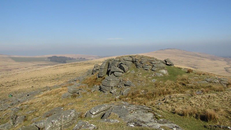
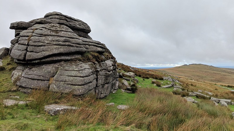
High up above the River Taw, Oke Tor is a large granite tor on the ridge from Belstone Common to the north, the conclusion of the ridge being at Okement Hill southward.
Hemery describes it, in High Dartmoor; "The ridge rises slightly to Ock Tor (1,500 feet), its affinity with E. Ockment country expressed by the near proximity of the river's head and the upper reach spread out below. The tor has three piles, of which the southern is the largest, with a tremendous break-away on the south-west side."
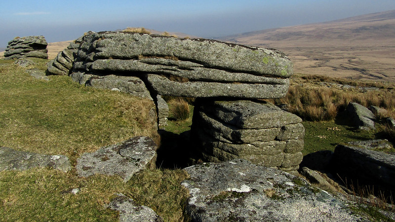
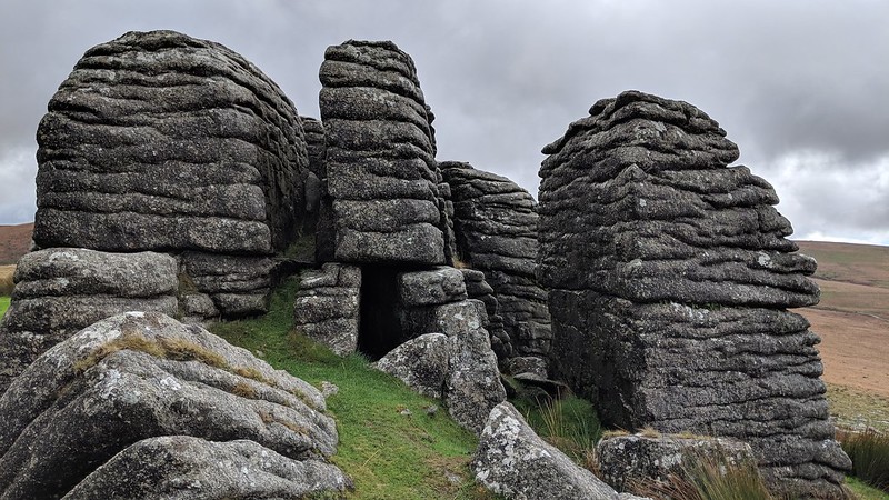
"The head of the pile, weathered into a pseudo-laminated, concave mass, resembles the edge of a giant rock basin; a lesser, though still large break-away lies on the south side of this pile, where a military shelter has been built." The repetitive horizontal jointing in the tor is remarkable.
Oke Tor
The map above is not a navigation tool and we recommend that the grid reference shown below is used in conjunction with an Ordnance Survey map and that training in its use with a compass is advised.
Grid Ref:
SX 6124 9004
Height:
466m
Parish:
Dartmoor Forest
Tor Classification:
Summit
Access:
Public
Rock Type:
Granite
Credit:
William Crossing Ordnance Survey
Reference / Further Reading:
Ordnance Survey Maps Eric Hemery: High Dartmoor
Please Support Us
We are proud to see the names of lesser-known tors are now being used more commonly on other websites and whilst this is to be encouraged we do request that, should you wish to use the information on this page, you provide a backlink to the website as reference, by copying the relevant address:
Please also consider a small donation to the upkeep of the site; any contribution goes toward the fees to keep the database online and any costs incurred when undertaking research such as subscriptions to online archives.