TORS OF DARTMOOR
a database of both lesser- & well-known rocks and outcrops
Old Hill RocksOld Hill Tor, Redbrook Ball, Red Brook Ball
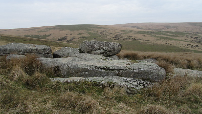 Though more usually known as Old Hill Rocks it is Eric Hemery (p299) that accredits this moderate pile with the status of "miniature tor". Here on the north slopes of Red Brook Ball there are four huge and quite impressive square faced rocks propped against each other that form beneath them small beetling caves, that look out spectacularly to the north and west over the ascending courses of both the Bala and Middle Brooks. Beyond the brooks the huge square topped cairn of Eastern Whitaburrow is seen above the ruin of Uncle Ab's House that according to Hemery was the former stables for horses that were employed on the Zeal Tor Tramroad. The cairn's distinctive appearance is often likened to the turret of a distant submarine. Hemery describes the cairn as one of "Dartmoor's most notable landmarks" and that is most apt as it is visible from many parts of what the author describes as "the Central Basin" of the Avon upland. 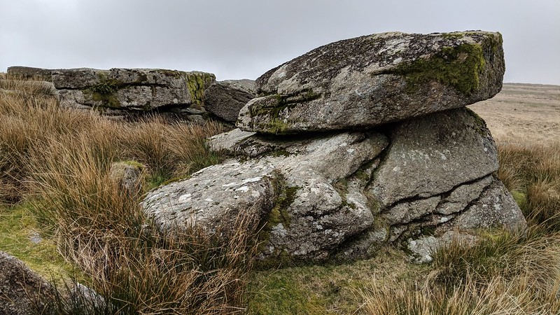 Above the tor remnant there is a giant slab of granite bedrock of some 50 feet in length and below the main rocks a 100 yards or so further large rocks extend and are suggestive of a now completely collapsed portion of this small pile. Despite their interest and appeal Old Hill Rocks remain a relatively overlooked group that is largely neglected in the literature. 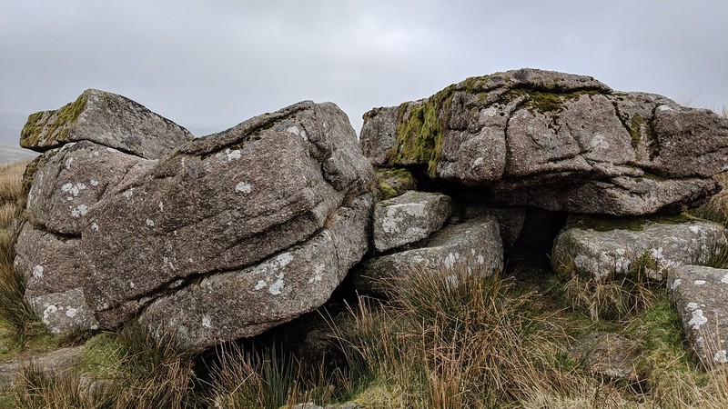 Apart from Hemery's seminal account from 1983 and old b/w photos on Tim Jenkinson's Flickr photostream that date to 1996, only Ken Ringwood (2013) seems to have mentioned the site where he writes of "An extremely low and flat granite tor on the hillside between Red Brook and Middle Brook, with clitter to the E. Made up of large blocks, with some rock having apparently been removed." His accompanying photograph of the ruined tor shows the immense slab of bedrock that is referred to above. 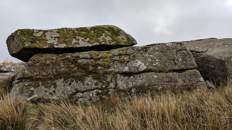
| ||||||||||||||||||||||||||||