TORS OF DARTMOOR
a database of both lesser- & well-known rocks and outcrops
Over Tor
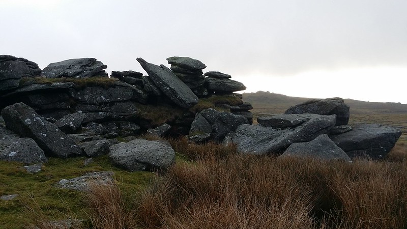 This is possibly one of the better, if not best known, of the lesser known tors of Dartmoor (if that makes sense). The tor consists of three relatively widespread and quite separate outcrops, of which the sturdiest and most north-eastern pile is known as Church Rock, documented elsewhere on this database. According to Crossing (1912), this rock used to be recognised as one of the "abodes of pixies" and, in addition to this, the author explains that church bells can be heard by placing an ear against the granite; a myth from which, no doubt, the rock has acquired its name. 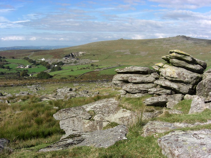 The most southern pile of the tor, now almost totally collapsed, is where a series of jumbled boulders, when viewed from the north, give the distinct impression of falling forwards into the dense and heavy clitter below. This observation is largely consistent with Hemery's (1983) reference to a tor that has been "overthrown", an assertion linked to the assumption that visitors once ransacked and vandalised the rocks at the turn of the 20th Century. Baring-Gould adds to this: "The tor Over Tor, on the right-hand side of the road, was overthrown by some trippers - the first swallows of a coming - early in the century." The earliest reference to Over Tor, however, comes much earlier in the mid 19th Century, when A.E. Bray described an attempt to visit (Great) Mis Tor, only to find it too laborious at the time and instead conceded to a much closer and, at first glance, 'insignificant' tor that "...though of no great magnitude, most amply repaid us for the visit. Probably from not being so elevated, and therefore less exposed to 'the pelting of the pitiless storm,' it is less bare and denuded than most others. Indeed it is almost covered with lichen and pendant moss: so much so, that it forcibly reminded me of grotto-work; to which the cavities, that are here more numerous than usual, not a little contributed." Bray also recorded three rock basins, two of which rest on a perpendicular slab on the north-west side of the south pile. The other one she affectionately named as 'Mrs. Bray's wash-hand basin'. Often filled with water, this small, yet fascinating, water-filled hollow continues to on occasion offer the facility of rinsing muddied fingers. 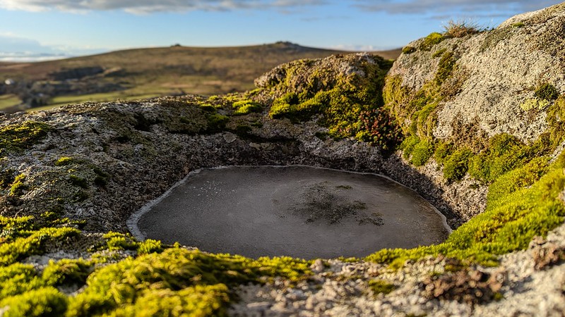 In light of these accounts, Over Tor would seem to be a rock pile that is steeped in myth and fantasy, for in addition to the above speculations there is also the large and deep excavation on the north side, approximately 3-400 yards away, known locally as Over Tor Gert, which is the product of tin mining in Over Tor Brook. Its lower end extends into Merrivale Newtake. Easily the largest and most ruinous of the piles, the southern group forms a rock face of some 10 feet in height on the Merrivale and King's Tor side. A short distance to the south-east of this point, an oblong topped worked stone lies at SX 55799 75213, and with feather and tare marks provides a good indication of the former quarrying activity of this area. 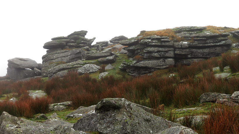 The third and least significant pile of the tor, though mostly flattened, nevertheless gives rise to a large and dense clitter on its western slope that extends through the newtake wall. Strangely, despite its proximity to the road and its many and well documented references, the Ordnance Survey (OS) continues to overlook the colourful history and folklore associated with this tor. Therefore, it is hoped that at some point in the future, Over Tor will receive the full attention it deserves and with its inclusion on maps will enable the rocks to become more widely recognised as one of the most intriguing and historically influential features of the moor, in the Merrivale region. One map that does show the tor is Harvey's Dartmoor Superwalker Map dated to 2001 that Hemery was affiliated with to record some local names that the OS are at present reluctant to include.
| ||||||||||||||||||||||||||||||