TORS OF DARTMOOR
a database of both lesser- & well-known rocks and outcrops
Parson's Brown LoafThe Map Stone, The Mapstone, Mattepaneston, The Parson's Loaf, Maetta's panstone 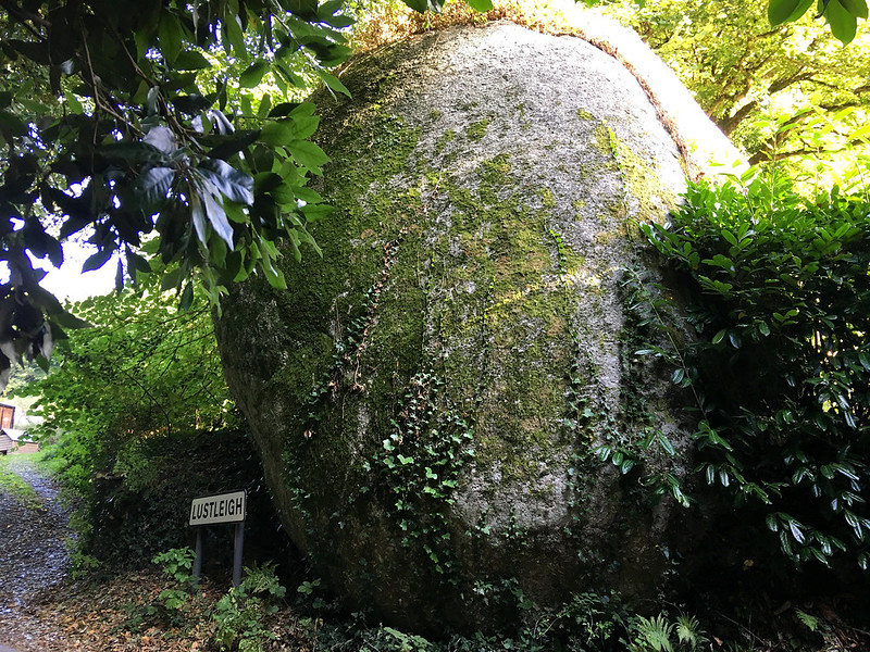 In 'The Book of Lustleigh' (2001), the village is described as being surrounded by "much disintegrated granite with curious weathered granite blocks like huge loaves". Coming out of the village and heading NNW up the road towards Combe at the point where the village sign can be seen is a towering gigantic dark rounded boulder on the east side that is marked as Parson's Brown Loaf on the 1886 edition of the Ordnance Survey map but is no longer shown on modern versions. 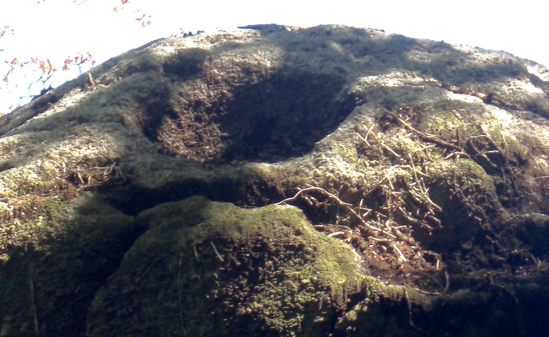 Despite the curious name the aforementioned book offers no reason for it merely describing it as a "mystery" but surely it must relate in some way to its shape as seen in the photographs. William Crossing (1905) certainly alludes to this and with the rock being not far from the Rectory he makes a tentative but possible link between the two. Tim Jenkinson (2015) identifies a fine rock basin here that he describes as being "etched into the top of the boulder" and advises that it "is just visible when viewing from below". 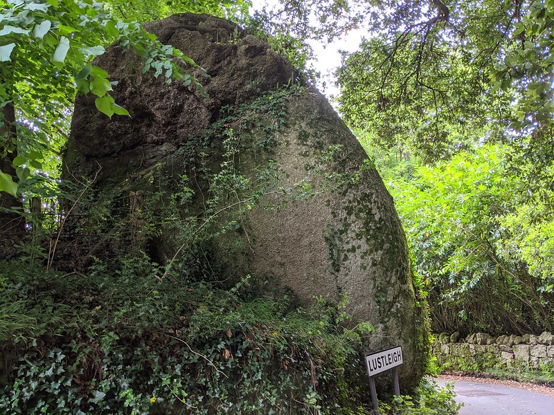 Crossing also explains that at one time the 'Loaf' was known as the Map Stone and that name is the one still marked on present day maps. In 'Lustleigh - A Dartmoor Village in Focus' (2018), we learn that "The rock is described as a 'panstone', that is to say it has a hollow on the top which collects water; nearby was a Saxon farm known as Maetta's farm. Thus, the rock was referred to as Maetta's panstone which, over the years, became shortened to Mapstone. It has been suggested that it was renamed in the Victorian era by those wishing to banish any possible connections with early druidic practices and called it The Parson's Brown Loaf, presumably in part due to its proximity to the old rectory." 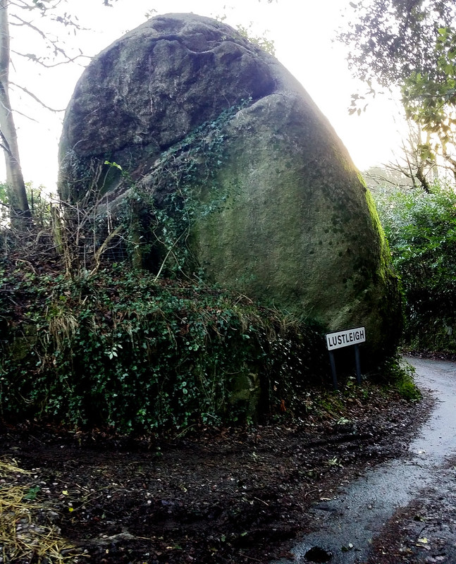 Of all the strangely shaped rocks in and around Lustleigh it is perhaps this one and the various examples at Pethybridge that best illustrate the 'Loaf' like phenomenon.
| ||||||||||||||||||||||||||||||