TORS OF DARTMOOR
a database of both lesser- & well-known rocks and outcrops
Pew TorPu Tor, Putor, Great Putor, Pewterdowne 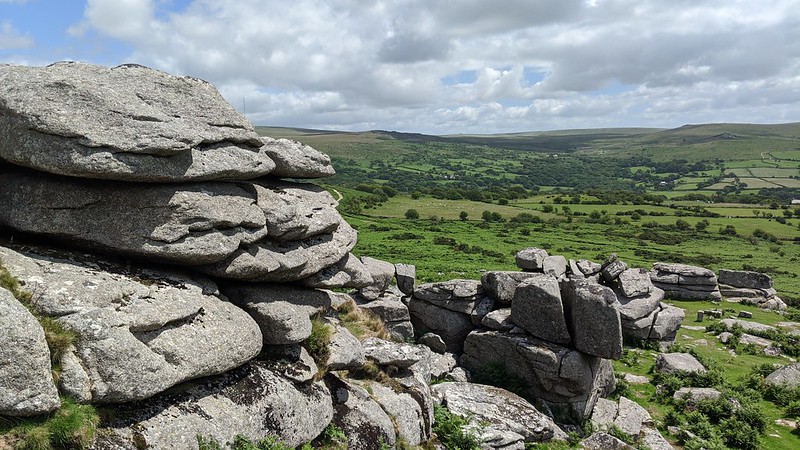 The magnificent rocks of Pew Tor dominate the skyline above the lowlands of Whitchurch and Plaster Downs above Tavistock on the western edge of Dartmoor. The tor's proximity to nearby lanes and roads results in it being visited frequently which has resulted in several wide, grassy paths being created leading up to the rocks from all directions. A good place to start would be from the car park on Pork Hill, passing over Barn Hill to Windy Post Cross and thence Feather Tor before reaching Pew Tor from the north. 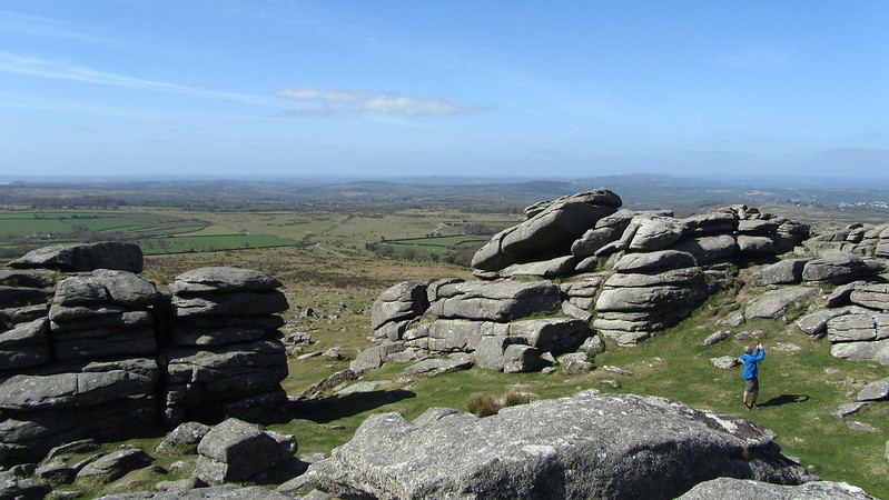 Consisting of several huge, layered granite towers the arrangement of the rockpiles here creates almost a natural amphitheatre, with short-cropped grass in between the outcrops giving protection from prevailing winds arriving from the Atlantic. Indeed, Hemery (1983) writes positively of Pew Tor, though favouring the more authentic, local spelling: "Pu Tor (approx. 1,025 feet) presents a distant impression of great size and, from certain angles, great elevation - especially on the frequent days of mist arising from the mild, moist air of south-west Devon." 'Pu' is the spelling also favoured by Crossing and on the Tithe Map of the Parish of Whitchurch when it is called 'Great Putor', but the spelling of 'Pew' appears to be a corruption created by the Ordnance Survey who use this name on their maps. It likely derives from the ancient name for the area, Pewterdowne (Gover, Mawer and Stenton). 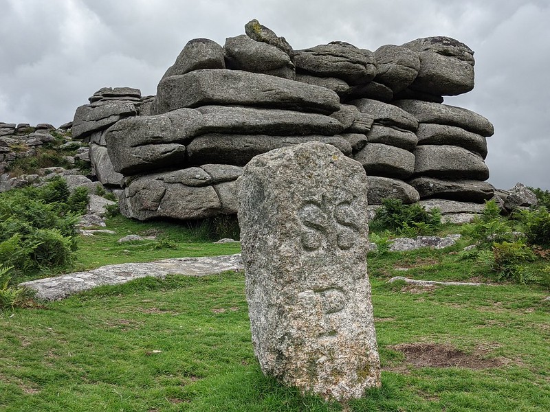 The tor contains more than its fair share of historic artefacts and includes 13 markers that encircle the rocks, these each inscribed on a granite slab in the outline of a hot cross bun; 9 were carved here in 1847 in an attempt to inform stonecutters that stone could not be taken within the boundary after the landowner noticed stonemasons robbing the area for high-quality granite depleting the local resource. And in 1896, over increasing concerns for Pew Tor, a further 4 markers (these the same design but with tiny drill holes) were incised which according to Brewer (2002) was due to Mr Duke of Merrivale Quarry wishing to clarify the limits to which stone could be removed. Sadly, one of the four 1896 markers remains unfound to this day. Pew Tor's granite is noted for being a particular grain, that of microgranite which was highly sought after by quarrymen and, as such, the tor still did suffer a little by the excavation of a quarry on the west slope at SX 5313 7358. All around the slopes you can stumble upon rocks that have been tare and feathered, characterised by repetitive grooves in an attempt to split the granite for industrial use such as providing strong stone for bridges. 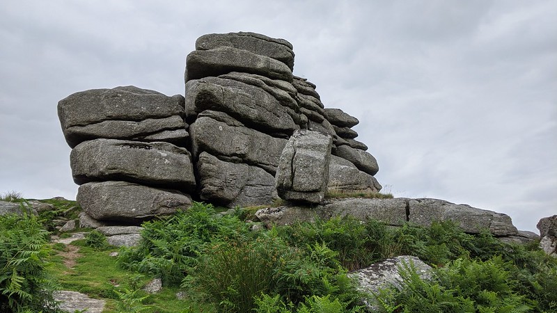 On the immediate east side of the tor resides a boundary marker denoting the parish boundaries of Sampford Spiney and Whitchurch which loops around the south flank. On the summit of Pew Tor are several rock basins which are a product of continuous and relentless weathering from wind, rain and ice. The vistas from the tor stand testament of the beauty of the periphery of the moor, penetrating deep into West Devon and the rising tors and hills of the distant, often hazy Bodmin Moor, and opposite towards the rock-strewn slopes above the densely wooded Walkham valley where the Staple and Mis Tors oppose one another to the north and east. On account of the sheer amount of things to see, easy accessibility and memorable views, Pew Tor is most certainly well worth an exploration, it will not disappoint.
| ||||||||||||||||||||||||||||||